 |
|
Location & QuickFacts
| FAA Information Effective: | 2008-09-25 |
| Airport Identifier: | NV42 |
| Airport Status: | Operational |
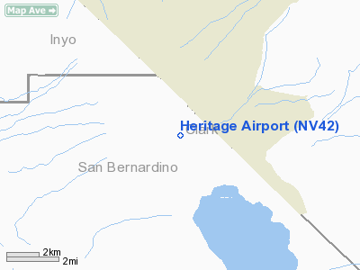
| Longitude/Latitude: | 115-37-53.0200W/35-46-32.9120N
-115.631394/35.775809 (Estimated) |
| Elevation: | 2575 ft / 784.86 m (Estimated) |
| Land: | 13 acres |
| From nearest city: | 15 nautical miles W of Jean, NV |
| Location: | Clark County, NV |
| Magnetic Variation: | 14E (1985) |
Owner & Manager
| Ownership: | Privately owned |
| Owner: | Hugh Heritage |
| Address: | P.o. Box 82134
Las Vegas, NV 89180 |
| Phone number: | 702-254-9640 |
| Manager: | Hugh Heritage |
| Address: | P.o. Box 82134
Las Vegas, NV 89180 |
| Phone number: | 702-254-9640 |
Airport Operations and Facilities
| Airport Use: | Private
PERSONAL USE. |
| Wind indicator: | Yes |
| Segmented Circle: | No |
| Control Tower: | No |
| Sectional chart: | Los Angeles |
| Region: | AWP - Western-Pacific |
| Boundary ARTCC: | ZLA - Los Angeles |
| Tie-in FSS: | RNO - Reno |
| FSS on Airport: | No |
| FSS Toll Free: | 1-800-WX-BRIEF |
Runway Information
Runway 02/20
| Dimension: | 3300 x 50 ft / 1005.8 x 15.2 m |
| Surface: | DIRT, |
| |
Runway 02 |
Runway 20 |
| Traffic Pattern: | Right | Left |
|
Radio Navigation Aids
| ID |
Type |
Name |
Ch |
Freq |
Var |
Dist |
| LSV | TACAN | Nellis | 012X | | 15E | 40.8 nm |
| INS | TACAN | Indian Springs | 067X | | 15E | 48.7 nm |
| LAS | VORTAC | Las Vegas | 116X | 116.90 | 15E | 29.3 nm |
| BLD | VORTAC | Boulder City | 114X | 116.70 | 15E | 39.7 nm |
| GFS | VORTAC | Goffs | 091X | 114.40 | 15E | 44.7 nm |
| VGT | VOT | North Las Vegas | | 108.20 | | 33.5 nm |
Remarks
- ELECTRIC UTILITY POLES/WIRES 60 FT AGL 1 NM SOUTH OF RY 02 & 2 NM NORTH OF RY 20.
- CHECK RWY CONDITIONS PRIOR TO USE. ARPT SUBJECT TO FLASH FLOODING AND SEVERE EROSION.
- PROVIDED PVT USE VFR ONLY.
Images and information placed above are from
http://www.airport-data.com/airport/NV42/
We thank them for the data!
| General Info
|
| Country |
United States
|
| State |
NEVADA
|
| FAA ID |
NV42
|
| Latitude |
35-46-32.912N
|
| Longitude |
115-37-53.020W
|
| Elevation |
2575 feet
|
| Near City |
JEAN
|
We don't guarantee the information is fresh and accurate. The data may
be wrong or outdated.
For more up-to-date information please refer to other sources.
|
|


