|
|
Hawthorne Industrial Airport |
Coordinates: 38°32′40″N 118°38′03″W / 38.54444°N 118.63417°W / 38.54444; -118.63417
| Hawthorne Industrial Airport |
| IATA: HTH – ICAO: KHTH – FAA LID: HTH |
| Summary |
| Airport type |
Public |
| Owner |
Mineral County |
| Serves |
Hawthorne, Nevada |
| Elevation AMSL |
4,215 ft / 1,285 m |
| Runways |
| Direction |
Length |
Surface |
| ft |
m |
| 10/28 |
6,000 |
1,829 |
Asphalt |
| 15/33 |
3,500 |
1,067 |
Dirt |
| Statistics (2006) |
| Aircraft operations |
12,700 |
| Source: Federal Aviation Administration |
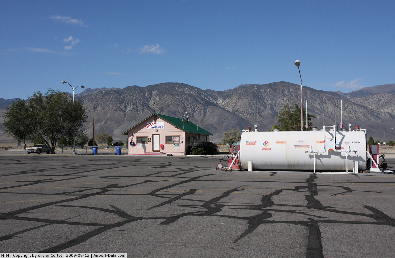
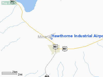
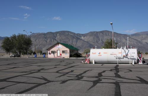
Hawthorne Industrial Airport (IATA: HTH, ICAO: KHTH, FAA LID: HTH), formerly known as Hawthorne Municipal Airport, is a county-owned public-use airport located one mile (2 km) north of the central business district of Hawthorne, in Mineral County, Nevada, United States.
Facilities and aircraft
Hawthorne Industrial Airport covers an area of 901 acres (365 ha) which contains two runways: 10/28 with a 6,000 x 100 ft (1,829 x 30 m) asphalt pavement and 15/33 with a 3,500 x 130 ft (1,067 x 40 m) dirt surface. For the 12-month period ending November 30, 2006, the airport had 12,700 aircraft operations, an average of 34 per day: 95% general aviation, 3% air taxi and 2% military.
The above content comes from Wikipedia and is published under free licenses – click here to read more.
 |
(Click on the photo to enlarge) |
Location & QuickFacts
| FAA Information Effective: | 2008-09-25 |
| Airport Identifier: | HTH |
| Airport Status: | Operational |
| Longitude/Latitude: | 118-38-03.4810W/38-32-39.7170N
-118.634300/38.544366 (Estimated) |
| Elevation: | 4215 ft / 1284.73 m (Estimated) |
| Land: | 901 acres |
| From nearest city: | 1 nautical miles N of Hawthorne, NV |
| Location: | Mineral County, NV |
| Magnetic Variation: | 17E (1965) |
Owner & Manager
| Ownership: | Publicly owned |
| Owner: | Mineral County |
| Address: | Po Box 1035
Hawthorne, NV 89415 |
| Phone number: | 775-945-3897 |
| Manager: | Cal Olson |
| Address: | Po Box 1035
Hawthorne, NV 89415 |
| Phone number: | 775-945-3897 |
Airport Operations and Facilities
| Airport Use: | Open to public |
| Wind indicator: | Yes |
| Segmented Circle: | Yes |
| Control Tower: | No |
| Lighting Schedule: | DUSK-DAWN
ACTVT MIRL RY 10/28 - CTAF 122.8. |
| Beacon Color: | Clear-Green (lighted land airport) |
| Landing fee charge: | No |
| Sectional chart: | San Francisco |
| Region: | AWP - Western-Pacific |
| Boundary ARTCC: | ZOA - Oakland |
| Tie-in FSS: | RNO - Reno |
| FSS on Airport: | No |
| FSS Toll Free: | 1-800-WX-BRIEF |
| NOTAMs Facility: | HTH (NOTAM-d service avaliable) |
| Federal Agreements: | NGPSY |
Airport Communications
| CTAF: | 122.800 |
| Unicom: | 122.800 |
Airport Services
| Fuel available: | 100 A |
| Airframe Repair: | NONE |
| Power Plant Repair: | NONE |
| Bottled Oxygen: | NONE |
| Bulk Oxygen: | NONE |
Runway Information
Runway 10/28
| Dimension: | 6000 x 100 ft / 1828.8 x 30.5 m |
| Surface: | ASPH, Good Condition |
| Weight Limit: | Single wheel: 53000 lbs.
Dual wheel: 93000 lbs.
Dual tandem wheel: 160000 lbs. |
| Edge Lights: | Medium |
| |
Runway 10 |
Runway 28 |
| Traffic Pattern: | Left | Left |
| Markings: | Non-precision instrument, Good Condition | Non-precision instrument, Good Condition |
| Crossing Height: | 0.00 ft | 49.00 ft |
| VASI: | | 2-light PAPI on left side |
| Visual Glide Angle: | 0.00° | 3.00° |
| Runway End Identifier: | Yes | Yes |
| Centerline Lights: | No | No |
| Touchdown Lights: | No | No |
|
Runway 15/33
| Dimension: | 3500 x 130 ft / 1066.8 x 39.6 m |
| Surface: | DIRT, Good Condition |
| |
Runway 15 |
Runway 33 |
| Traffic Pattern: | Left | Left |
| Markings: | None, | None, |
| Runway End Identifier: | No | No |
| Centerline Lights: | No | No |
| Touchdown Lights: | No | No |
| Obstruction: | 23 ft rr, 100.0 ft from runway, 4:1 slope to clear | , 50:1 slope to clear |
|
Radio Navigation Aids
| ID |
Type |
Name |
Ch |
Freq |
Var |
Dist |
| MVA | VORTAC | Mina | 098X | 115.10 | 17E | 28.3 nm |
Remarks
- RY 33 STARTS AT NORTH EDGE RY 10/28.
- ULTRALIGHT ACTIVITY ON & INVOF ARPT.
Images and information placed above are from
http://www.airport-data.com/airport/HTH/
We thank them for the data!
| General Info
|
| Country |
United States
|
| State |
NEVADA
|
| FAA ID |
HTH
|
| Latitude |
38-32-39.717N
|
| Longitude |
118-38-03.481W
|
| Elevation |
4215 feet
|
| Near City |
HAWTHORNE
|
We don't guarantee the information is fresh and accurate. The data may
be wrong or outdated.
For more up-to-date information please refer to other sources.
|
|