 |
|
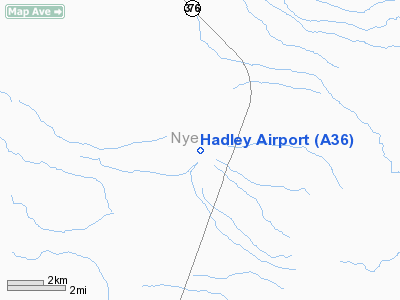
| Hadley Airport |
| IATA: none – ICAO: none – FAA LID: A36 |
| Summary |
| Airport type |
Public |
| Owner |
U.S. Bureau of Land Management |
| Location |
Round Mountain, Nevada |
| Elevation AMSL |
5,744 ft / 1,751 m |
| Coordinates |
38°41′39″N 117°08′48″W / 38.69417°N 117.14667°W / 38.69417; -117.14667 |
| Runways |
| Direction |
Length |
Surface |
| ft |
m |
| 17/35 |
6,776 |
2,065 |
Asphalt |
| Statistics (2005) |
| Aircraft operations |
2,000 |
| Source: Federal Aviation Administration |
Hadley Airport (FAA LID: A36) is a public-use airport located four nautical miles (7 km) southwest of the central business district of Round Mountain, a town in Nye County, Nevada, United States. History
In the 1930s, American World War I flying ace Kenneth R. Unger ran a flying school and air shows from the airport.
Facilities and aircraft
Hadley Airport covers an area of 35 acres (14 ha). It contains one runway designated 17/35 which has an asphalt surface measuring 6,776 x 60 feet (2,065 x 18 m). For the 12-month period ending June 30, 2005, the airport had 2,000 general aviation aircraft operations, an average of 166 per month.
The above content comes from Wikipedia and is published under free licenses – click here to read more.
Location & QuickFacts
| FAA Information Effective: | 2008-09-25 |
| Airport Identifier: | A36 |
| Airport Status: | Operational |
| Longitude/Latitude: | 117-08-48.3080W/38-41-38.7540N
-117.146752/38.694098 (Estimated) |
| Elevation: | 5744 ft / 1750.77 m (Surveyed) |
| Land: | 35 acres |
| From nearest city: | 4 nautical miles SW of Round Mountain, NV |
| Location: | Nye County, NV |
| Magnetic Variation: | 15E (1985) |
Owner & Manager
| Ownership: | Privately owned |
| Owner: | Round Mountain Gold Corp |
| Address: | Po Box 480
Round Mountain, NV 89045 |
| Phone number: | 775-377-2366 |
| Manager: | Earl Doege |
| Address: | Po Box 480
Round Mountain, NV 89045 |
| Phone number: | 775-377-3103 |
Airport Operations and Facilities
| Airport Use: | Open to public |
| Wind indicator: | No |
| Segmented Circle: | No |
| Control Tower: | No |
| Sectional chart: | Las Vegas |
| Region: | AWP - Western-Pacific |
| Boundary ARTCC: | ZLC - Salt Lake City |
| Tie-in FSS: | RNO - Reno |
| FSS Toll Free: | 1-800-WX-BRIEF |
| NOTAMs Facility: | RNO (NOTAM-d service avaliable) |
Airport Communications
Airport Services
Runway Information
Runway 17/35
| Dimension: | 6776 x 60 ft / 2065.3 x 18.3 m |
| Surface: | ASPH, Good Condition |
| |
Runway 17 |
Runway 35 |
| Traffic Pattern: | Left | Left |
| Markings: | Nonstandard, Fair Condition
RWY 17 MARKINGS FADED. | Nonstandard, Fair Condition
RWY 35 MARKINGS FADED |
| Obstruction: | 4 ft fence, 200.0 ft from runway, 90 ft left of centerline
RY 17/35 +5' FENCE RUNS PARALLEL TO RY 90' L OF RY 17 & 90' R OF RY 35, RY 35 ROAD RUNS PARALLEL TO RY 60 FT LEFT. | 15 ft road, 200.0 ft from runway, 60 ft left of centerline |
|
Radio Navigation Aids
| ID |
Type |
Name |
Ch |
Freq |
Var |
Dist |
| TPH | VORTAC | Tonopah | 119X | 117.20 | 17E | 40.2 nm |
| MVA | VORTAC | Mina | 098X | 115.10 | 17E | 42.3 nm |
Remarks
- AIRPORT AVBL DURING VFR CONDITIONS AND DAYLIGHT HOURS ONLY.
- PRVD USE IS DURING VFR CONDITIONS & DLGT HRS ONLY.
Images and information placed above are from
http://www.airport-data.com/airport/A36/
We thank them for the data!
| General Info
|
| Country |
United States
|
| State |
NEVADA
|
| FAA ID |
A36
|
| Latitude |
38-41-38.754N
|
| Longitude |
117-08-48.308W
|
| Elevation |
5744 feet
|
| Near City |
ROUND MOUNTAIN
|
We don't guarantee the information is fresh and accurate. The data may
be wrong or outdated.
For more up-to-date information please refer to other sources.
|
|


