 |
|
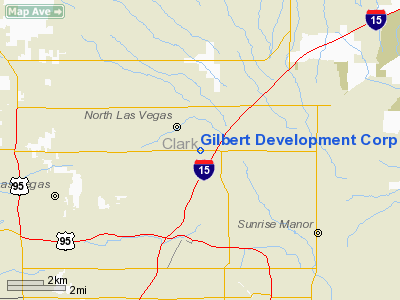
Gilbert Development Corp Heliport |
Location & QuickFacts
| FAA Information Effective: | 2008-09-25 |
| Airport Identifier: | NV61 |
| Airport Status: | Operational |
| Longitude/Latitude: | 115-08-01.0090W/36-13-04.8900N
-115.133614/36.218025 (Estimated) |
| Elevation: | 1981 ft / 603.81 m (Estimated) |
| Land: | 0 acres |
| From nearest city: | 5 nautical miles W of Las Vegas, NV |
| Location: | Clark County, NV |
| Magnetic Variation: | 14E (1985) |
Owner & Manager
| Ownership: | Privately owned |
| Owner: | Steve Gilbert |
| Address: | Po Box 665
Cedar City, UT 84720 |
| Phone number: | 435-586-5138 |
| Manager: | Steve Gilbert |
| Address: | Po Box 665
Cedar City, UT 84720 |
| Phone number: | 435-586-5138 |
Airport Operations and Facilities
| Airport Use: | Private |
| Wind indicator: | Yes |
| Segmented Circle: | No |
| Control Tower: | No |
| Landing fee charge: | No |
| Sectional chart: | Las Vegas |
| Region: | AWP - Western-Pacific |
| Boundary ARTCC: | ZLA - Los Angeles |
| Tie-in FSS: | RNO - Reno |
| FSS on Airport: | No |
| FSS Toll Free: | 1-800-WX-BRIEF |
Runway Information
Helipad H1
| Dimension: | 60 x 60 ft / 18.3 x 18.3 m |
| Surface: | ASPH, |
| |
Runway H1 |
Runway |
| Traffic Pattern: | Left | Left |
|
Radio Navigation Aids
| ID |
Type |
Name |
Ch |
Freq |
Var |
Dist |
| MCY | NDB | Mercury | | 326.00 | 16E | 49.7 nm |
| LSV | TACAN | Nellis | 012X | | 15E | 5.5 nm |
| INS | TACAN | Indian Springs | 067X | | 15E | 34.1 nm |
| LAS | VORTAC | Las Vegas | 116X | 116.90 | 15E | 8.4 nm |
| BLD | VORTAC | Boulder City | 114X | 116.70 | 15E | 18.7 nm |
| VGT | VOT | North Las Vegas | | 108.20 | | 3.4 nm |
Remarks
- CONDL VFR; PVT USE; PROVIDED PILOTS ESTABLISH AND REMAIN IN TWO-WAY RADIO COMMUNICATION WITH LAS VEGAS TOWER WHILE OPERATING INTO OR OUT OF THE LAS VEGAS TERMINAL CONTROL AREA.
Images and information placed above are from
http://www.airport-data.com/airport/NV61/
We thank them for the data!
| General Info
|
| Country |
United States
|
| State |
NEVADA
|
| FAA ID |
NV61
|
| Latitude |
36-13-04.890N
|
| Longitude |
115-08-01.009W
|
| Elevation |
1981 feet
|
| Near City |
LAS VEGAS
|
We don't guarantee the information is fresh and accurate. The data may
be wrong or outdated.
For more up-to-date information please refer to other sources.
|
|


