 |
|
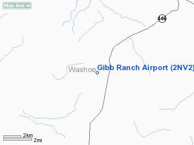
Location & QuickFacts
| FAA Information Effective: | 2008-09-25 |
| Airport Identifier: | 2NV2 |
| Airport Status: | Operational |
| Longitude/Latitude: | 119-40-29.0000W/39-50-05.0000N
-119.674722/39.834722 (Estimated) |
| Elevation: | 4242 ft / 1292.96 m (Estimated) |
| Land: | 0 acres |
| From nearest city: | 18 nautical miles NE of Sparks, NV |
| Location: | Washoe County, NV |
| Magnetic Variation: | 16E (1995) |
Owner & Manager
| Ownership: | Privately owned |
| Owner: | Jon R. Gibb |
| Address: | 5100 Grey Van Rd
Reno, NV 89510 |
| Phone number: | 775-475-0315 |
| Manager: | Sherry Gibb |
| Address: | 5100 Grey Van Rd
Reno, NV 89510 |
| Phone number: | 775-475-0315 |
Airport Operations and Facilities
| Airport Use: | Private |
| Wind indicator: | Yes |
| Segmented Circle: | No |
| Control Tower: | No |
| Sectional chart: | San Francisco |
| Region: | AWP - Western-Pacific |
| Boundary ARTCC: | ZOA - Oakland |
| Tie-in FSS: | RNO - Reno |
| FSS Toll Free: | 1-800-WX-BRIEF |
Runway Information
Runway 16/34
| Dimension: | 4000 x 40 ft / 1219.2 x 12.2 m |
| Surface: | DIRT, |
| Surface Treatment: | Aggregate Friction Seal Coat |
| |
Runway 16 |
Runway 34 |
| Traffic Pattern: | Left | Left |
|
Radio Navigation Aids
| ID |
Type |
Name |
Ch |
Freq |
Var |
Dist |
| AHC | VOR/DME | Amedee | 027X | 109.00 | 17E | 34.1 nm |
| SWR | VOR/DME | Squaw Valley | 079X | 113.20 | 16E | 48.0 nm |
| FMG | VORTAC | Mustang | 126X | 117.90 | 16E | 18.3 nm |
| HZN | VORTAC | Hazen | 088X | 114.10 | 17E | 36.7 nm |
Remarks
- SEE AIRSPACE CASE 92-AWP-2059-NRA.
Images and information placed above are from
http://www.airport-data.com/airport/2NV2/
We thank them for the data!
| General Info
|
| Country |
United States
|
| State |
NEVADA
|
| FAA ID |
2NV2
|
| Latitude |
39-50-05.000N
|
| Longitude |
119-40-29.000W
|
| Elevation |
4242 feet
|
| Near City |
SPARKS
|
We don't guarantee the information is fresh and accurate. The data may
be wrong or outdated.
For more up-to-date information please refer to other sources.
|
|


