 |
|
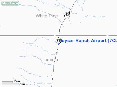
Location & QuickFacts
| FAA Information Effective: | 2008-09-25 |
| Airport Identifier: | 7CL8 |
| Airport Status: | Operational |
| Longitude/Latitude: | 114-37-56.0090W/38-39-50.8200N
-114.632225/38.664117 (Estimated) |
| Elevation: | 5977 ft / 1821.79 m (Surveyed) |
| Land: | 34 acres |
| From nearest city: | 37 nautical miles SE of Ely/pioche, NV |
| Location: | Lincoln County, NV |
| Magnetic Variation: | 15E (1985) |
Owner & Manager
| Ownership: | Privately owned |
| Owner: | Geyser Ranch Llc
ATTN: DOUG CARRIGER, SENIOIR VP/COMMUNITY AFFAIRS |
| Address: | Po Box 37008
Coyote Springs, NV 89037 |
| Phone number: | 702-422-1400 |
| Manager: | Demar Dahl |
| Address: | Po Box 266
Fallon, NV 89407 |
| Phone number: | 775-741-4168 |
Airport Operations and Facilities
| Airport Use: | Private |
| Wind indicator: | No |
| Segmented Circle: | No |
| Control Tower: | No |
| Landing fee charge: | No |
| Sectional chart: | Las Vegas |
| Region: | AWP - Western-Pacific |
| Boundary ARTCC: | ZLC - Salt Lake City |
| Tie-in FSS: | RNO - Reno |
| FSS on Airport: | No |
| FSS Toll Free: | 1-800-WX-BRIEF |
Airport Services
| Airframe Repair: | NONE |
| Power Plant Repair: | NONE |
| Bottled Oxygen: | NONE |
| Bulk Oxygen: | NONE |
Runway Information
Runway 17/35
| Dimension: | 4450 x 60 ft / 1356.4 x 18.3 m |
| Surface: | DIRT, Fair Condition
+2 FT BRUSH AND WEEDS OVERRUN LAST 700 FT SOUTH END OF RY. |
| |
Runway 17 |
Runway 35 |
| Traffic Pattern: | Left | Left |
| Obstruction: | 5 ft fence, 75.0 ft from runway, 15:1 slope to clear | 4 ft fence, 100.0 ft from runway, 25:1 slope to clear |
|
Radio Navigation Aids
| ID |
Type |
Name |
Ch |
Freq |
Var |
Dist |
| ELY | VOR/DME | Ely | 043X | 110.60 | 14E | 39.4 nm |
| ILC | VORTAC | Wilson Creek | 110X | 116.30 | 16E | 27.3 nm |
Remarks
- POWER LINES N, S & W OF RY; RANCH N OF RY; POWER SUBSTATION S OF RY.
- NO NIGHT OPERATIONS.
- AIRPORT NOT MAINTAINED.
- UP TO 4 FT BRUSH ON BANKS ALONG BOTH SIDES OF RY.
- NOT REQUIRED, GREATER THAN 20 NM FM AN INSTRUMENTED RWY ARPT.
Images and information placed above are from
http://www.airport-data.com/airport/7CL8/
We thank them for the data!
| General Info
|
| Country |
United States
|
| State |
NEVADA
|
| FAA ID |
7CL8
|
| Latitude |
38-39-50.820N
|
| Longitude |
114-37-56.009W
|
| Elevation |
5977 feet
|
| Near City |
ELY/PIOCHE
|
We don't guarantee the information is fresh and accurate. The data may
be wrong or outdated.
For more up-to-date information please refer to other sources.
|
|


