 |
|
| Gabbs Airport |
| IATA: GAB – ICAO: KGAB – FAA LID: GAB |
| Summary |
| Airport type |
Public |
| Owner |
Nye County |
| Serves |
Gabbs, Nevada |
| Elevation AMSL |
4,700 ft / 1,433 m |
| Coordinates |
38°55′27″N 117°57′32″W / 38.92417°N 117.95889°W / 38.92417; -117.95889 |
| Runways |
| Direction |
Length |
Surface |
| ft |
m |
| 8/26 |
5,900 |
1,798 |
Dirt |
| 16/34 |
2,800 |
853 |
Dirt |
| Statistics (2007) |
| Aircraft operations |
200 |
| Source: Federal Aviation Administration |
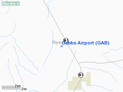
Gabbs Airport (IATA: GAB, ICAO: KGAB, FAA LID: GAB) is a county-owned public-use airport located four nautical miles (7 km) northwest of the central business district of Gabbs, a city in Nye County, Nevada, United States.
Facilities and aircraft
Gabbs Airport covers an area of 880 acres (356 ha) at an elevation of 4,700 feet (1,433 m) above mean sea level. It has two runways with dirt surfaces: 8/26 measuring 5,900 by 65 feet (1,798 x 20 m) and 16/34 measuring 2,800 by 65 feet (853 x 20 m). For the 12-month period ending April 30, 2007, the airport had 200 aircraft operations, all of which were general aviation.
The above content comes from Wikipedia and is published under free licenses – click here to read more.
Location & QuickFacts
| FAA Information Effective: | 2008-09-25 |
| Airport Identifier: | GAB |
| Airport Status: | Operational |
| Longitude/Latitude: | 117-57-32.4260W/38-55-26.7280N
-117.959007/38.924091 (Estimated) |
| Elevation: | 4700 ft / 1432.56 m (Estimated) |
| Land: | 880 acres |
| From nearest city: | 4 nautical miles NW of Gabbs, NV |
| Location: | Nye County, NV |
| Magnetic Variation: | 15E (1985) |
Owner & Manager
| Ownership: | Publicly owned |
| Owner: | Nye County |
| Address: | Box 153
Tonopah, NV 89049 |
| Phone number: | 775-482-8157 |
| Manager: | Samson Yao |
| Address: | 250 N. Hwy 160 #2
Pahrump, NV 89060 |
| Phone number: | 775-751-6855 |
Airport Operations and Facilities
| Airport Use: | Open to public |
| Wind indicator: | Yes |
| Segmented Circle: | Yes |
| Control Tower: | No |
| Lighting Schedule: | DUSK-DAWN |
| Beacon Color: | Clear-Green (lighted land airport) |
| Landing fee charge: | No |
| Sectional chart: | Las Vegas |
| Region: | AWP - Western-Pacific |
| Boundary ARTCC: | ZOA - Oakland |
| Tie-in FSS: | RNO - Reno |
| FSS on Airport: | No |
| FSS Toll Free: | 1-800-WX-BRIEF |
| NOTAMs Facility: | RNO (NOTAM-d service avaliable) |
| Federal Agreements: | NGSY |
Airport Communications
Airport Services
| Airframe Repair: | NONE |
| Power Plant Repair: | NONE |
| Bottled Oxygen: | NONE |
| Bulk Oxygen: | NONE |
Runway Information
Runway 08/26
| Dimension: | 5900 x 65 ft / 1798.3 x 19.8 m |
| Surface: | DIRT, Good Condition
WEEDS +1' FULL LENGTH OF RWY.
WEEDS +1' FULL LENGTH OF RWY. |
| |
Runway 08 |
Runway 26 |
| Traffic Pattern: | Left | Left |
|
Runway 16/34
| Dimension: | 2800 x 65 ft / 853.4 x 19.8 m |
| Surface: | DIRT, Good Condition
WEEDS +1' FULL LENGTH OF RWY.
WEEDS +1' FULL LENGTH OF RWY. |
| |
Runway 16 |
Runway 34 |
| Traffic Pattern: | Left | Left |
|
Radio Navigation Aids
| ID |
Type |
Name |
Ch |
Freq |
Var |
Dist |
| NFL | TACAN | Fallon | 082X | | 16E | 45.7 nm |
| MVA | VORTAC | Mina | 098X | 115.10 | 17E | 21.8 nm |
Remarks
- RCMD LAND RY 08; TKOF RY 26 WIND PMTG.
- RY 08/26 & RY 16/34 NO LINE OF SIGHT BETWEEN RYS.
- ESTABD PRIOR TO 5/15/59.
Images and information placed above are from
http://www.airport-data.com/airport/GAB/
We thank them for the data!
| General Info
|
| Country |
United States
|
| State |
NEVADA
|
| FAA ID |
GAB
|
| Latitude |
38-55-26.728N
|
| Longitude |
117-57-32.426W
|
| Elevation |
4700 feet
|
| Near City |
GABBS
|
We don't guarantee the information is fresh and accurate. The data may
be wrong or outdated.
For more up-to-date information please refer to other sources.
|
|


