 |
|
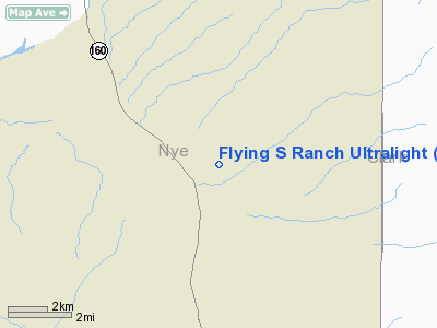
Flying S Ranch Ultralight Airport |
Location & QuickFacts
| FAA Information Effective: | 2008-09-25 |
| Airport Identifier: | NV54 |
| Airport Status: | Operational |
| Longitude/Latitude: | 115-59-20.0400W/36-18-25.2600N
-115.988900/36.307017 (Estimated) |
| Elevation: | 2800 ft / 853.44 m (Estimated) |
| Land: | 10 acres |
| From nearest city: | 7 nautical miles SW of Pahrump, NV |
| Location: | Nye County, NV |
| Magnetic Variation: | 14E (1995) |
Owner & Manager
| Ownership: | Privately owned |
| Owner: | Vic Spankowski |
| Address: | 1451 E Fort Churchill Rd.
Pahrump, NV 89048 |
| Phone number: | 775-764-2334 |
| Manager: | Vic Spankowski |
| Address: | 1451 E Fort Churchill Rd.
Pahrump, NV 89048 |
| Phone number: | 775-764-2334 |
Airport Operations and Facilities
| Airport Use: | Private |
| Wind indicator: | Yes |
| Segmented Circle: | No |
| Control Tower: | No |
| Sectional chart: | Las Vegas |
| Region: | AWP - Western-Pacific |
| Boundary ARTCC: | ZLA - Los Angeles |
| Tie-in FSS: | RNO - Reno |
| FSS Toll Free: | 1-800-WX-BRIEF |
Runway Information
Runway 05/23
| Dimension: | 800 x 25 ft / 243.8 x 7.6 m |
| Surface: | GRVL, |
| |
Runway 05 |
Runway 23 |
| Traffic Pattern: | Left | Left |
|
Helipad H1
| Dimension: | 40 x 30 ft / 12.2 x 9.1 m |
| Surface: | CONC, |
| |
Runway H1 |
Runway |
| Traffic Pattern: | Left | Left |
|
Radio Navigation Aids
| ID |
Type |
Name |
Ch |
Freq |
Var |
Dist |
| MCY | NDB | Mercury | | 326.00 | 16E | 19.4 nm |
| INS | TACAN | Indian Springs | 067X | | 15E | 22.7 nm |
| LSV | TACAN | Nellis | 012X | | 15E | 46.9 nm |
| LAS | VORTAC | Las Vegas | 116X | 116.90 | 15E | 42.5 nm |
| BTY | VORTAC | Beatty | 094X | 114.70 | 16E | 47.1 nm |
| VGT | VOT | North Las Vegas | | 108.20 | | 38.5 nm |
Remarks
- PROVIDED VFR OPNS, PRIVATE USE, AND SPONSOR ENSURES OBSTRUCTION FREE INGRESS AND EGRESS ROUTES.
Images and information placed above are from
http://www.airport-data.com/airport/NV54/
We thank them for the data!
| General Info
|
| Country |
United States
|
| State |
NEVADA
|
| FAA ID |
NV54
|
| Latitude |
36-18-25.260N
|
| Longitude |
115-59-20.040W
|
| Elevation |
2800 feet
|
| Near City |
PAHRUMP
|
We don't guarantee the information is fresh and accurate. The data may
be wrong or outdated.
For more up-to-date information please refer to other sources.
|
|


