 |
|
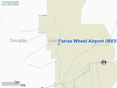
Location & QuickFacts
| FAA Information Effective: | 2008-09-25 |
| Airport Identifier: | NV33 |
| Airport Status: | Operational |
| Longitude/Latitude: | 119-23-45.5810W/38-49-59.6800N
-119.395995/38.833244 (Estimated) |
| Elevation: | 4848 ft / 1477.67 m (Surveyed) |
| Land: | 16 acres |
| From nearest city: | 6 nautical miles E of Smith Valley, NV |
| Location: | Lyon County, NV |
| Magnetic Variation: | 16E (1985) |
Owner & Manager
| Ownership: | Privately owned |
| Owner: | Valley View Airport Llc |
| Address: | Po Box 169
Smith, NV 89430 |
| Phone number: | 775-465-2699 |
| Manager: | Joseph Miceli |
| Address: | Po Box 177
Wellington, NV 89444 |
| Phone number: | 775-465-2699 |
Airport Operations and Facilities
| Airport Use: | Private |
| Wind indicator: | Yes |
| Segmented Circle: | No |
| Control Tower: | No |
| Lighting Schedule: | RDO-CTL
ACTVT MIRL RY 16/34 AND ARPT BCN 122.9. |
| Beacon Color: | Clear-Green (lighted land airport) |
| Landing fee charge: | No |
| Sectional chart: | San Francisco |
| Region: | AWP - Western-Pacific |
| Boundary ARTCC: | ZOA - Oakland |
| Tie-in FSS: | RNO - Reno |
| FSS on Airport: | No |
| FSS Toll Free: | 1-800-WX-BRIEF |
Airport Services
| Fuel available: | 100LL
EMERGENCY FUEL ONLY. |
| Airframe Repair: | NONE |
| Power Plant Repair: | NONE |
| Bottled Oxygen: | NONE |
| Bulk Oxygen: | NONE |
Runway Information
Runway 16/34
| Dimension: | 3600 x 100 ft / 1097.3 x 30.5 m
ASPH LENGTH 3,350 FT, REMAINING 250 FT DIRT, 125 FT EQUALLY BOTH ENDS.
HAS 22 FT WIDE ASPHALT CENTER ON 100 FT WIDE DIRT RY. |
| Surface: | ASPH-DIRT, Good Condition |
| Edge Lights: | Non-standard lighting system
NSTD MIRL DO NOT RUN FULL LENGTH OF RY EITHER SIDE. RY 16 MIRL ON LEFT SIDE ONLY EXTEND FIRST 2/3 OF RY. RY 34 MIRL ON LEFT SIDE ONLY EXTEND FIRST 2/3 OF RY. |
| |
Runway 16 |
Runway 34 |
| Traffic Pattern: | Left | Right |
| Markings: | None, | None, |
| Obstruction: | 30 ft tree, 350.0 ft from runway
ROAD CROSSES DIAGONALLY 120 FT FM RY 16 THLD. | 40 ft tree, 200.0 ft from runway
ROAD CROSSES DIAGONALLY 100 FT FM RY 34 THLD. |
|
Radio Navigation Aids
| ID |
Type |
Name |
Ch |
Freq |
Var |
Dist |
| NFL | TACAN | Fallon | 082X | | 16E | 47.6 nm |
| SWR | VOR/DME | Squaw Valley | 079X | 113.20 | 16E | 45.8 nm |
| FMG | VORTAC | Mustang | 126X | 117.90 | 16E | 43.7 nm |
| HZN | VORTAC | Hazen | 088X | 114.10 | 17E | 45.1 nm |
Images and information placed above are from
http://www.airport-data.com/airport/NV33/
We thank them for the data!
| General Info
|
| Country |
United States
|
| State |
NEVADA
|
| FAA ID |
NV33
|
| Latitude |
38-49-59.680N
|
| Longitude |
119-23-45.581W
|
| Elevation |
4848 feet
|
| Near City |
SMITH VALLEY
|
We don't guarantee the information is fresh and accurate. The data may
be wrong or outdated.
For more up-to-date information please refer to other sources.
|
|


