|
|
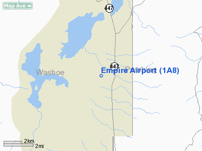
| Empire Airport |
 |
| IATA: none – ICAO: none – FAA LID: 1A8 |
| Summary |
| Operator |
US Gypsum Company |
| Location |
Empire, Nevada |
| Elevation AMSL |
3,990 ft / 1,216.2 m |
| Coordinates |
40°34′41″N 119°21′10″W / 40.57806°N 119.35278°W / 40.57806; -119.35278Coordinates: 40°34′41″N 119°21′10″W / 40.57806°N 119.35278°W / 40.57806; -119.35278 |
| Runways |
| Direction |
Length |
Surface |
| ft |
m |
| 7/25 |
3,170 |
966 |
Dirt |
| 18/36 |
3,770 |
1,149 |
Dirt |
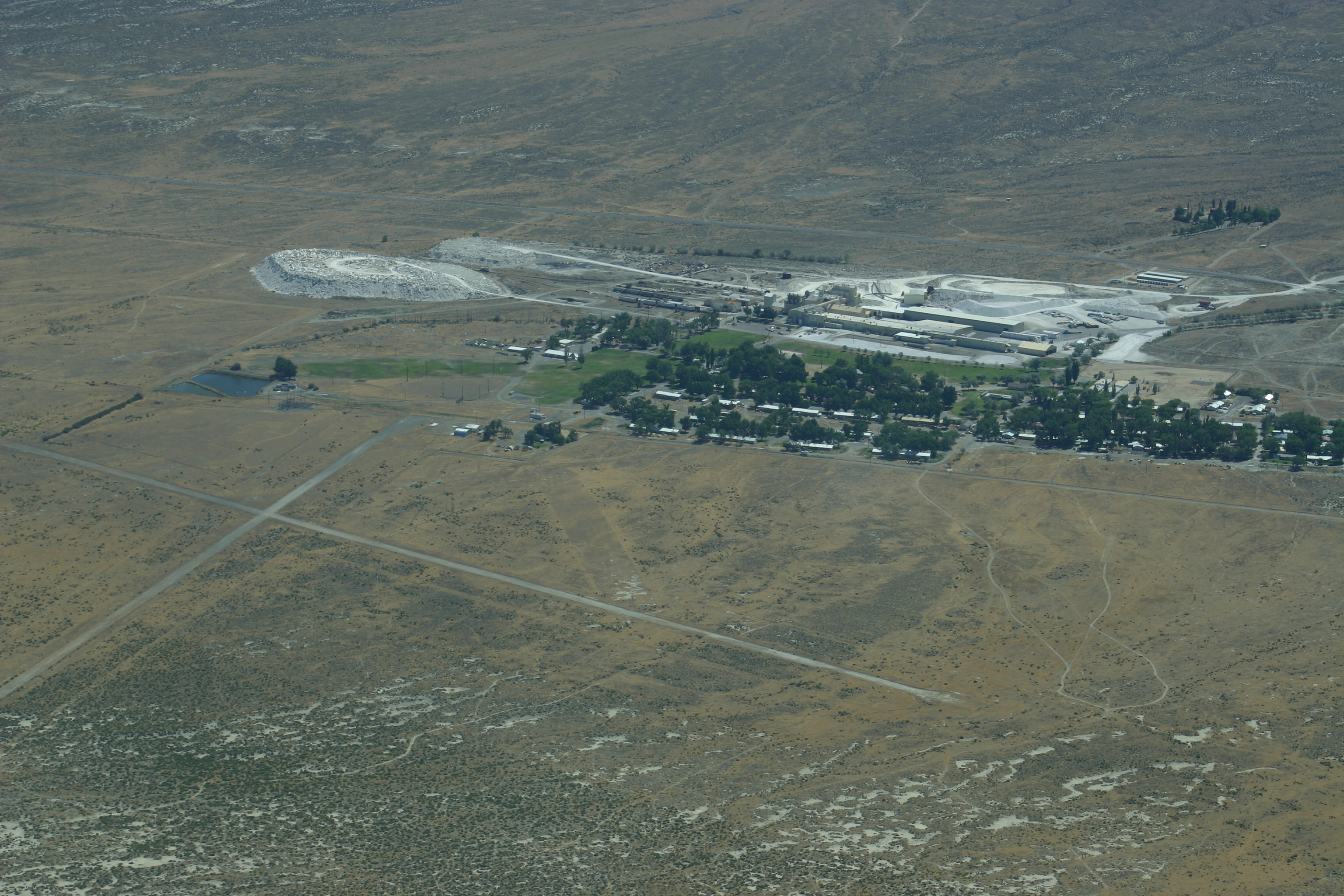
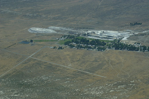
Empire Airport (FAA LID: 1A8) is a public airport located on the west side of Empire, in Washoe County, Nevada, USA.
Facilities
Empire Airport covers 75 acres (30 ha) and has two runways:
- Runway 7/25: 3,170 ft × 48 ft (970 m × 15 m), Surface: Dirt
- Runway 18/36: 3,770 × 42 ft (1,150 × 13 m), Surface: Dirt
The above content comes from Wikipedia and is published under free licenses – click here to read more.
Location & QuickFacts
| FAA Information Effective: | 2008-09-25 |
| Airport Identifier: | 1A8 |
| Airport Status: | Operational |
| Longitude/Latitude: | 119-21-09.6700W/40-34-40.6470N
-119.352686/40.577957 (Estimated) |
| Elevation: | 3990 ft / 1216.15 m (Estimated) |
| Land: | 75 acres |
| From nearest city: | 1 nautical miles W of Empire, NV |
| Location: | Washoe County, NV |
| Magnetic Variation: | 17E (1985) |
Owner & Manager
| Ownership: | Publicly owned |
| Owner: | Us Gypsum Company |
| Address: | Po Box 130
Empire, NV 89405 |
| Phone number: | 775-557-2341 |
| Manager: | Ken Sanuelson |
| Address: | Us Gypsum Company, Po Box 130
Empire, NV 89405 |
| Phone number: | 775-557-2341 |
Airport Operations and Facilities
| Airport Use: | Open to public |
| Wind indicator: | Yes |
| Segmented Circle: | Yes |
| Control Tower: | No |
| Landing fee charge: | No |
| Sectional chart: | Klamath Falls |
| Region: | AWP - Western-Pacific |
| Boundary ARTCC: | ZOA - Oakland |
| Tie-in FSS: | RNO - Reno |
| FSS Toll Free: | 1-800-WX-BRIEF |
| NOTAMs Facility: | RNO (NOTAM-d service avaliable) |
Airport Communications
Runway Information
Runway 07/25
| Dimension: | 3170 x 48 ft / 966.2 x 14.6 m |
| Surface: | DIRT, Good Condition |
| |
Runway 07 |
Runway 25 |
| Traffic Pattern: | Right | Left |
| Displaced threshold: | 0.00 ft | 800.00 ft
DSPLCD THLD MKD BY 8 WHITE TIRES. |
| Obstruction: | , 50:1 slope to clear | 40 ft pline, 50.0 ft from runway, 1:1 slope to clear
APCH RATIO 21:1 TO DSPLCD THLD DUE TO 40 FT PLINES 850 FT FROM THLD L & R OF CNTRLN. |
|
Runway 18/36
| Dimension: | 3770 x 42 ft / 1149.1 x 12.8 m |
| Surface: | DIRT, Good Condition |
| |
Runway 18 |
Runway 36 |
| Traffic Pattern: | Right | Left |
| Obstruction: | 25 ft pline, 1000.0 ft from runway, 40:1 slope to clear | , 50:1 slope to clear |
|
Radio Navigation Aids
| ID |
Type |
Name |
Ch |
Freq |
Var |
Dist |
| AHC | VOR/DME | Amedee | 027X | 109.00 | 17E | 41.0 nm |
| LLC | VORTAC | Lovelock | 112X | 116.50 | 16E | 44.7 nm |
Remarks
- NO TKOF RY 07 DUE TO PLINE & BALL FIELD LGTS +50 FT.
- RY 18/36 THLDS MARKED WITH WHITE TIRES.
- 1 FT BERMS AROUND ALL RYS.
- VFR USE ONLY; RY 25 THR DSPLCD TO PROVIDE 20:1 APCH SLOPE.
Images and information placed above are from
http://www.airport-data.com/airport/1A8/
We thank them for the data!
| General Info
|
| Country |
United States
|
| State |
NEVADA
|
| FAA ID |
1A8
|
| Latitude |
40-34-40.647N
|
| Longitude |
119-21-09.670W
|
| Elevation |
3990 feet
|
| Near City |
EMPIRE
|
We don't guarantee the information is fresh and accurate. The data may
be wrong or outdated.
For more up-to-date information please refer to other sources.
|
|