 |
|
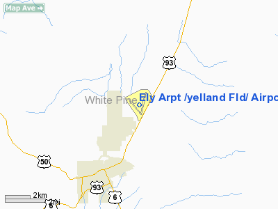
Ely Arpt /yelland Fld/ Airport |
Ely Airport
Yelland Field |
| IATA: ELY – ICAO: KELY – FAA LID: ELY |
| Summary |
| Owner |
White Pine County |
| Serves |
Ely, Nevada |
| Elevation AMSL |
6,259 ft / 1,908 m |
| Coordinates |
39°17′59″N 114°50′31″W / 39.29972°N 114.84194°W / 39.29972; -114.84194 |
| Runways |
| Direction |
Length |
Surface |
| ft |
m |
| 18/36 |
6,018 |
1,834 |
Asphalt |
| 12/30 |
4,814 |
1,467 |
Asphalt |
| Statistics (2007) |
| Aircraft operations |
10,260 |
| Based aircraft |
28 |
| Source: Federal Aviation Administration |
Ely Airport (IATA: ELY, ICAO: KELY, FAA LID: ELY), also known as Yelland Field, is a county-owned public-use airport located three miles (5 km) northeast of the central business district of Ely, a city in White Pine County, Nevada, United States. It is served by one commercial airline, with service subsidized by the Essential Air Service program. History
On November 12, 2006, Air Midwest (operating as U.S. Airways Express) commenced service to McCarran International Airport in Las Vegas, Nevada. These flights include a stop at Cedar City Regional Airport in Cedar City, Utah, because McCarran requires Transportation Security Administration screening not available at Ely Airport. Previously, scheduled service was provided by Scenic Airlines with flights to North Las Vegas Airport and Elko Regional Airport.
Facilities and aircraft
Ely Airport covers an area of 3,450 acres (14 km) which contains two asphalt paved runways: 18/36 measuring 6,018 x 150 ft. (1,834 x 46 m) and 12/30 measuring 4,814 x 60 ft. (1,467 x 18 m).
For the 12-month period ending August 31, 2007, the airport had 10,260 aircraft operations, an average of 28 per day: 76% general aviation, 23% air taxi and 1% military. At that time there were 28 aircraft based at this airport: 43% single-engine, 7% multi-engine, 7% helicopter, 7% glider and 36% ultralight.
Airlines and destinations
| Airlines |
Destinations |
| Great Lakes Airlines |
Denver, Moab |
The above content comes from Wikipedia and is published under free licenses – click here to read more.
Location & QuickFacts
| FAA Information Effective: | 2008-09-25 |
| Airport Identifier: | ELY |
| Airport Status: | Operational |
| Longitude/Latitude: | 114-50-30.8000W/39-17-58.9000N
-114.841889/39.299694 (Estimated) |
| Elevation: | 6259 ft / 1907.74 m (Surveyed) |
| Land: | 3450 acres |
| From nearest city: | 3 nautical miles NE of Ely, NV |
| Location: | White Pine County, NV |
| Magnetic Variation: | 14E (2005) |
Owner & Manager
| Ownership: | Publicly owned |
| Owner: | White Pine County |
| Address: | Po Box 659
Ely, NV 89301 |
| Phone number: | 775-289-2341 |
| Manager: | Ron Williams |
| Address: | P.o. Box 150631
Ely, NV 89315-0437 |
| Phone number: | 775-289-6817 |
Airport Operations and Facilities
| Airport Use: | Open to public |
| Wind indicator: | Yes |
| Segmented Circle: | Yes |
| Control Tower: | No |
| Lighting Schedule: | DUSK-DAWN
ACTVT MIRL RY 12/30 & 18/36 AND VASI RYS 18 & 36 - CTAF. |
| Beacon Color: | Clear-Green (lighted land airport) |
| Landing fee charge: | No |
| Sectional chart: | Las Vegas |
| Region: | AWP - Western-Pacific |
| Boundary ARTCC: | ZLC - Salt Lake City |
| Tie-in FSS: | RNO - Reno |
| FSS on Airport: | No |
| FSS Toll Free: | 1-800-WX-BRIEF |
| NOTAMs Facility: | ELY (NOTAM-d service avaliable) |
| Certification type/date: | I L U 05/1973
PPR 24 HRS FOR ACR OPNS WITH MORE THAN 30 PSGR SEATS CALL AMGR 775-289-6817. |
| Federal Agreements: | NGSY |
Airport Communications
| CTAF: | 122.800 |
| Unicom: | 122.800 |
Airport Services
| Fuel available: | 100LLA
SERVICE CHARGE FOR FUEL AFTER HOURS. |
| Airframe Repair: | MINOR |
| Power Plant Repair: | MINOR |
| Bottled Oxygen: | HIGH |
| Bulk Oxygen: | NONE |
Runway Information
Runway 12/30
| Dimension: | 4814 x 60 ft / 1467.3 x 18.3 m |
| Surface: | ASPH, Fair Condition |
| Weight Limit: | Single wheel: 15000 lbs. |
| Edge Lights: | Medium |
| |
Runway 12 |
Runway 30 |
| Longitude: | 114-51-06.8285W | 114-50-28.0021W |
| Latitude: | 39-18-12.3069N | 39-17-35.5343N |
| Elevation: | 6240.00 ft | 6259.00 ft |
| Alignment: | 127 | 127 |
| Traffic Pattern: | Left | Left |
| Markings: | Non-precision instrument, Fair Condition | Non-precision instrument, Fair Condition |
| Runway End Identifier: | No | No |
| Centerline Lights: | No | No |
| Touchdown Lights: | No | No |
| Obstruction: | , 50:1 slope to clear | 31 ft pline, 630.0 ft from runway, 200 ft right of centerline, 13:1 slope to clear |
|
Runway 18/36
| Dimension: | 6018 x 150 ft / 1834.3 x 45.7 m |
| Surface: | ASPH, Good Condition |
| Surface Treatment: | Porous Friction Course |
| Weight Limit: | Single wheel: 70000 lbs.
Dual wheel: 85000 lbs.
Dual tandem wheel: 130000 lbs. |
| Edge Lights: | Medium |
| |
Runway 18 |
Runway 36 |
| Longitude: | 114-50-08.3119W | 114-50-26.5356W |
| Latitude: | 39-18-31.7636N | 39-17-34.0122N |
| Elevation: | 6225.00 ft | 6259.00 ft |
| Alignment: | 127 | 14 |
| Traffic Pattern: | Left | Left |
| Markings: | Non-precision instrument, Good Condition | Non-precision instrument, Good Condition |
| Crossing Height: | 26.00 ft | 26.00 ft |
| VASI: | 2-box on left side
VASI RY 18 OTS INDEFLY. | 2-box on left side |
| Visual Glide Angle: | 3.00° | 3.00° |
| Runway End Identifier: | No | No |
| Centerline Lights: | No | No |
| Touchdown Lights: | No | No |
|
Radio Navigation Aids
| ID |
Type |
Name |
Ch |
Freq |
Var |
Dist |
| ELY | VOR/DME | Ely | 043X | 110.60 | 14E | 0.3 nm |
Remarks
- PAVEMENT COND: RWY 18/36 GOOD; RWY 12/30 GOOD: TWYS GOOD; APRON FAIR.
- ULTRA-LIGHT ACFT OPERG ON RWY 12 END AND IN VCNTY OF ARPT DALGT HRS.
- SOFT SHOULDERS ADJACENT ALL RWYS AND TWYS.
- RY 12/30 NOT AVBL FOR ACFT OVER 30 PSGR SEATS.
- PPR 24 HRS FOR AIR CARRIER OPNS WITH MORE THAN 30 PSGR SEATS CALL ARPT MGR (775) 289-8804.
Images and information placed above are from
http://www.airport-data.com/airport/ELY/
We thank them for the data!
| General Info
|
| Country |
United States
|
| State |
NEVADA
|
| FAA ID |
ELY
|
| Latitude |
39-17-58.900N
|
| Longitude |
114-50-30.800W
|
| Elevation |
6259 feet
|
| Near City |
ELY
|
We don't guarantee the information is fresh and accurate. The data may
be wrong or outdated.
For more up-to-date information please refer to other sources.
|
|


