 |
|
| Dyer Airport |
| IATA: none – ICAO: none – FAA LID: 2Q9 |
| Summary |
| Airport type |
Public |
| Operator |
U.S. Bureau of Land Management |
| Location |
Dyer, Nevada |
| Elevation AMSL |
4,899 ft / 1,493.2 m |
| Coordinates |
37°36′35″N 118°00′23″W / 37.60972°N 118.00639°W / 37.60972; -118.00639Coordinates: 37°36′35″N 118°00′23″W / 37.60972°N 118.00639°W / 37.60972; -118.00639 |
| Runways |
| Direction |
Length |
Surface |
| ft |
m |
| 12/30 |
2,870 |
875 |
Soil |
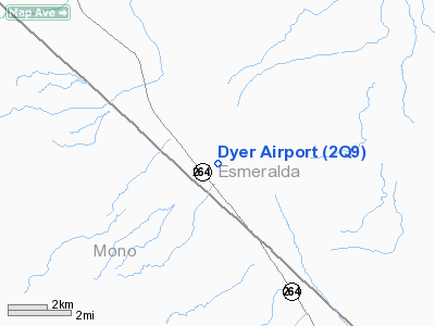
Dyer Airport (FAA LID: 2Q9) is a public airport located six miles (10 km) southeast of the central business district of Dyer, in Esmeralda County, Nevada, USA.
Facilities
Dyer Airport covers 156 acres (63 ha) and has one runway:
- Runway 12/30: 2,870 x 50 ft (875 x 15 m), Surface: Dirt
The above content comes from Wikipedia and is published under free licenses – click here to read more.
Location & QuickFacts
| FAA Information Effective: | 2008-09-25 |
| Airport Identifier: | 2Q9 |
| Airport Status: | Operational |
| Longitude/Latitude: | 118-00-23.3600W/37-36-34.7530N
-118.006489/37.609654 (Estimated) |
| Elevation: | 4899 ft / 1493.22 m (Surveyed) |
| Land: | 156 acres |
| From nearest city: | 6 nautical miles SE of Dyer, NV |
| Location: | Esmeralda County, NV |
| Magnetic Variation: | 15E (1985) |
Owner & Manager
| Ownership: | Publicly owned |
| Owner: | Us Bureau Of Land Management |
| Address: | 300 Booth Street
Reno, NV 89502 |
| Phone number: | 702-784-5451 |
| Manager: | Dick Tremaine |
| Address: | P.o. Box 248
Dyer, NV 89010 |
| Phone number: | 775-572-3059 |
Airport Operations and Facilities
| Airport Use: | Open to public |
| Wind indicator: | Yes |
| Segmented Circle: | No |
| Control Tower: | No |
| Landing fee charge: | No |
| Sectional chart: | San Francisco |
| Region: | AWP - Western-Pacific |
| Boundary ARTCC: | ZOA - Oakland |
| Tie-in FSS: | RNO - Reno |
| FSS on Airport: | No |
| FSS Toll Free: | 1-800-WX-BRIEF |
| NOTAMs Facility: | RNO (NOTAM-d service avaliable) |
Airport Communications
Airport Services
| Airframe Repair: | MAJOR |
| Power Plant Repair: | MAJOR |
| Bottled Oxygen: | NONE |
| Bulk Oxygen: | NONE |
Runway Information
Runway 12/30
| Dimension: | 2870 x 50 ft / 874.8 x 15.2 m
N W END RWY 12-30 WIDTH VARIES DUE WEEDS |
| Surface: | DIRT, Fair Condition
APPCH RWY 12 HAS WEEDS TO 5 INCHES |
| |
Runway 12 |
Runway 30 |
| Traffic Pattern: | Left | Left |
| Obstruction: | 25 ft pole, 440.0 ft from runway, 120 ft left of centerline, 17:1 slope to clear | 40 ft trees, 1245.0 ft from runway, 31:1 slope to clear |
|
Radio Navigation Aids
| ID |
Type |
Name |
Ch |
Freq |
Var |
Dist |
| BIH | VOR/DME | Bishop | 033X | 109.60 | 15E | 22.1 nm |
| OAL | VORTAC | Coaldale | 124X | 117.70 | 17E | 26.2 nm |
Remarks
- RECOMMEND TKOF RY 12 WIND PERMITTING TO AVOID OBSTRUCTION. RECOMMEND LNDG RY 30 FULL STOP ONLY.
- RY 12/30 +1 FT BERMS BOTH SIDES OF RY.
Images and information placed above are from
http://www.airport-data.com/airport/2Q9/
We thank them for the data!
| General Info
|
| Country |
United States
|
| State |
NEVADA
|
| FAA ID |
2Q9
|
| Latitude |
37-36-34.753N
|
| Longitude |
118-00-23.360W
|
| Elevation |
4899 feet
|
| Near City |
DYER
|
We don't guarantee the information is fresh and accurate. The data may
be wrong or outdated.
For more up-to-date information please refer to other sources.
|
|


