 |
|
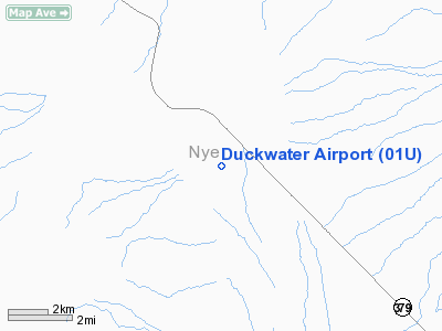
Location & QuickFacts
| FAA Information Effective: | 2008-09-25 |
| Airport Identifier: | 01U |
| Airport Status: | Operational |
| Longitude/Latitude: | 115-38-01.1290W/38-51-05.7590N
-115.633647/38.851600 (Estimated) |
| Elevation: | 5124 ft / 1561.80 m (Surveyed) |
| Land: | 275 acres |
| From nearest city: | 6 nautical miles SE of Duckwater, NV |
| Location: | Nye County, NV |
| Magnetic Variation: | 15E (1985) |
Owner & Manager
| Ownership: | Publicly owned |
| Owner: | Us Blm |
| Address: | Po Box 12000
Reno, NV 89520 |
| Phone number: | 775-861-6400 |
| Manager: | Unknown |
| Address: |
|
Airport Operations and Facilities
| Airport Use: | Open to public |
| Wind indicator: | No |
| Segmented Circle: | No |
| Control Tower: | No |
| Landing fee charge: | No |
| Sectional chart: | Las Vegas |
| Region: | AWP - Western-Pacific |
| Boundary ARTCC: | ZLC - Salt Lake City |
| Tie-in FSS: | RNO - Reno |
| FSS on Airport: | No |
| FSS Toll Free: | 1-800-WX-BRIEF |
| NOTAMs Facility: | RNO (NOTAM-d service avaliable) |
Airport Communications
Airport Services
| Airframe Repair: | NONE |
| Power Plant Repair: | NONE |
| Bottled Oxygen: | NONE |
| Bulk Oxygen: | NONE |
Runway Information
Runway 03/21
| Dimension: | 2700 x 75 ft / 823.0 x 22.9 m |
| Surface: | DIRT, Poor Condition
RY OVERGROWN UNSUITABLE FOR AIRCRAFT USE.
RY OVERGROWN UNSUITABLE FOR AICRAFT USE |
| |
Runway 03 |
Runway 21 |
| Traffic Pattern: | Left | Left |
| Markings: | None, | None, |
| Obstruction: | 15 ft road, 47 ft right of centerline | 15 ft road, 0.0 ft from runway, 47 ft left of centerline |
|
Runway 15/33
| Dimension: | 3400 x 80 ft / 1036.3 x 24.4 m |
| Surface: | DIRT, Poor Condition
RY OVERGROWN UNSUITABLE FOR AIRCRAFT USE.
RY OVERGROWN UNSUITABLE FOR AICRAFT USE |
| |
Runway 15 |
Runway 33 |
| Traffic Pattern: | Left | Left |
| Markings: | None, | None, |
| Obstruction: | , 50:1 slope to clear | 15 ft road, 30.0 ft from runway, 2:1 slope to clear |
|
Radio Navigation Aids
| ID |
Type |
Name |
Ch |
Freq |
Var |
Dist |
| ELY | VOR/DME | Ely | 043X | 110.60 | 14E | 45.4 nm |
Remarks
- WATCH FOR LIVESTOCK ON RWYS.
- RYS 03/21 & 15/33 HAVE UNCONTROLLED VEH ACCESS.
- RY 03/21 +1 FT BERM FULL LENGTH NORTH SIDE, -2 FT DITCH FULL LENGTH SOUTH SIDE.
- RY 15/33 +1 FT BERM BOTH SIDES OF RY.
- RY 3, 2 STAKES N EDGE OF RY, 135 FT FROM RY END, +4 FT HIGH.
- ARPT CLOSED INDEFINITELY.
- ESTABD PRIOR TO MAY 1959.
Images and information placed above are from
http://www.airport-data.com/airport/01U/
We thank them for the data!
| General Info
|
| Country |
United States
|
| State |
NEVADA
|
| FAA ID |
01U
|
| Latitude |
38-51-05.759N
|
| Longitude |
115-38-01.129W
|
| Elevation |
5124 feet
|
| Near City |
DUCKWATER
|
We don't guarantee the information is fresh and accurate. The data may
be wrong or outdated.
For more up-to-date information please refer to other sources.
|
|


