 |
|
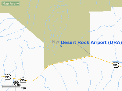
Location & QuickFacts
| FAA Information Effective: | 2008-09-25 |
| Airport Identifier: | DRA |
| Airport Status: | Operational |
| Longitude/Latitude: | 116-01-58.1110W/36-37-09.8380N
-116.032809/36.619399 (Estimated) |
| Elevation: | 3314 ft / 1010.11 m (Surveyed) |
| Land: | 100 acres |
| From nearest city: | 3 nautical miles SW of Mercury, NV |
| Location: | Nye County, NV |
| Magnetic Variation: | 15E (1980) |
Owner & Manager
| Ownership: | Publicly owned |
| Owner: | Us Dept Energy/nevada |
| Address: | Po Box 435 M/s 733
Mercury, NV 89023 |
| Phone number: | 702-295-6489 |
| Manager: | Lawrence Draper
DEPT. OF ENERGY M/S 210. |
| Address: | Box 98518
Las Vegas, NV 89193-8518 |
| Phone number: | 702-295-4015 |
Airport Operations and Facilities
| Airport Use: | Private |
| Wind indicator: | Yes |
| Segmented Circle: | No |
| Control Tower: | No |
| Landing fee charge: | No |
| Sectional chart: | Las Vegas |
| Region: | AWP - Western-Pacific |
| Boundary ARTCC: | ZLA - Los Angeles |
| Tie-in FSS: | RNO - Reno |
| FSS on Airport: | No |
| FSS Toll Free: | 1-800-WX-BRIEF |
| NOTAMs Facility: | DRA (NOTAM-d service avaliable) |
Airport Communications
Airport Services
| Fuel available: | A |
| Airframe Repair: | NONE |
| Power Plant Repair: | NONE |
| Bottled Oxygen: | NONE |
| Bulk Oxygen: | NONE |
Runway Information
Runway 02/20
| Dimension: | 7515 x 100 ft / 2290.6 x 30.5 m |
| Surface: | ASPH, Good Condition |
| Edge Lights: | Medium
MIRL RY 02/20 OTS INDEFLY. |
| |
Runway 02 |
Runway 20 |
| Traffic Pattern: | Left | Left |
| Markings: | Basic, Good Condition | Basic, Good Condition |
| Displaced threshold: | 0.00 ft | 2465.00 ft |
| VASI: | | 2-box on left side
VASI RY 02/20 OTS INDEFLY. |
| Runway End Identifier: | No | No |
| Centerline Lights: | No | No |
| Obstruction: | , 50:1 slope to clear
+3' BUSH 50' OUT ON RIGHT EDGE OF RWY. | 100 ft pline, 3100.0 ft from runway, 28:1 slope to clear
RISING TERRAIN OUT FROM THR. |
|
Radio Navigation Aids
| ID |
Type |
Name |
Ch |
Freq |
Var |
Dist |
| MCY | NDB | Mercury | | 326.00 | 16E | 0.5 nm |
| INS | TACAN | Indian Springs | 067X | | 15E | 17.6 nm |
| BTY | VORTAC | Beatty | 094X | 114.70 | 16E | 36.1 nm |
| VGT | VOT | North Las Vegas | | 108.20 | | 47.0 nm |
Remarks
- USED REGULARLY BY DEPT OF ENERGY F-27, F-227, DC-9, DHC-7, KINGAIR-MIL C-130, MILITARY & D.O.E. HELICOPTERS.
- RWY 20 TERRAIN RISES THROUGHOUT APCH ZONE.
- RWY 20 CLEAR APCH FROM DSPLCD THR XCP FOR +60' ASCENDING TERRAIN TO END OF DSPLCD AREA.
Images and information placed above are from
http://www.airport-data.com/airport/DRA/
We thank them for the data!
| General Info
|
| Country |
United States
|
| State |
NEVADA
|
| FAA ID |
DRA
|
| Latitude |
36-37-09.838N
|
| Longitude |
116-01-58.111W
|
| Elevation |
3314 feet
|
| Near City |
MERCURY
|
We don't guarantee the information is fresh and accurate. The data may
be wrong or outdated.
For more up-to-date information please refer to other sources.
|
|


