 |
|
Location & QuickFacts
| FAA Information Effective: | 2008-09-25 |
| Airport Identifier: | NV97 |
| Airport Status: | Operational |
| Longitude/Latitude: | 119-19-20.0000W/38-41-03.0000N
-119.322222/38.684167 (Estimated) |
| Elevation: | 5358 ft / 1633.12 m (Estimated) |
| Land: | 20 acres |
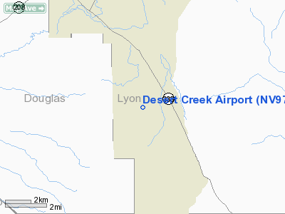
| From nearest city: | 8 nautical miles SE of Wellington, NV |
| Location: | Lyon County, NV |
| Magnetic Variation: | () |
Owner & Manager
| Ownership: | Privately owned |
| Owner: | Manny & Sharon Puerta |
| Address: | P.o. Box 83
Wellington, NV 89444 |
| Phone number: | 775-465-2404 |
| Manager: | Manny & Sharon Puerta |
| Address: | P.o. Box 83
Wellington, NV 89444 |
| Phone number: | 775-465-2404 |
Airport Operations and Facilities
| Airport Use: | Private |
| Wind indicator: | Yes |
| Segmented Circle: | No |
| Control Tower: | No |
| Sectional chart: | San Francisco |
| Region: | AWP - Western-Pacific |
| Boundary ARTCC: | ZOA - Oakland |
| Tie-in FSS: | RNO - Reno |
| FSS Toll Free: | 1-800-WX-BRIEF |
Airport Services
Runway Information
Runway 17/35
| Dimension: | 1441 x 60 ft / 439.2 x 18.3 m |
| Surface: | GRVL, |
| |
Runway 17 |
Runway 35 |
| Traffic Pattern: | Left | Left |
| Obstruction: | 10 ft trees, 10.0 ft from runway | 5 ft fence, 50.0 ft from runway |
|
Radio Navigation Aids
| ID |
Type |
Name |
Ch |
Freq |
Var |
Dist |
Remarks
- AIRPORT FREQ 122.85.
- AVOID OVERFLIGHT OF HOMES. LAND SOUTH, TAKE- OFF NORTH.
- DEER AND DOGS ON RY.
- MOUNTAIN 1.5 NM WEST AND 2 NM SOUTH.
- PROVIDED PRIVATE USE ONLY, VFR OPNS AND CONDUCT OPNS IN ACCORDANCE WITH REQUIREMENTS OF OVERLYING AIRSPACE.
Images and information placed above are from
http://www.airport-data.com/airport/NV97/
We thank them for the data!
|
|


