 |
|
| Derby Field |
| IATA: LOL – ICAO: KLOL – FAA LID: LOL |
| Summary |
| Airport type |
Public |
| Operator |
Pershing County |
| Location |
3,904 |
| Elevation AMSL |
1,189.9 ft / m |
| Coordinates |
40°03′59″N 118°33′55″W / 40.06639°N 118.56528°W / 40.06639; -118.56528Coordinates: 40°03′59″N 118°33′55″W / 40.06639°N 118.56528°W / 40.06639; -118.56528 |
| Runways |
| Direction |
Length |
Surface |
| ft |
m |
| 1/19 |
5,529 |
1,685 |
Asphalt |
| 7/25 |
4,922 |
1,500 |
Asphalt |
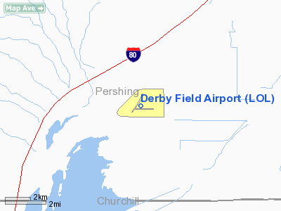
Derby Field (IATA: LOL, ICAO: KLOL, FAA LID: LOL) is a public airport located eight miles (13 km) southwest of the central business district (CBD) of Lovelock, in Pershing County, Nevada, USA.
Facilities
Derby Field covers 550 acres (223 ha) and has two runways:
- Runway 1/19: 5,529 x 75 ft (1,685 x 23 m), Surface: Asphalt
- Runway 7/25: 4,922 x 75 ft (1,500 x 23 m), Surface: Asphalt
The above content comes from Wikipedia and is published under free licenses – click here to read more.
Location & QuickFacts
| FAA Information Effective: | 2008-09-25 |
| Airport Identifier: | LOL |
| Airport Status: | Operational |
| Longitude/Latitude: | 118-33-54.5990W/40-03-59.0580N
-118.565166/40.066405 (Estimated) |
| Elevation: | 3904 ft / 1189.94 m (Surveyed) |
| Land: | 550 acres |
| From nearest city: | 8 nautical miles SW of Lovelock, NV |
| Location: | Pershing County, NV |
| Magnetic Variation: | 18E (1985) |
Owner & Manager
| Ownership: | Publicly owned |
| Owner: | Pershing County |
| Address: | County Clerks Ofs, Po Box 820
Lovelock, NV 89419 |
| Phone number: | 775-273-2208 |
| Manager: | Frank Gonsalves |
| Address: | Box 777
Lovelock, NV 89419 |
| Phone number: | 775-273-4922 |
Airport Operations and Facilities
| Airport Use: | Open to public |
| Wind indicator: | Yes |
| Segmented Circle: | Yes |
| Control Tower: | No |
| Lighting Schedule: | DUSK-DAWN
ACTVT MIRL AND REIL RY 01/19 - CTAF. |
| Beacon Color: | Clear-Green (lighted land airport) |
| Landing fee charge: | No |
| Sectional chart: | Klamath Falls |
| Region: | AWP - Western-Pacific |
| Traffic Pattern Alt: | 800 ft |
| Boundary ARTCC: | ZOA - Oakland |
| Tie-in FSS: | RNO - Reno |
| FSS on Airport: | No |
| FSS Toll Free: | 1-800-WX-BRIEF |
| NOTAMs Facility: | LOL (NOTAM-d service avaliable) |
| Federal Agreements: | NGY2 |
Airport Communications
| CTAF: | 122.800 |
| Unicom: | 122.800 |
Airport Services
| Fuel available: | 100LL
24 HR SELF-SERVICE |
| Bottled Oxygen: | NONE |
| Bulk Oxygen: | NONE |
Runway Information
Runway 01/19
| Dimension: | 5529 x 75 ft / 1685.2 x 22.9 m |
| Surface: | ASPH, Good Condition |
| Weight Limit: | Single wheel: 30000 lbs. |
| Edge Lights: | Medium |
| |
Runway 01 |
Runway 19 |
| Longitude: | 118-34-22.2330W | 118-33-46.2309W |
| Latitude: | 40-03-42.8960N | 40-04-30.0014N |
| Elevation: | 3900.00 ft | 3904.00 ft |
| Alignment: | 30 | 127 |
| Traffic Pattern: | Left | Left |
| Markings: | Non-precision instrument, Fair Condition
MARKINGS FADED | Non-precision instrument, Fair Condition
MARKINGS FADED |
| Crossing Height: | 40.00 ft | 40.00 ft |
| VASI: | 2-box on left side | 2-box on left side |
| Visual Glide Angle: | 3.00° | 3.00° |
| Runway End Identifier: | Yes | Yes |
| Obstruction: | , 50:1 slope to clear | 4 ft fence, 300.0 ft from runway, 25:1 slope to clear |
|
Runway 07/25
| Dimension: | 4922 x 75 ft / 1500.2 x 22.9 m |
| Surface: | ASPH, Fair Condition |
| Weight Limit: | Single wheel: 17000 lbs. |
| |
Runway 07 |
Runway 25 |
| Longitude: | 118-34-16.5480W | 118-33-13.2444W |
| Latitude: | 40-03-51.4200N | 40-03-51.0750N |
| Elevation: | 3900.00 ft | 3900.00 ft |
| Alignment: | 90 | 127 |
| Traffic Pattern: | Left | Left |
| Markings: | Basic, Good Condition | Basic, Good Condition |
| Displaced threshold: | 0.00 ft | 120.00 ft |
| Obstruction: | , 50:1 slope to clear
RY 07 3 FT BERM 175 FT FM EOR. | 5 ft fence, 250.0 ft from runway, 10:1 slope to clear |
|
Radio Navigation Aids
| ID |
Type |
Name |
Ch |
Freq |
Var |
Dist |
| NFL | TACAN | Fallon | 082X | | 16E | 39.6 nm |
| LLC | VORTAC | Lovelock | 112X | 116.50 | 16E | 3.6 nm |
| HZN | VORTAC | Hazen | 088X | 114.10 | 17E | 38.6 nm |
Remarks
- TWY CLSD PERMLY.
- ESTABLISHED PRIOR TO 5/15/59
Images and information placed above are from
http://www.airport-data.com/airport/LOL/
We thank them for the data!
| General Info
|
| Country |
United States
|
| State |
NEVADA
|
| FAA ID |
LOL
|
| Latitude |
40-03-59.058N
|
| Longitude |
118-33-54.599W
|
| Elevation |
3904 feet
|
| Near City |
LOVELOCK
|
We don't guarantee the information is fresh and accurate. The data may
be wrong or outdated.
For more up-to-date information please refer to other sources.
|
|


