 |
|
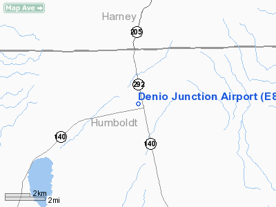
Location & QuickFacts
| FAA Information Effective: | 2008-09-25 |
| Airport Identifier: | E85 |
| Airport Status: | Operational |
| Longitude/Latitude: | 118-37-51.6230W/41-57-14.6250N
-118.631006/41.954062 (Estimated) |
| Elevation: | 4202 ft / 1280.77 m (Estimated) |
| Land: | 100 acres |
| From nearest city: | 3 nautical miles SE of Denio, NV |
| Location: | Humboldt County, NV |
| Magnetic Variation: | 16E (1995) |
Owner & Manager
| Ownership: | Publicly owned |
| Owner: | Us Bureau Of Land Mgmt
AIRPORT LEASED TO HUMBOLDT COUNTY, 50 W. FIFTH ST, WINNENUCCA NV 89445. |
| Address: | Po Box 12000
Reno, NV 89502 |
| Phone number: | 775-861-6400 |
| Manager: | John Russum
ROAD SUPERINTENDENT. |
| Address: | 50 W Fifth Street
Winnemucca, NV 89445 |
| Phone number: | 775-623-6416 |
Airport Operations and Facilities
| Airport Use: | Open to public |
| Wind indicator: | Yes |
| Segmented Circle: | No |
| Control Tower: | No |
| Sectional chart: | Klamath Falls |
| Region: | AWP - Western-Pacific |
| Boundary ARTCC: | ZLA - Los Angeles |
| Responsible ARTCC: | ZLC - Salt Lake City |
| Tie-in FSS: | RNO - Reno |
| FSS Toll Free: | 1-800-WX-BRIEF |
| NOTAMs Facility: | RNO (NOTAM-d service avaliable) |
Airport Communications
Airport Services
| Fuel available: | MOGAS
MOGAS AVBL DALGT HRS AT ADJACENT CAFE (775) 941-0371. |
Runway Information
Runway 02/20
| Dimension: | 3320 x 42 ft / 1011.9 x 12.8 m |
| Surface: | DIRT, Fair Condition |
| |
Runway 02 |
Runway 20 |
| Traffic Pattern: | Left | Left |
| Obstruction: | 484 ft hill, 6700.0 ft from runway, 13:1 slope to clear | 17 ft road, 250.0 ft from runway, 14:1 slope to clear |
|
Runway 07/25
| Dimension: | 3100 x 100 ft / 944.9 x 30.5 m |
| Surface: | DIRT, Fair Condition |
| |
Runway 07 |
Runway 25 |
| Traffic Pattern: | Left | Left |
| Markings: | , | Nonstandard,
RY 25 THLD MARKED WITH WHITE TIRES. |
| Obstruction: | , 50:1 slope to clear | 30 ft pline, 630.0 ft from runway, 21:1 slope to clear |
|
Runway 13/31
| Dimension: | 3430 x 90 ft / 1045.5 x 27.4 m |
| Surface: | DIRT, Fair Condition |
| |
Runway 13 |
Runway 31 |
| Traffic Pattern: | Left | Left |
| Markings: | , | Nonstandard,
RY 31 THLD MARKED WITH WHITE TIRES. |
| Obstruction: | , 50:1 slope to clear | 54 ft trees, 675.0 ft from runway, 12:1 slope to clear |
|
Radio Navigation Aids
| ID |
Type |
Name |
Ch |
Freq |
Var |
Dist |
| RMD | NDB | Mc Dermitt State | | 204.00 | 17E | 40.8 nm |
| SDO | VORTAC | Sod House | 090X | 114.30 | 18E | 42.4 nm |
Remarks
- RYS MAY BE SOFT DURING WINTER MONTHS.
- PROVIDED VFR OPNS AND CLEAR 20: APCHS.
Images and information placed above are from
http://www.airport-data.com/airport/E85/
We thank them for the data!
| General Info
|
| Country |
United States
|
| State |
NEVADA
|
| FAA ID |
E85
|
| Latitude |
41-57-14.625N
|
| Longitude |
118-37-51.623W
|
| Elevation |
4202 feet
|
| Near City |
DENIO
|
We don't guarantee the information is fresh and accurate. The data may
be wrong or outdated.
For more up-to-date information please refer to other sources.
|
|


