 |
|
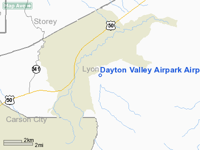
Dayton Valley Airpark Airport |
Location & QuickFacts
| FAA Information Effective: | 2008-09-25 |
| Airport Identifier: | A34 |
| Airport Status: | Operational |
| Longitude/Latitude: | 119-33-19.6000W/39-14-18.3000N
-119.555444/39.238417 (Estimated) |
| Elevation: | 4414 ft / 1345.39 m (Surveyed) |
| Land: | 90 acres |
| From nearest city: | 2 nautical miles E of Dayton/carson City, NV |
| Location: | Lyon County, NV |
| Magnetic Variation: | 16E (1985) |
Owner & Manager
| Ownership: | Privately owned |
| Owner: | Dayton Valley Airport, Llc |
| Address: | 5525 Kietzke Lane, Suite 102
Reno, NV 89511 |
| Phone number: | 775-348-9444 |
| Manager: | Spike Duncan |
| Address: | 208 Dolittle Court
Dayton, NV 89403 |
| Phone number: | 775-246-7620 |
Airport Operations and Facilities
| Airport Use: | Open to public |
| Wind indicator: | Yes |
| Segmented Circle: | Yes |
| Control Tower: | No |
| Sectional chart: | San Francisco |
| Region: | AWP - Western-Pacific |
| Boundary ARTCC: | ZOA - Oakland |
| Tie-in FSS: | RNO - Reno |
| FSS Toll Free: | 1-800-WX-BRIEF |
| NOTAMs Facility: | RNO (NOTAM-d service avaliable) |
Airport Communications
Runway Information
Runway 05/23
| Dimension: | 5343 x 75 ft / 1628.5 x 22.9 m |
| Surface: | ASPH, |
| Weight Limit: | Single wheel: 30000 lbs.
Dual wheel: 70000 lbs. |
| |
Runway 05 |
Runway 23 |
| Longitude: | 119-33-50.3889W | 119-32-48.8750W |
| Latitude: | 39-14-07.1605N | 39-14-29.4999N |
| Elevation: | 4414.00 ft | 4372.00 ft |
| Alignment: | 65 | 127 |
| Traffic Pattern: | Right | Left |
| Markings: | Basic, Good Condition | Basic, Good Condition |
| Displaced threshold: | 991.00 ft | 0.00 ft |
| Obstruction: | 100 ft tower, 2000.0 ft from runway, 400 ft right of centerline, 20:1 slope to clear
RY 05 APCH SLOPE TO DSPLCD THLD 20:1. | , 50:1 slope to clear |
|
Radio Navigation Aids
| ID |
Type |
Name |
Ch |
Freq |
Var |
Dist |
| NFL | TACAN | Fallon | 082X | | 16E | 41.0 nm |
| SWR | VOR/DME | Squaw Valley | 079X | 113.20 | 16E | 33.4 nm |
| FMG | VORTAC | Mustang | 126X | 117.90 | 16E | 18.2 nm |
| HZN | VORTAC | Hazen | 088X | 114.10 | 17E | 30.8 nm |
Remarks
- NOISE ABATEMENT: SMALL ACFT .75 NM SOUTH AT 5,414 FT MSL - 1,000 FT AGL; JETS & LARGE ACFT 1.75 NM SOUTH AT 6,414 FT MSL - 2,000 FT AGL; EXTEND TAKEOFFS BEYOND SCHOOLS & RESIDENTIAL AREAS.
- FOR FIELD INFORMATION CALL (775) 246-7620.
Images and information placed above are from
http://www.airport-data.com/airport/A34/
We thank them for the data!
| General Info
|
| Country |
United States
|
| State |
NEVADA
|
| FAA ID |
A34
|
| Latitude |
39-14-18.300N
|
| Longitude |
119-33-19.600W
|
| Elevation |
4414 feet
|
| Near City |
DAYTON/CARSON CITY
|
We don't guarantee the information is fresh and accurate. The data may
be wrong or outdated.
For more up-to-date information please refer to other sources.
|
|


