 |
|
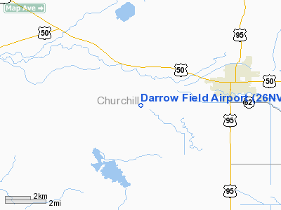
Location & QuickFacts
| FAA Information Effective: | 2008-09-25 |
| Airport Identifier: | 26NV |
| Airport Status: | Operational |
| Longitude/Latitude: | 118-51-50.0000W/39-27-30.0000N
-118.863889/39.458333 (Estimated) |
| Elevation: | 3965 ft / 1208.53 m (Estimated) |
| Land: | 0 acres |
| From nearest city: | 6 nautical miles SW of Fallon, NV |
| Location: | Churchill County, NV |
| Magnetic Variation: | 15E (2000) |
Owner & Manager
| Ownership: | Privately owned |
| Owner: | Thomas Darrow |
| Address: | 5505 Hettinger Place
Fallon, NV 89406 |
| Phone number: | 775-867-2042 |
| Manager: | Thomas Darrow |
| Address: | 5505 Hettinger Place
Fallon, NV 89406 |
| Phone number: | 775-867-2042 |
Airport Operations and Facilities
| Airport Use: | Private |
| Wind indicator: | Yes |
| Segmented Circle: | No |
| Control Tower: | No |
| Sectional chart: | San Francisco |
| Region: | AWP - Western-Pacific |
| Boundary ARTCC: | ZOA - Oakland |
| Tie-in FSS: | RNO - Reno |
| FSS Toll Free: | 1-800-WX-BRIEF |
Runway Information
Runway 16/34
| Dimension: | 2600 x 25 ft / 792.5 x 7.6 m |
| Surface: | ASPH, |
| |
Runway 16 |
Runway 34 |
| Traffic Pattern: | Left | Left |
|
Radio Navigation Aids
| ID |
Type |
Name |
Ch |
Freq |
Var |
Dist |
| NFL | TACAN | Fallon | 082X | | 16E | 7.8 nm |
| HZN | VORTAC | Hazen | 088X | 114.10 | 17E | 7.1 nm |
| FMG | VORTAC | Mustang | 126X | 117.90 | 16E | 37.0 nm |
| LLC | VORTAC | Lovelock | 112X | 116.50 | 16E | 42.2 nm |
Remarks
- PROVIDED VFR PRIVATE USE.
Images and information placed above are from
http://www.airport-data.com/airport/26NV/
We thank them for the data!
| General Info
|
| Country |
United States
|
| State |
NEVADA
|
| FAA ID |
26NV
|
| Latitude |
39-27-30.000N
|
| Longitude |
118-51-50.000W
|
| Elevation |
3965 feet
|
| Near City |
FALLON
|
We don't guarantee the information is fresh and accurate. The data may
be wrong or outdated.
For more up-to-date information please refer to other sources.
|
|


