 |
|
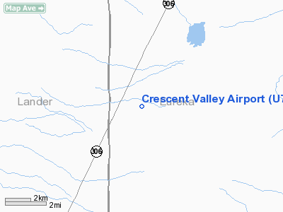
Location & QuickFacts
| FAA Information Effective: | 2008-09-25 |
| Airport Identifier: | U74 |
| Airport Status: | Operational |
| Longitude/Latitude: | 116-33-48.6000W/40-24-57.4000N
-116.563500/40.415944 (Estimated) |
| Elevation: | 4787 ft / 1459.08 m (Surveyed) |
| Land: | 640 acres |
| From nearest city: | 1 nautical miles E of Crescent Valley, NV |
| Location: | Eureka County, NV |
| Magnetic Variation: | 16E (1985) |
Owner & Manager
| Ownership: | Publicly owned |
| Owner: | Bureau Of Land Management |
| Address: | P.o. Box 12000
Reno, NV 89520 |
| Phone number: | 775-861-6400 |
| Manager: | Ronald Damele |
| Address: | P.o. Box 714
Eureka, NV 89316 |
| Phone number: | 775-237-5717 |
Airport Operations and Facilities
| Airport Use: | Open to public |
| Wind indicator: | No |
| Segmented Circle: | No |
| Control Tower: | No |
| Landing fee charge: | No |
| Sectional chart: | Salt Lake City |
| Region: | AWP - Western-Pacific |
| Boundary ARTCC: | ZLC - Salt Lake City |
| Tie-in FSS: | RNO - Reno |
| FSS on Airport: | No |
| FSS Toll Free: | 1-800-WX-BRIEF |
| NOTAMs Facility: | RNO (NOTAM-d service avaliable) |
Airport Communications
Airport Services
| Airframe Repair: | NONE |
| Power Plant Repair: | NONE |
| Bottled Oxygen: | NONE |
| Bulk Oxygen: | NONE |
Runway Information
Runway 05/23
| Dimension: | 5424 x 60 ft / 1653.2 x 18.3 m |
| Surface: | DIRT, Fair Condition |
| |
Runway 05 |
Runway 23 |
| Longitude: | 116-34-13.7410W | 116-33-07.9908W |
| Latitude: | 40-24-58.5373N | 40-25-17.1253N |
| Elevation: | 4791.00 ft | 4747.00 ft |
| Alignment: | 70 | 127 |
| Traffic Pattern: | Left | Left |
| Markings: | None, | None, |
| Obstruction: | 17 ft road, 35.0 ft from runway, 2:1 slope to clear | 15 ft road, 30.0 ft from runway, 2:1 slope to clear |
|
Runway 14/32
| Dimension: | 4650 x 75 ft / 1417.3 x 22.9 m |
| Surface: | DIRT, Good Condition |
| |
Runway 14 |
Runway 32 |
| Longitude: | 116-34-11.6777W | 116-33-43.5316W |
| Latitude: | 40-25-05.5439N | 40-24-24.9508N |
| Elevation: | 4788.00 ft | 4762.00 ft |
| Alignment: | 127 | 127 |
| Traffic Pattern: | Left | Left |
| Markings: | None, | None, |
| Obstruction: | 60 ft tree, 675.0 ft from runway, 100 ft right of centerline, 11:1 slope to clear | , 50:1 slope to clear |
|
Radio Navigation Aids
| ID |
Type |
Name |
Ch |
Freq |
Var |
Dist |
| BQU | VOR/DME | Bullion | 092X | 114.50 | 17E | 42.0 nm |
| BAM | VORTAC | Battle Mountain | 059X | 112.20 | 18E | 18.8 nm |
Remarks
- UNCONTROLLED VEHICLE ACCESS ALL RYS.
- CATTLE ON & INVOF RYS.
- RY 14/32 +2 FT EARTH RIDGES ALONG RY EDGES AND 3 FT BERM ALONG BOTH SIDES 0F RY.
- RY 15/23 -1 FT DRAINAGE DITCH BOTH SIDES RY; + 2 FT EARTH RIDGES ALONG RY EDGES.
- RY 05/23 FIRST 1600 FT OF RY 23 ROUGH SURFACE.
Images and information placed above are from
http://www.airport-data.com/airport/U74/
We thank them for the data!
| General Info
|
| Country |
United States
|
| State |
NEVADA
|
| FAA ID |
U74
|
| Latitude |
40-24-57.400N
|
| Longitude |
116-33-48.600W
|
| Elevation |
4787 feet
|
| Near City |
CRESCENT VALLEY
|
We don't guarantee the information is fresh and accurate. The data may
be wrong or outdated.
For more up-to-date information please refer to other sources.
|
|


