 |
|
Location & QuickFacts
| FAA Information Effective: | 2008-09-25 |
| Airport Identifier: | NV27 |
| Airport Status: | Operational |
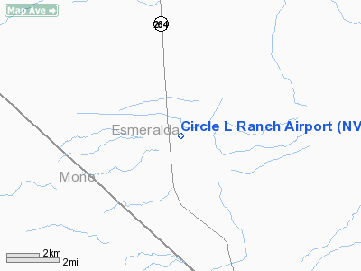
| Longitude/Latitude: | 118-05-03.3790W/37-42-59.7480N
-118.084272/37.716597 (Estimated) |
| Elevation: | 4835 ft / 1473.71 m (Estimated) |
| Land: | 52 acres |
| From nearest city: | 3 nautical miles N of Dyer, NV |
| Location: | Esmeralda County, NV |
| Magnetic Variation: | 15E (1985) |
Owner & Manager
| Ownership: | Privately owned |
| Owner: | James & Christine Boyce |
| Address: | P.o. Box 280
Dyer, NV 89010 |
| Phone number: | 702-572-3232 |
| Manager: | James Boyce |
| Address: | P.o. Box 280
Dyer, NV 89010 |
| Phone number: | 702-572-3301 |
Airport Operations and Facilities
| Airport Use: | Private |
| Wind indicator: | Yes |
| Segmented Circle: | No |
| Control Tower: | No |
| Landing fee charge: | Yes |
| Sectional chart: | San Francisco |
| Region: | AWP - Western-Pacific |
| Boundary ARTCC: | ZOA - Oakland |
| Tie-in FSS: | RNO - Reno |
| FSS on Airport: | No |
| FSS Toll Free: | 1-800-WX-BRIEF |
Airport Services
| Airframe Repair: | NONE |
| Power Plant Repair: | NONE |
| Bottled Oxygen: | NONE |
| Bulk Oxygen: | NONE |
Runway Information
Runway 03/21
| Dimension: | 4400 x 60 ft / 1341.1 x 18.3 m |
| Surface: | ASPH, Fair Condition |
| |
Runway 03 |
Runway 21 |
| Traffic Pattern: | Left | Left |
| Markings: | None, | None, |
| Obstruction: | 85 ft tree, 1200.0 ft from runway, 11:1 slope to clear | , 50:1 slope to clear
+2' BRUSH 10' OUT LEFT AND RIGHT OF CENTERLINE; +3' FENCE 100' OUT. |
|
Runway 13/31
| Dimension: | 4400 x 60 ft / 1341.1 x 18.3 m |
| Surface: | ASPH, Fair Condition |
| |
Runway 13 |
Runway 31 |
| Traffic Pattern: | Left | Left |
| Markings: | None, | None, |
|
Radio Navigation Aids
| ID |
Type |
Name |
Ch |
Freq |
Var |
Dist |
| BIH | VOR/DME | Bishop | 033X | 109.60 | 15E | 24.4 nm |
| OAL | VORTAC | Coaldale | 124X | 117.70 | 17E | 22.8 nm |
Remarks
- CAUTION: MAY BE BRUSH WATER VEHICLES AND CATTLE ON RWYS.
- MGR REQ TEL NOTICE PRIOR TO LNDG: CALL 702-572-3232.
- (A58-3) +4' FENCE 5' OUT; +20' BLDGS AND +50' TREES; 100' OUT AND 100' LEFT OF CENTERLINE.
- EXISTED PRIOR TO 15 MAY 1959.
Images and information placed above are from
http://www.airport-data.com/airport/NV27/
We thank them for the data!
| General Info
|
| Country |
United States
|
| State |
NEVADA
|
| FAA ID |
NV27
|
| Latitude |
37-42-59.748N
|
| Longitude |
118-05-03.379W
|
| Elevation |
4835 feet
|
| Near City |
DYER
|
We don't guarantee the information is fresh and accurate. The data may
be wrong or outdated.
For more up-to-date information please refer to other sources.
|
|


