 |
|
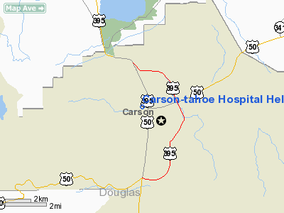
Carson-tahoe Hospital Heliport |
Location & QuickFacts
| FAA Information Effective: | 2008-09-25 |
| Airport Identifier: | NV60 |
| Airport Status: | Operational |
| Longitude/Latitude: | 119-46-18.6520W/39-10-16.6740N
-119.771848/39.171298 (Estimated) |
| Elevation: | 4710 ft / 1435.61 m (Estimated) |
| Land: | 0 acres |
| From nearest city: | 1 nautical miles N of Carson City, NV |
| Location: | Carson City County, NV |
| Magnetic Variation: | 16E (1985) |
Owner & Manager
| Ownership: | Privately owned |
| Owner: | Carson-tahoe Regional Health Care |
| Address: | 775 Fleischmann Way
Carson City, NV 89701 |
| Phone number: | 775-882-1361 |
| Manager: | Hospital Security |
| Address: | 775 Fleischmann Way
Carson City, NV 89701 |
| Phone number: | 775-885-4236 |
Airport Operations and Facilities
| Airport Use: | Private
MEDICAL. |
| Wind indicator: | Yes |
| Segmented Circle: | No |
| Control Tower: | No |
| Landing fee charge: | No |
| Sectional chart: | San Francisco |
| Region: | AWP - Western-Pacific |
| Boundary ARTCC: | ZOA - Oakland |
| Tie-in FSS: | RNO - Reno |
| FSS Toll Free: | 1-800-WX-BRIEF |
Runway Information
Helipad H1
| Dimension: | 40 x 40 ft / 12.2 x 12.2 m |
| Surface: | ASPH,
ALUMINUM/ROOF TOP. |
| |
Runway H1 |
Runway |
| Traffic Pattern: | Left | Left |
|
Radio Navigation Aids
| ID |
Type |
Name |
Ch |
Freq |
Var |
Dist |
| SWR | VOR/DME | Squaw Valley | 079X | 113.20 | 16E | 23.2 nm |
| FMG | VORTAC | Mustang | 126X | 117.90 | 16E | 22.3 nm |
| HZN | VORTAC | Hazen | 088X | 114.10 | 17E | 41.5 nm |
Remarks
Images and information placed above are from
http://www.airport-data.com/airport/NV60/
We thank them for the data!
| General Info
|
| Country |
United States
|
| State |
NEVADA
|
| FAA ID |
NV60
|
| Latitude |
39-10-16.674N
|
| Longitude |
119-46-18.652W
|
| Elevation |
4710 feet
|
| Near City |
CARSON CITY
|
We don't guarantee the information is fresh and accurate. The data may
be wrong or outdated.
For more up-to-date information please refer to other sources.
|
|


