 |
|
Location & QuickFacts
| FAA Information Effective: | 2008-09-25 |
| Airport Identifier: | NV10 |
| Airport Status: | Operational |
| Longitude/Latitude: | 114-55-32.9590W/35-59-16.9220N
-114.925822/35.988034 (Estimated) |
| Elevation: | 2300 ft / 701.04 m (Estimated) |
| Land: | 25 acres |
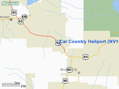
| From nearest city: | 2 nautical miles SE of Henderson, NV |
| Location: | Clark County, NV |
| Magnetic Variation: | 14E (1990) |
Owner & Manager
| Ownership: | Privately owned |
| Owner: | Car Country Inter. Ltd |
| Address: | 2525 S. Boulder Highway
Henderson, NV 89015 |
| Phone number: | 702-566-5000 |
| Manager: | Barry W. Stubbs |
| Address: | 2525 S. Boulder Highway
Henderson, NV 89015 |
| Phone number: | 702-566-5000 |
Airport Operations and Facilities
| Airport Use: | Private |
| Wind indicator: | Yes |
| Segmented Circle: | No |
| Control Tower: | No |
| Sectional chart: | Phoenix |
| Region: | AWP - Western-Pacific |
| Boundary ARTCC: | ZLA - Los Angeles |
| Tie-in FSS: | RNO - Reno |
| FSS on Airport: | No |
| FSS Toll Free: | 1-800-WX-BRIEF |
Runway Information
Helipad H1
| Dimension: | 20 x 20 ft / 6.1 x 6.1 m |
| Surface: | ASPH, |
| |
Runway H1 |
Runway |
| Traffic Pattern: | Left | Left |
|
Radio Navigation Aids
| ID |
Type |
Name |
Ch |
Freq |
Var |
Dist |
| LSV | TACAN | Nellis | 012X | | 15E | 16.2 nm |
| BLD | VORTAC | Boulder City | 114X | 116.70 | 15E | 3.1 nm |
| LAS | VORTAC | Las Vegas | 116X | 116.90 | 15E | 12.6 nm |
| VGT | VOT | North Las Vegas | | 108.20 | | 19.0 nm |
Remarks
- PROVIDED VFR/PVT USE; CONTACT NEVADA POWER CO & WESTERN AREA POWER ADMN REGARDING THE RELOCATION & RAISING OF PLINES WHICH WOULD AFFECT THE LNDG AREA.
Images and information placed above are from
http://www.airport-data.com/airport/NV10/
We thank them for the data!
| General Info
|
| Country |
United States
|
| State |
NEVADA
|
| FAA ID |
NV10
|
| Latitude |
35-59-16.922N
|
| Longitude |
114-55-32.959W
|
| Elevation |
2300 feet
|
| Near City |
HENDERSON
|
We don't guarantee the information is fresh and accurate. The data may
be wrong or outdated.
For more up-to-date information please refer to other sources.
|
|


