 |
|
| Beatty Airport |
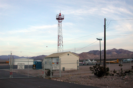 |
| View from the entrance gate |
| IATA: BTY – ICAO: KBTY – FAA LID: BTY |
| Summary |
| Airport type |
Public |
| Owner |
Nye County |
| Serves |
Beatty, Nevada |
| Elevation AMSL |
3,170 ft / 966 m |
| Coordinates |
36°51′40″N 116°47′13″W / 36.86111°N 116.78694°W / 36.86111; -116.78694 |
| Runways |
| Direction |
Length |
Surface |
| ft |
m |
| 16/34 |
5,600 |
1,707 |
Asphalt |
| Statistics (2009) |
| Aircraft operations |
1,005 |
| Based aircraft |
9 |
| Source: Federal Aviation Administration |
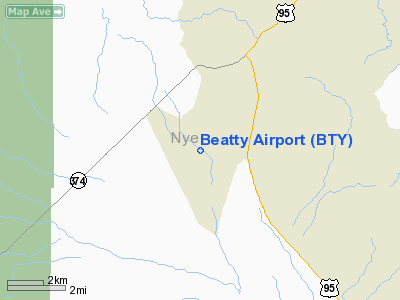
Beatty Airport (IATA: BTY, ICAO: KBTY, FAA LID: BTY) is a county-owned public-use airport located three nautical miles (6 km) southwest of the central business district of Beatty, a town in Nye County, Nevada, United States.
Facilities and aircraft
Beatty Airport covers an area of 440 acres (178 ha) at an elevation of 3,170 feet (966 m) above mean sea level. It has one runway designated 16/34 with an asphalt surface measuring 5,600 by 60 feet (1,707 x 18 m).
For the 12-month period ending December 31, 2009, the airport had 1,005 aircraft operations, an average of 83 per month: 90% general aviation, 7% air taxi, and 3% military. At that time there were 9 aircraft based at this airport: 56% single-engine, 11% multi-engine and 33% glider.
The above content comes from Wikipedia and is published under free licenses – click here to read more.
Location & QuickFacts
| FAA Information Effective: | 2008-09-25 |
| Airport Identifier: | BTY |
| Airport Status: | Operational |
| Longitude/Latitude: | 116-47-13.2130W/36-51-39.8060N
-116.787004/36.861057 (Estimated) |
| Elevation: | 3170 ft / 966.22 m (Estimated) |
| Land: | 440 acres |
| From nearest city: | 3 nautical miles SW of Beatty, NV |
| Location: | Nye County, NV |
| Magnetic Variation: | 14E (1985) |
Owner & Manager
| Ownership: | Publicly owned |
| Owner: | Nye County |
| Address: | P O Box 153
Tonopah, NV 89049 |
| Phone number: | 775-482-8191 |
| Manager: | Joni Eastley |
| Address: | Po Box 151
Tonopah, NV 89049 |
| Phone number: | 775-482-9466 |
Airport Operations and Facilities
| Airport Use: | Open to public |
| Wind indicator: | Yes |
| Segmented Circle: | Yes |
| Control Tower: | No |
| Lighting Schedule: | DUSK-DAWN
ACTVT MIRL RY 16/34 - CTAF. |
| Beacon Color: | Clear-Green (lighted land airport) |
| Landing fee charge: | No |
| Sectional chart: | Las Vegas |
| Region: | AWP - Western-Pacific |
| Boundary ARTCC: | ZLA - Los Angeles |
| Tie-in FSS: | RNO - Reno |
| FSS on Airport: | No |
| FSS Toll Free: | 1-800-WX-BRIEF |
| NOTAMs Facility: | RNO (NOTAM-d service avaliable) |
| Federal Agreements: | NGYS2 |
Airport Communications
Airport Services
| Airframe Repair: | NONE |
| Power Plant Repair: | NONE |
| Bottled Oxygen: | NONE |
| Bulk Oxygen: | NONE |
Runway Information
Runway 16/34
| Dimension: | 5600 x 60 ft / 1706.9 x 18.3 m |
| Surface: | ASPH, |
| Weight Limit: | Single wheel: 15000 lbs.
Dual wheel: 30000 lbs. |
| Edge Lights: | Medium |
| |
Runway 16 |
Runway 34 |
| Traffic Pattern: | Left | Left |
| Markings: | Basic, Good Condition | Basic, Good Condition |
| Runway End Identifier: | No | No |
| Centerline Lights: | No | No |
| Touchdown Lights: | No | No |
|
Radio Navigation Aids
| ID |
Type |
Name |
Ch |
Freq |
Var |
Dist |
| MCY | NDB | Mercury | | 326.00 | 16E | 39.2 nm |
| BTY | VORTAC | Beatty | 094X | 114.70 | 16E | 4.1 nm |
Remarks
- LOW FLYING MILITARY ACFT INVOF ARPT.
- ESTABD PRIOR TO 15 MAY 1959.
Images and information placed above are from
http://www.airport-data.com/airport/BTY/
We thank them for the data!
| General Info
|
| Country |
United States
|
| State |
NEVADA
|
| FAA ID |
BTY
|
| Latitude |
36-51-39.806N
|
| Longitude |
116-47-13.213W
|
| Elevation |
3170 feet
|
| Near City |
BEATTY
|
We don't guarantee the information is fresh and accurate. The data may
be wrong or outdated.
For more up-to-date information please refer to other sources.
|
|


