 |
|
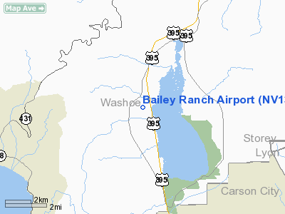
Location & QuickFacts
| FAA Information Effective: | 2008-09-25 |
| Airport Identifier: | NV13 |
| Airport Status: | Operational |
| Longitude/Latitude: | 119-49-42.0000W/39-16-58.0000N
-119.828333/39.282778 (Estimated) |
| Elevation: | 5060 ft / 1542.29 m (Estimated) |
| Land: | 16 acres |
| From nearest city: | 8 nautical miles NW of Carson City, NV |
| Location: | Washoe County, NV |
| Magnetic Variation: | 16E (1990) |
Owner & Manager
| Ownership: | Privately owned |
| Owner: | Stanley E. Bailey |
| Address: | 4105 Hwy 395 N.
Carson City, NV 89704 |
| Phone number: | 702-849-1211 |
| Manager: | Stanley E. Bailey |
| Address: | 4105 Hwy 395 N.
Carson City, NV 89704 |
| Phone number: | 702-849-1211 |
Airport Operations and Facilities
| Airport Use: | Private |
| Wind indicator: | Yes |
| Segmented Circle: | No |
| Control Tower: | No |
| Sectional chart: | San Francisco |
| Region: | AWP - Western-Pacific |
| Boundary ARTCC: | ZOA - Oakland |
| Tie-in FSS: | RNO - Reno |
| FSS on Airport: | No |
| FSS Toll Free: | 1-800-WX-BRIEF |
Runway Information
Runway 07/25
| Dimension: | 2600 x 50 ft / 792.5 x 15.2 m |
| Surface: | TURF, |
| |
Runway 07 |
Runway 25 |
| Traffic Pattern: | Left | Left |
|
Radio Navigation Aids
| ID |
Type |
Name |
Ch |
Freq |
Var |
Dist |
| SWR | VOR/DME | Squaw Valley | 079X | 113.20 | 16E | 21.4 nm |
| FMG | VORTAC | Mustang | 126X | 117.90 | 16E | 16.9 nm |
| HZN | VORTAC | Hazen | 088X | 114.10 | 17E | 41.1 nm |
Remarks
- PROVIDED ARPT CONTINUES TO BE OPERATED FOR PVT USE VFR ONLY.
Images and information placed above are from
http://www.airport-data.com/airport/NV13/
We thank them for the data!
| General Info
|
| Country |
United States
|
| State |
NEVADA
|
| FAA ID |
NV13
|
| Latitude |
39-16-58.000N
|
| Longitude |
119-49-42.000W
|
| Elevation |
5060 feet
|
| Near City |
CARSON CITY
|
We don't guarantee the information is fresh and accurate. The data may
be wrong or outdated.
For more up-to-date information please refer to other sources.
|
|


