 |
|
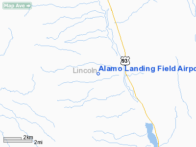
Alamo Landing Field Airport |
| Alamo Landing Field |
| IATA: none – ICAO: none – FAA LID: L92 |
| Summary |
| Airport type |
Public |
| Owner |
U.S. Bureau of Land Management |
| Serves |
Alamo, Nevada |
| Elevation AMSL |
3,719 ft / 1,134 m |
| Coordinates |
37°21′45″N 115°11′40″W / 37.3625°N 115.19444°W / 37.3625; -115.19444 |
| Runways |
| Direction |
Length |
Surface |
| ft |
m |
| 14/32 |
5,000 |
1,524 |
Dirt |
| 15/33 |
2,500 |
762 |
Dirt |
| Statistics (2007) |
| Aircraft operations |
230 |
| Source: Federal Aviation Administration |
Alamo Landing Field (FAA LID: L92) is a public-use airport located 2 nautical miles (3.7 km; 2.3 mi) west of the central business district of Alamo, in Lincoln County, Nevada, United States. The airport is owned by the U.S. Bureau of Land Management. It is the closest public-use airport to Groom Lake. History
This airport was abandoned prior to 1959 and resumed service around 1994. It was also known as Pahranagat Airport.
Facilities and aircraft
Alamo Landing Field covers an area of 640 acres (260 ha) at an elevation of 640 ft (200 m) above mean sea level. It has two runways with dirt surfaces: 14/32 is 5,000 by 120 ft (1,500 by 37 m) and 15/33 is 2,500 by 70 ft (760 by 21 m). For the 12-month period ending January 31, 2007, the airport had 230 aircraft operations, an average of 19 per month: 87% military and 13% general aviation.
The above content comes from Wikipedia and is published under free licenses – click here to read more.
Location & QuickFacts
| FAA Information Effective: | 2008-09-25 |
| Airport Identifier: | L92 |
| Airport Status: | Operational |
| Longitude/Latitude: | 115-11-40.0640W/37-21-44.8590N
-115.194462/37.362461 (Estimated) |
| Elevation: | 3719 ft / 1133.55 m (Estimated) |
| Land: | 640 acres |
| From nearest city: | 2 nautical miles W of Alamo, NV |
| Location: | Lincoln County, NV |
| Magnetic Variation: | 14E (1985) |
Owner & Manager
| Ownership: | Publicly owned |
| Owner: | Us Bureau Of Land Management |
| Address: | 300 Booth Street
Reno, NV 89502 |
| Phone number: | 775-334-8969 |
| Manager: | Wendy Rudder |
| Address: | P.o. Box 509
Alamo, NV 89001 |
| Phone number: | 775-334-8969 |
Airport Operations and Facilities
| Airport Use: | Open to public |
| Wind indicator: | No |
| Segmented Circle: | No |
| Control Tower: | No |
| Landing fee charge: | No |
| Sectional chart: | Las Vegas |
| Region: | AWP - Western-Pacific |
| Boundary ARTCC: | ZLA - Los Angeles |
| Tie-in FSS: | RNO - Reno |
| FSS on Airport: | No |
| FSS Toll Free: | 1-800-WX-BRIEF |
| NOTAMs Facility: | RNO (NOTAM-d service avaliable) |
| Federal Agreements: | N |
Airport Communications
Runway Information
Runway 14/32
| Dimension: | 5000 x 120 ft / 1524.0 x 36.6 m |
| Surface: | DIRT, Fair Condition |
| |
Runway 14 |
Runway 32 |
| Traffic Pattern: | Left | Left |
| Obstruction: | 5 ft brush, 153.0 ft from runway, 30:1 slope to clear | 5 ft berm, 100.0 ft from runway, 20:1 slope to clear |
|
Runway 15/33
| Dimension: | 2500 x 70 ft / 762.0 x 21.3 m |
| Surface: | DIRT, Fair Condition |
| |
Runway 15 |
Runway 33 |
| Traffic Pattern: | Left | Left |
| Obstruction: | 8 ft berm, 22.0 ft from runway, 2:1 slope to clear | 5 ft berm, 50.0 ft from runway, 10:1 slope to clear |
|
Radio Navigation Aids
| ID |
Type |
Name |
Ch |
Freq |
Var |
Dist |
Remarks
- NO LINE OF SIGHT BETWEEN RWY ENDS.
- RYS 15/33 & 14/32 LIVESTOCK INVOF OF RYS.
- UNCONTROLLED VEHICLE ACCESS
- E111: VFR USE.
Images and information placed above are from
http://www.airport-data.com/airport/L92/
We thank them for the data!
| General Info
|
| Country |
United States
|
| State |
NEVADA
|
| FAA ID |
L92
|
| Latitude |
37-21-44.859N
|
| Longitude |
115-11-40.064W
|
| Elevation |
3719 feet
|
| Near City |
ALAMO
|
We don't guarantee the information is fresh and accurate. The data may
be wrong or outdated.
For more up-to-date information please refer to other sources.
|
|


