 |
|
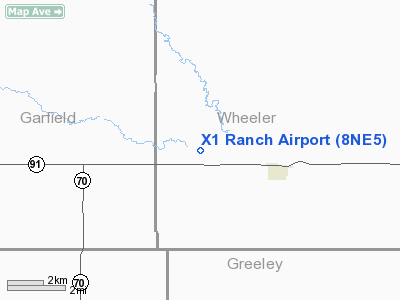
Location & QuickFacts
| FAA Information Effective: | 2008-09-25 |
| Airport Identifier: | 8NE5 |
| Airport Status: | Operational |
| Longitude/Latitude: | 098-43-47.2970W/41-47-26.0290N
-98.729805/41.790564 (Estimated) |
| Elevation: | 2070 ft / 630.94 m (Estimated) |
| Land: | 0 acres |
| From nearest city: | 3 nautical miles NW of Ericson, NE |
| Location: | Wheeler County, NE |
| Magnetic Variation: | 08E (1985) |
Owner & Manager
| Ownership: | Privately owned |
| Owner: | Bryan Anderson |
| Address: | 48743 Highway 91
Ericson, NE 68637 |
| Phone number: | 308-653-2116 |
| Manager: | Bryan Anderson |
| Address: | 48743 Hwy 91
Ericson, NE 68637 |
| Phone number: | 308-653-2116 |
Airport Operations and Facilities
| Airport Use: | Private |
| Wind indicator: | Yes |
| Segmented Circle: | No |
| Control Tower: | No |
| Landing fee charge: | No |
| Sectional chart: | Omaha |
| Region: | ACE - Central |
| Boundary ARTCC: | ZMP - Minneapolis |
| Tie-in FSS: | OLU - Columbus |
| FSS on Airport: | No |
| FSS Toll Free: | 1-800-WX-BRIEF |
Runway Information
Runway 11/29
| Dimension: | 3000 x 170 ft / 914.4 x 51.8 m |
| Surface: | TURF, |
| |
Runway 11 |
Runway 29 |
| Traffic Pattern: | Left | Left |
| Obstruction: | | 30 ft trees, 1320.0 ft from runway |
|
Radio Navigation Aids
| ID |
Type |
Name |
Ch |
Freq |
Var |
Dist |
| ODX | NDB | Ord | | 356.00 | 07E | 14.0 nm |
| BUB | NDB | Burwell | | 377.00 | 07E | 18.7 nm |
| BVN | NDB | Alaby | | 332.00 | 06E | 30.6 nm |
| BBW | NDB | Broken Bow | | 265.00 | 08E | 46.0 nm |
| CUZ | VOR/DME | Custer County | 19X | 108.20 | 08E | 46.9 nm |
| OBH | VORTAC | Wolbach | 095X | 114.80 | 07E | 30.1 nm |
| ONL | VORTAC | O'neill | 086X | 113.90 | 10E | 40.9 nm |
Remarks
- PRVDD APCH TO EACH RWY MAINTD FOR MINIMUM 20:1 APCH RATIO AND TRSNL SFC MAINTD FOR 7:1.
Images and information placed above are from
http://www.airport-data.com/airport/8NE5/
We thank them for the data!
| General Info
|
| Country |
United States
|
| State |
NEBRASKA
|
| FAA ID |
8NE5
|
| Latitude |
41-47-26.029N
|
| Longitude |
098-43-47.297W
|
| Elevation |
2070 feet
|
| Near City |
ERICSON
|
We don't guarantee the information is fresh and accurate. The data may
be wrong or outdated.
For more up-to-date information please refer to other sources.
|
|


