 |
|
Location & QuickFacts
| FAA Information Effective: | 2008-09-25 |
| Airport Identifier: | NE06 |
| Airport Status: | Operational |
| Longitude/Latitude: | 098-25-31.2930W/42-49-29.9940N
-98.425359/42.824998 (Estimated) |
| Elevation: | 1395 ft / 425.20 m (Estimated) |
| Land: | 0 acres |
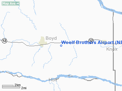
| From nearest city: | 2 nautical miles E of Lynch, NE |
| Location: | Boyd County, NE |
| Magnetic Variation: | 07E (1985) |
Owner & Manager
| Ownership: | Privately owned |
| Owner: | Frank D. Pfeifer |
| Address: | 90122 497th Ave.
Bristow, NE 68719 |
| Phone number: | 402-583-9948 |
| Manager: | Frank D. Pfeifer |
| Address: | 90122 497th Ave.
Bristow, NE 68719 |
| Phone number: | 402-583-9948 |
Airport Operations and Facilities
| Airport Use: | Private |
| Wind indicator: | Yes |
| Segmented Circle: | No |
| Control Tower: | No |
| Landing fee charge: | No |
| Sectional chart: | Omaha |
| Region: | ACE - Central |
| Boundary ARTCC: | ZMP - Minneapolis |
| Tie-in FSS: | OLU - Columbus |
| FSS on Airport: | No |
| FSS Toll Free: | 1-800-WX-BRIEF |
Airport Services
| Fuel available: | 80 |
| Airframe Repair: | MINOR |
| Power Plant Repair: | MINOR |
Runway Information
Runway E/W
| Dimension: | 2500 x 150 ft / 762.0 x 45.7 m |
| Surface: | TURF, |
| |
Runway E |
Runway W |
| Traffic Pattern: | Left | Left |
|
Runway N/S
| Dimension: | 2500 x 150 ft / 762.0 x 45.7 m |
| Surface: | TURF, |
| |
Runway N |
Runway S |
| Traffic Pattern: | Left | Left |
|
Runway NW/SE
| Dimension: | 2600 x 150 ft / 792.5 x 45.7 m |
| Surface: | TURF, |
| |
Runway NW |
Runway SE |
| Traffic Pattern: | Left | Left |
|
Radio Navigation Aids
| ID |
Type |
Name |
Ch |
Freq |
Var |
Dist |
| AGZ | NDB | Wagner | | 392.00 | 08E | 15.4 nm |
| YKN | VOR/DME | Yankton | 051X | 111.40 | 07E | 46.2 nm |
| ONL | VORTAC | O'neill | 086X | 113.90 | 10E | 24.2 nm |
Remarks
- PRVDD 20:1 APCH SLOPES ARE MAINTD.
Images and information placed above are from
http://www.airport-data.com/airport/NE06/
We thank them for the data!
| General Info
|
| Country |
United States
|
| State |
NEBRASKA
|
| FAA ID |
NE06
|
| Latitude |
42-49-29.994N
|
| Longitude |
098-25-31.293W
|
| Elevation |
1395 feet
|
| Near City |
LYNCH
|
We don't guarantee the information is fresh and accurate. The data may
be wrong or outdated.
For more up-to-date information please refer to other sources.
|
|


