 |
|
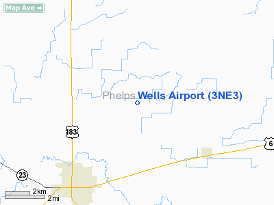
Location & QuickFacts
| FAA Information Effective: | 2008-09-25 |
| Airport Identifier: | 3NE3 |
| Airport Status: | Operational |
| Longitude/Latitude: | 099-19-01.3500W/40-30-00.0400N
-99.317042/40.500011 (Estimated) |
| Elevation: | 2275 ft / 693.42 m (Estimated) |
| Land: | 0 acres |
| From nearest city: | 5 nautical miles NE of Holdrege, NE |
| Location: | Phelps County, NE |
| Magnetic Variation: | 08E (1985) |
Owner & Manager
| Ownership: | Privately owned |
| Owner: | Harley Wells |
| Address: | Rt 3 Box 146
Holdredge, NE 68949 |
| Phone number: | 308-995-4646 |
| Manager: | David Harley Wells |
| Address: | Rt 3 Box 146
Holdredge, NE 68949 |
| Phone number: | 308-995-4646 |
Airport Operations and Facilities
| Airport Use: | Private |
| Wind indicator: | Yes |
| Segmented Circle: | No |
| Control Tower: | No |
| Sectional chart: | Omaha |
| Region: | ACE - Central |
| Boundary ARTCC: | ZDV - Denver |
| Tie-in FSS: | OLU - Columbus |
| FSS on Airport: | No |
| FSS Toll Free: | 1-800-WX-BRIEF |
Airport Services
| Fuel available: | 80 |
| Airframe Repair: | NONE |
| Power Plant Repair: | NONE |
Runway Information
Runway N/S
| Dimension: | 2500 x 100 ft / 762.0 x 30.5 m |
| Surface: | TURF, |
| |
Runway N |
Runway S |
| Traffic Pattern: | Left | Left |
|
Radio Navigation Aids
| ID |
Type |
Name |
Ch |
Freq |
Var |
Dist |
| HDE | NDB | Holdrege | | 396.00 | 07E | 3.3 nm |
| RRX | NDB | Darr | | 326.00 | 07E | 32.1 nm |
| PSS | NDB | Prosser | | 338.00 | 07E | 39.9 nm |
| CSB | NDB | Harry Strunk | | 389.00 | 08E | 40.2 nm |
| DWL | NDB | Willow | | 353.00 | 08E | 41.1 nm |
| NRN | NDB | Norton | | 230.00 | 08E | 46.8 nm |
| PHG | NDB | Phillipsburg | | 368.00 | 08E | 47.7 nm |
| EAR | VOR | Kearney | | 111.20 | 10E | 19.7 nm |
| OZB | VOR | Cozad | | 109.00 | 09E | 38.4 nm |
| HSI | VOR/DME | Hastings | 025X | 108.80 | 07E | 41.0 nm |
Images and information placed above are from
http://www.airport-data.com/airport/3NE3/
We thank them for the data!
| General Info
|
| Country |
United States
|
| State |
NEBRASKA
|
| FAA ID |
3NE3
|
| Latitude |
40-30-00.040N
|
| Longitude |
099-19-01.350W
|
| Elevation |
2275 feet
|
| Near City |
HOLDREGE
|
We don't guarantee the information is fresh and accurate. The data may
be wrong or outdated.
For more up-to-date information please refer to other sources.
|
|


