 |
|
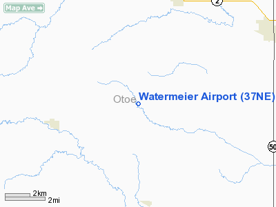
Location & QuickFacts
| FAA Information Effective: | 2008-09-25 |
| Airport Identifier: | 37NE |
| Airport Status: | Operational |
| Longitude/Latitude: | 096-18-28.0380W/40-36-28.0010N
-96.307788/40.607778 (Estimated) |
| Elevation: | 1100 ft / 335.28 m (Estimated) |
| Land: | 0 acres |
| From nearest city: | 4 nautical miles N of Burr, NE |
| Location: | Otoe County, NE |
| Magnetic Variation: | 06E (1985) |
Owner & Manager
| Ownership: | Privately owned |
| Owner: | Junior L Watermeier |
| Address: | Rt 1, Box 96
Burr, NE 68324 |
| Phone number: | 402-828-5090 |
| Manager: | Junior L Watermeier |
| Address: | Rt 1, Box 96
Burr, NE 68324 |
| Phone number: | 402-828-5090 |
Airport Operations and Facilities
| Airport Use: | Private |
| Wind indicator: | Yes |
| Segmented Circle: | No |
| Control Tower: | No |
| Landing fee charge: | No |
| Sectional chart: | Kansas City |
| Region: | ACE - Central |
| Boundary ARTCC: | ZMP - Minneapolis |
| Tie-in FSS: | OLU - Columbus |
| FSS on Airport: | No |
| FSS Toll Free: | 1-800-WX-BRIEF |
Runway Information
Runway 15/33
| Dimension: | 2000 x 60 ft / 609.6 x 18.3 m |
| Surface: | TURF, |
| |
Runway 15 |
Runway 33 |
| Traffic Pattern: | Left | Left |
|
Radio Navigation Aids
| ID |
Type |
Name |
Ch |
Freq |
Var |
Dist |
| AFK | NDB | Nebraska City | | 347.00 | 05E | 20.4 nm |
| LN | NDB | Potts | | 385.00 | 06E | 22.4 nm |
| AYB | NDB | Auburn | | 430.00 | 05E | 25.2 nm |
| PMV | NDB | Plattsmouth | | 329.00 | 06E | 27.0 nm |
| BJU | NDB | Big Blue | | 248.00 | 06E | 27.4 nm |
| HWB | NDB | Shaw | | 263.00 | 06E | 29.1 nm |
| MLE | NDB | Millard | | 371.00 | 06E | 36.4 nm |
| SWT | NDB | Seward | | 269.00 | 06E | 39.7 nm |
| AHQ | NDB | Wahoo | | 400.00 | 07E | 40.2 nm |
| SDA | NDB | Shenandoah | | 411.00 | 05E | 41.9 nm |
| FNB | NDB | Brenner | | 404.00 | 05E | 45.9 nm |
| FBY | NDB | Fairbury | | 293.00 | 06E | 47.1 nm |
| MYZ | NDB | Marysville | | 341.00 | 06E | 47.8 nm |
| OM | NDB | Gerfi | | 320.00 | 05E | 48.3 nm |
| OFF | TACAN | Offutt | 054X | | 05E | 35.8 nm |
| BIE | VOR | Beatrice | | 110.60 | 07E | 27.5 nm |
| PWE | VORTAC | Pawnee City | 071X | 112.40 | 05E | 24.9 nm |
| LNK | VORTAC | Lincoln | 108X | 116.10 | 09E | 27.4 nm |
| OVR | VORTAC | Omaha | 110X | 116.30 | 08E | 42.5 nm |
| OMA | VOT | Omaha | | 109.00 | | 45.5 nm |
Remarks
- PROVIDED THAT THE APPROACH TO EACH RWY IS MAINTAINED FOR A MINIMUM 20:1 GLIDE SLOE AND THAT THE TRANSITIONAL SURFACE BE MAINTAINED FOR A 7:1 SLOPE.
Images and information placed above are from
http://www.airport-data.com/airport/37NE/
We thank them for the data!
| General Info
|
| Country |
United States
|
| State |
NEBRASKA
|
| FAA ID |
37NE
|
| Latitude |
40-36-28.001N
|
| Longitude |
096-18-28.038W
|
| Elevation |
1100 feet
|
| Near City |
BURR
|
We don't guarantee the information is fresh and accurate. The data may
be wrong or outdated.
For more up-to-date information please refer to other sources.
|
|


