 |
|
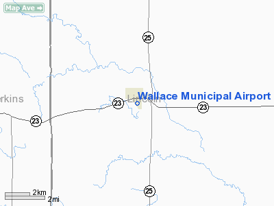
Location & QuickFacts
| FAA Information Effective: | 2008-09-25 |
| Airport Identifier: | 64V |
| Airport Status: | Operational |
| Longitude/Latitude: | 101-09-50.5610W/40-49-56.0080N
-101.164045/40.832224 (Estimated) |
| Elevation: | 3101 ft / 945.18 m (Surveyed) |
| Land: | 89 acres |
| From nearest city: | 1 nautical miles S of Wallace, NE |
| Location: | Lincoln County, NE |
| Magnetic Variation: | 09E (1985) |
Owner & Manager
| Ownership: | Publicly owned |
| Owner: | Village Of Wallace |
| Address: | P.o. Box 126
Wallace, NE 69169-0126 |
| Phone number: | 308-387-4321 |
| Manager: | Lea & Stuart Vanboening |
| Address: | P.o. Box 126
Wallace, NE 69169-0126 |
| Phone number: | 308-387-4615 |
Airport Operations and Facilities
| Airport Use: | Open to public |
| Wind indicator: | Yes |
| Segmented Circle: | No |
| Control Tower: | No |
| Lighting Schedule: | DUSK-DAWN |
| Beacon Color: | Clear-Green (lighted land airport) |
| Landing fee charge: | No |
| Sectional chart: | Cheyenne |
| Region: | ACE - Central |
| Boundary ARTCC: | ZDV - Denver |
| Tie-in FSS: | OLU - Columbus |
| FSS on Airport: | No |
| FSS Toll Free: | 1-800-WX-BRIEF |
| NOTAMs Facility: | OLU (NOTAM-d service avaliable) |
| Federal Agreements: | 1 |
Airport Communications
Airport Services
| Airframe Repair: | NONE |
| Power Plant Repair: | NONE |
| Bottled Oxygen: | NONE |
| Bulk Oxygen: | NONE |
Runway Information
Runway 13/31
| Dimension: | 2800 x 50 ft / 853.4 x 15.2 m |
| Surface: | ASPH, Fair Condition |
| Edge Lights: | Non-standard lighting system
NSTD LIRL. LGTS ARE 100 FT FROM PAVEMENT EDGE ON BOTH SIDES. |
| |
Runway 13 |
Runway 31 |
| Traffic Pattern: | Left | Left |
| Markings: | None, | , |
| Displaced threshold: | 200.00 ft
THLD DSPLCD 200 FT FOR DAY OPNS; 400 FT FOR NIGHT OPNS; MKD WITH LGTS ONLY. | 0.00 ft |
| Obstruction: |
0:1 APPROACH SLOPE.
ROAD, 21' ABOVE, 165' AWAY FROM, RWY END. ROAD IS OFFSET BOTHSIDES OF CENTERLINE. | 51 ft other, 1970.0 ft from runway, 95 ft right of centerline, 34:1 slope to clear |
|
Radio Navigation Aids
| ID |
Type |
Name |
Ch |
Freq |
Var |
Dist |
| MCK | FAN MARKER | Mc Cook | | | 11E | 48.4 nm |
| GGF | NDB | Grant | | 359.00 | 09E | 25.9 nm |
| IML | NDB | Imperial | | 283.00 | 09E | 28.6 nm |
| DWL | NDB | Willow | | 353.00 | 08E | 49.7 nm |
| SAE | VOR/DME | Searle | 39X | 110.20 | 11E | 32.7 nm |
| MCK | VOR/DME | Mc Cook | 100X | 115.30 | 08E | 45.9 nm |
| LBF | VORTAC | North Platte | 121X | 117.40 | 11E | 23.0 nm |
| HCT | VORTAC | Hayes Center | 124X | 117.70 | 11E | 25.2 nm |
Images and information placed above are from
http://www.airport-data.com/airport/64V/
We thank them for the data!
| General Info
|
| Country |
United States
|
| State |
NEBRASKA
|
| FAA ID |
64V
|
| Latitude |
40-49-56.008N
|
| Longitude |
101-09-50.561W
|
| Elevation |
3101 feet
|
| Near City |
WALLACE
|
We don't guarantee the information is fresh and accurate. The data may
be wrong or outdated.
For more up-to-date information please refer to other sources.
|
|


