 |
|
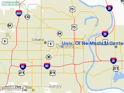
Univ. Of Ne Medical Center Heliport |
Location & QuickFacts
| FAA Information Effective: | 2008-09-25 |
| Airport Identifier: | 61NE |
| Airport Status: | Operational |
| Longitude/Latitude: | 095-58-43.0550W/41-15-17.9950N
-95.978626/41.254999 (Estimated) |
| Elevation: | 1160 ft / 353.57 m (Estimated) |
| Land: | 0 acres |
| From nearest city: | 0 nautical miles N of Omaha, NE |
| Location: | Douglas County, NE |
| Magnetic Variation: | 06E (1985) |
Owner & Manager
| Ownership: | Privately owned |
| Owner: | Univ Of Ne Medical Center |
| Address: | 600 S. 42nd St
Omaha, NE 68198-1160 |
| Phone number: | 402-559-4499 |
| Manager: | Celeste Felix |
| Address: | 600 S. 42nd St
Omaha, NE 68198-1160 |
| Phone number: | 402-559-6702 |
Airport Operations and Facilities
| Airport Use: | Private
MEDICAL. |
| Wind indicator: | Yes |
| Segmented Circle: | No |
| Control Tower: | No |
| Lighting Schedule: | DUSK-DAWN
ACTVT PERIMETER LGTS - 123.050. |
| Beacon Color: | Clear-Green-Yellow (heliport) |
| Landing fee charge: | No |
| Sectional chart: | Omaha |
| Region: | ACE - Central |
| Boundary ARTCC: | ZMP - Minneapolis |
| Tie-in FSS: | OLU - Columbus |
| FSS on Airport: | No |
| FSS Toll Free: | 1-800-WX-BRIEF |
Airport Communications
| Unicom: | 123.050
MULTICOM 122.050. |
Airport Services
Runway Information
Helipad H1
| Dimension: | 45 x 45 ft / 13.7 x 13.7 m
ROOFTOP. |
| Surface: | CONC,
ROOFTOP. |
| |
Runway H1 |
Runway |
| Traffic Pattern: | Left | Left |
|
Helipad H2
| Dimension: | 45 x 45 ft / 13.7 x 13.7 m
ROOFTOP. |
| Surface: | CONC,
ROOFTOP. |
| |
Runway H2 |
Runway |
| Traffic Pattern: | Left | Left |
|
Radio Navigation Aids
| ID |
Type |
Name |
Ch |
Freq |
Var |
Dist |
| OM | NDB | Gerfi | | 320.00 | 05E | 6.8 nm |
| MLE | NDB | Millard | | 371.00 | 06E | 7.1 nm |
| PMV | NDB | Plattsmouth | | 329.00 | 06E | 18.9 nm |
| FET | NDB | Fremont | | 311.00 | 06E | 27.0 nm |
| AHQ | NDB | Wahoo | | 400.00 | 07E | 28.0 nm |
| HNR | NDB | Harlan | | 272.00 | 05E | 34.7 nm |
| RDK | NDB | Red Oak | | 230.00 | 04E | 35.8 nm |
| AFK | NDB | Nebraska City | | 347.00 | 05E | 39.4 nm |
| SDA | NDB | Shenandoah | | 411.00 | 05E | 39.8 nm |
| AIO | NDB | Atlantic | | 365.00 | 04E | 43.0 nm |
| LN | NDB | Potts | | 385.00 | 06E | 46.9 nm |
| AYB | NDB | Auburn | | 430.00 | 05E | 49.9 nm |
| OFF | TACAN | Offutt | 054X | | 05E | 9.0 nm |
| TQE | VOR | Tekamah | | 108.40 | 07E | 31.6 nm |
| SCB | VOR/DME | Scribner | 47X | 111.00 | 06E | 36.1 nm |
| OVR | VORTAC | Omaha | 110X | 116.30 | 08E | 12.1 nm |
| LNK | VORTAC | Lincoln | 108X | 116.10 | 09E | 39.9 nm |
| OMA | VOT | Omaha | | 109.00 | | 4.8 nm |
Remarks
- APCH/DEP PATHS MAINTD 8:1; 2:1 TRSN SFC.
Images and information placed above are from
http://www.airport-data.com/airport/61NE/
We thank them for the data!
| General Info
|
| Country |
United States
|
| State |
NEBRASKA
|
| FAA ID |
61NE
|
| Latitude |
41-15-17.995N
|
| Longitude |
095-58-43.055W
|
| Elevation |
1160 feet
|
| Near City |
OMAHA
|
We don't guarantee the information is fresh and accurate. The data may
be wrong or outdated.
For more up-to-date information please refer to other sources.
|
|


