 |
|
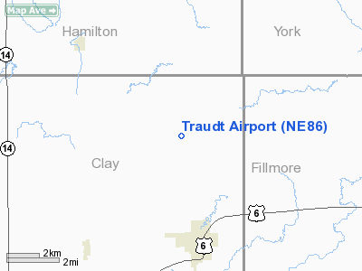
Location & QuickFacts
| FAA Information Effective: | 2008-09-25 |
| Airport Identifier: | NE86 |
| Airport Status: | Operational |
| Longitude/Latitude: | 097-52-11.1750W/40-39-56.0370N
-97.869771/40.665566 (Estimated) |
| Elevation: | 1725 ft / 525.78 m (Estimated) |
| Land: | 0 acres |
| From nearest city: | 3 nautical miles N of Sutton, NE |
| Location: | Clay County, NE |
| Magnetic Variation: | 07E (1985) |
Owner & Manager
| Ownership: | Privately owned |
| Owner: | Dale Traudt |
| Address: | Rt 2, Box 25
Aurora, NE 68818 |
| Phone number: | 402-694-3144 |
| Manager: | Dale E Traudt |
| Address: | Rt 2, Box 25
Aurora, NE 68818 |
| Phone number: | 402-694-3144 |
Airport Operations and Facilities
| Airport Use: | Private |
| Segmented Circle: | No |
| Control Tower: | No |
| Landing fee charge: | No |
| Sectional chart: | Omaha |
| Region: | ACE - Central |
| Boundary ARTCC: | ZMP - Minneapolis |
| Tie-in FSS: | OLU - Columbus |
| FSS on Airport: | No |
| FSS Toll Free: | 1-800-WX-BRIEF |
Runway Information
Runway 14/32
| Dimension: | 3200 x 50 ft / 975.4 x 15.2 m |
| Surface: | TURF, |
| |
Runway 14 |
Runway 32 |
| Traffic Pattern: | Left | Left |
|
Radio Navigation Aids
| ID |
Type |
Name |
Ch |
Freq |
Var |
Dist |
| FMZ | NDB | Beklof | | 392.00 | 07E | 14.5 nm |
| JYR | NDB | York | | 257.00 | 06E | 18.1 nm |
| PSS | NDB | Prosser | | 338.00 | 07E | 27.7 nm |
| HJH | NDB | Hebron | | 323.00 | 06E | 33.5 nm |
| SWT | NDB | Seward | | 269.00 | 06E | 36.5 nm |
| FBY | NDB | Fairbury | | 293.00 | 06E | 43.6 nm |
| HSI | VOR/DME | Hastings | 025X | 108.80 | 07E | 25.8 nm |
| GRI | VORTAC | Grand Island | 057X | 112.00 | 07E | 27.9 nm |
| OBH | VORTAC | Wolbach | 095X | 114.80 | 07E | 48.0 nm |
Remarks
- PRVDD APCH SFC IS CLEARED FOR A 20-1 GLIDE SLOPE.
Images and information placed above are from
http://www.airport-data.com/airport/NE86/
We thank them for the data!
| General Info
|
| Country |
United States
|
| State |
NEBRASKA
|
| FAA ID |
NE86
|
| Latitude |
40-39-56.037N
|
| Longitude |
097-52-11.175W
|
| Elevation |
1725 feet
|
| Near City |
SUTTON
|
We don't guarantee the information is fresh and accurate. The data may
be wrong or outdated.
For more up-to-date information please refer to other sources.
|
|


