 |
|
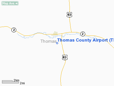
Location & QuickFacts
| FAA Information Effective: | 2008-09-25 |
| Airport Identifier: | TIF |
| Airport Status: | Operational |
| Longitude/Latitude: | 100-34-13.1000W/41-57-45.7500N
-100.570306/41.962708 (Estimated) |
| Elevation: | 2925 ft / 891.54 m (Surveyed) |
| Land: | 591 acres |
| From nearest city: | 1 nautical miles S of Thedford, NE |
| Location: | Thomas County, NE |
| Magnetic Variation: | 08E (2000) |
Owner & Manager
| Ownership: | Publicly owned |
| Owner: | Thomas County Airport Authority |
| Address: | P.o. Box 22, Sandhill Oil, Hc 58 Box 2
Thedford, NE 69166-0022 |
| Phone number: | 308-645-2233 |
| Manager: | Alan Jameson |
| Address: | P.o. Box 22, Sandhill Oil, Hc 58 Box 2
Thedford, NE 69166-0022 |
| Phone number: | 308-645-2233 |
Airport Operations and Facilities
| Airport Use: | Open to public |
| Wind indicator: | Yes |
| Segmented Circle: | No |
| Control Tower: | No |
| Lighting Schedule: | DUSK-DAWN |
| Beacon Color: | Clear-Green (lighted land airport) |
| Sectional chart: | Omaha |
| Region: | ACE - Central |
| Boundary ARTCC: | ZDV - Denver |
| Tie-in FSS: | OLU - Columbus |
| FSS on Airport: | No |
| FSS Toll Free: | 1-800-WX-BRIEF |
| NOTAMs Facility: | TIF (NOTAM-d service avaliable) |
| Federal Agreements: | N |
Airport Communications
Airport Services
Runway Information
Runway 11/29
| Dimension: | 4400 x 60 ft / 1341.1 x 18.3 m |
| Surface: | ASPH, Good Condition |
| Edge Lights: | Medium |
| |
Runway 11 |
Runway 29 |
| Longitude: | 100-34-38.6719W | 100-33-47.4455W |
| Latitude: | 41-57-56.0634N | 41-57-35.3800N |
| Elevation: | 2925.00 ft | 2910.00 ft |
| Alignment: | 118 | 127 |
| Traffic Pattern: | Left | Left |
| Markings: | Non-precision instrument, Good Condition | Non-precision instrument, Good Condition |
|
Radio Navigation Aids
| ID |
Type |
Name |
Ch |
Freq |
Var |
Dist |
| TDD | VOR/DME | Thedford | 023X | 108.60 | 09E | 6.7 nm |
| ANW | VOR/DME | Ainsworth | 074X | 112.70 | 09E | 44.7 nm |
| CUZ | VOR/DME | Custer County | 19X | 108.20 | 08E | 48.9 nm |
Remarks
- PRVDD MAINTAIN A CLEAR 20:1 APCH & A CLEAR 7:1 TRANSITIONAL SFC.
Images and information placed above are from
http://www.airport-data.com/airport/TIF/
We thank them for the data!
| General Info
|
| Country |
United States
|
| State |
NEBRASKA
|
| FAA ID |
TIF
|
| Latitude |
41.962169
41° 57' 43.81" N
|
| Longitude |
-100.569014
100° 34' 08.45" W
|
| Elevation |
2926 feet
892 meters
|
| Magnetic Variation |
007° E (01/06)
|
| Beacon |
Yes
|
| Operating Agency |
PRIVATE
|
| Daylight Saving Time |
Second Sunday in March at 0200 to first Sunday in November at 0200 local time (Exception Arizona and that portion of Indiana in the Eastern Time Zone)
|
We don't guarantee the information is fresh and accurate. The data may
be wrong or outdated.
For more up-to-date information please refer to other sources.
|
|


