 |
|
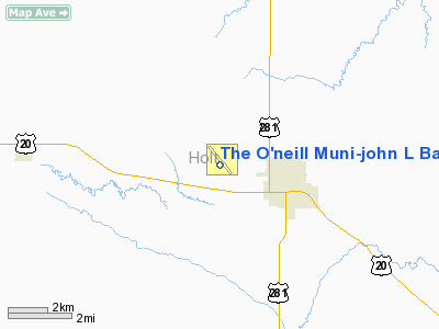
The O'neill Muni-john L Baker Field Airport |
Location & QuickFacts
| FAA Information Effective: | 2008-09-25 |
| Airport Identifier: | ONL |
| Airport Status: | Operational |
| Longitude/Latitude: | 098-41-17.0000W/42-28-11.6000N
-98.688056/42.469889 (Estimated) |
| Elevation: | 2031 ft / 619.05 m (Surveyed) |
| Land: | 316 acres |
| From nearest city: | 2 nautical miles NW of O'neill, NE |
| Location: | Holt County, NE |
| Magnetic Variation: | 09E (1980) |
Owner & Manager
| Ownership: | Publicly owned |
| Owner: | O'neill Airport Authority
BARTON BECKER, CHAIRMAN OF ARPT AUTHORITY. |
| Address: | 87204 John L. Baker Road
O'neill, NE 68763-4614 |
| Phone number: | 402-336-4686 |
| Manager: | Brian Williams |
| Address: | 87204 John L. Baker Road, Rr 1 Box 17d
O'neill, NE 68763-4614 |
| Phone number: | 402-336-3377 |
Airport Operations and Facilities
| Airport Use: | Open to public |
| Wind indicator: | Yes |
| Segmented Circle: | Yes |
| Control Tower: | No |
| Lighting Schedule: | DUSK-DAWN
ACTVT MIRL RY 13/31 & REIL RY 13 - CTAF. |
| Beacon Color: | Clear-Green (lighted land airport) |
| Landing fee charge: | No |
| Sectional chart: | Omaha |
| Region: | ACE - Central |
| Boundary ARTCC: | ZMP - Minneapolis |
| Tie-in FSS: | OLU - Columbus |
| FSS on Airport: | No |
| FSS Toll Free: | 1-800-WX-BRIEF |
| NOTAMs Facility: | ONL (NOTAM-d service avaliable) |
| Federal Agreements: | NGY |
Airport Communications
| CTAF: | 122.800 |
| Unicom: | 122.800 |
Airport Services
| Fuel available: | 100LLA |
| Airframe Repair: | MAJOR |
| Power Plant Repair: | MAJOR |
| Bottled Oxygen: | NONE |
| Bulk Oxygen: | NONE |
Runway Information
Runway 04/22
| Dimension: | 3030 x 120 ft / 923.5 x 36.6 m
WIDEND 60' TO THE WEST |
| Surface: | TURF, Fair Condition |
| |
Runway 04 |
Runway 22 |
| Longitude: | 098-41-24.3180W | 098-40-56.8170W |
| Latitude: | 42-27-57.0110N | 42-28-18.9110N |
| Elevation: | 2030.00 ft | 2027.00 ft |
| Alignment: | 43 | 127 |
| Traffic Pattern: | Left | Left |
| Obstruction: | 26 ft pline, 530.0 ft from runway, 20:1 slope to clear | 4 ft fence, 150.0 ft from runway, 37:1 slope to clear |
|
Runway 13/31
| Dimension: | 4409 x 75 ft / 1343.9 x 22.9 m
WIDEND 60' TO THE WEST |
| Surface: | ASPH, Good Condition |
| Weight Limit: | Single wheel: 30000 lbs. |
| Edge Lights: | Medium |
| |
Runway 13 |
Runway 31 |
| Longitude: | 098-41-36.3880W | 098-40-57.6680W |
| Latitude: | 42-28-28.0250N | 42-27-55.2480N |
| Elevation: | 2031.00 ft | 2031.00 ft |
| Alignment: | 127 | 127 |
| Traffic Pattern: | Left | Left |
| Markings: | Non-precision instrument, Fair Condition | Non-precision instrument, Fair Condition |
| Crossing Height: | 39.00 ft | 39.00 ft |
| VASI: | pulsating/steady burning on left side | pulsating/steady burning on left side |
| Visual Glide Angle: | 3.00° | 3.00° |
| Runway End Identifier: | Yes | |
|
Radio Navigation Aids
| ID |
Type |
Name |
Ch |
Freq |
Var |
Dist |
| AGZ | NDB | Wagner | | 392.00 | 08E | 39.7 nm |
| RBE | NDB | Rock County | | 341.00 | 08E | 39.9 nm |
| BUB | NDB | Burwell | | 377.00 | 07E | 46.5 nm |
Remarks
- RY 04/22 NOT PLOWED WINTER MONTHS.
Images and information placed above are from
http://www.airport-data.com/airport/ONL/
We thank them for the data!
| General Info
|
| Country |
United States
|
| State |
NEBRASKA
|
| FAA ID |
ONL
|
| Latitude |
42-28-11.600N
|
| Longitude |
098-41-17.000W
|
| Elevation |
2031 feet
|
| Near City |
O'NEILL
|
We don't guarantee the information is fresh and accurate. The data may
be wrong or outdated.
For more up-to-date information please refer to other sources.
|
|


