 |
|
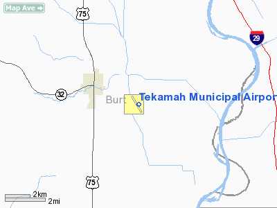
Location & QuickFacts
| FAA Information Effective: | 2008-09-25 |
| Airport Identifier: | TQE |
| Airport Status: | Operational |
| Longitude/Latitude: | 096-10-40.6000W/41-45-48.7000N
-96.177944/41.763528 (Estimated) |
| Elevation: | 1027 ft / 313.03 m (Surveyed) |
| Land: | 277 acres |
| From nearest city: | 2 nautical miles SE of Tekamah, NE |
| Location: | Burt County, NE |
| Magnetic Variation: | 07E (1980) |
Owner & Manager
| Ownership: | Publicly owned |
| Owner: | Tekamah Airport Authority
CHMN ARPT AUTH, ED MORROW. |
| Address: | P.o.box 34
Tekamah, NE 68061 |
| Phone number: | 402-374-1771 |
| Manager: | Carl Schroeder
MANAGERS CELL 402-870-0219 |
| Address: | 508 So 13th
Tekamah, NE 68061 |
| Phone number: | 402-374-1755 |
Airport Operations and Facilities
| Airport Use: | Open to public |
| Wind indicator: | Yes |
| Segmented Circle: | Yes |
| Control Tower: | No |
| Lighting Schedule: | DUSK-DAWN
ACTVT RY 32 REIL - CTAF. |
| Beacon Color: | Clear-Green (lighted land airport) |
| Landing fee charge: | No |
| Sectional chart: | Omaha |
| Region: | ACE - Central |
| Traffic Pattern Alt: | 1000 ft |
| Boundary ARTCC: | ZMP - Minneapolis |
| Tie-in FSS: | OLU - Columbus |
| FSS on Airport: | No |
| FSS Toll Free: | 1-800-WX-BRIEF |
| NOTAMs Facility: | TQE (NOTAM-d service avaliable) |
| Federal Agreements: | NGY |
Airport Communications
| CTAF: | 123.000 |
| Unicom: | 123.000 |
Airport Services
| Fuel available: | 100LLA |
| Airframe Repair: | MAJOR
J&D AIRCRAFT SERVICE 402-374-1700. |
| Power Plant Repair: | MAJOR
J&D AIRCRAFT SERVICE 402-374-1700. |
| Bottled Oxygen: | NONE |
| Bulk Oxygen: | NONE |
Runway Information
Runway 14/32
| Dimension: | 4002 x 75 ft / 1219.8 x 22.9 m |
| Surface: | CONC, Good Condition |
| Weight Limit: | Single wheel: 30000 lbs.
Dual wheel: 45000 lbs. |
| Edge Lights: | Medium |
| |
Runway 14 |
Runway 32 |
| Longitude: | 096-10-52.3470W | 096-10-28.8180W |
| Latitude: | 41-46-06.4280N | 41-45-31.0380N |
| Elevation: | 1027.00 ft | 1024.00 ft |
| Alignment: | 127 | 127 |
| Traffic Pattern: | Left | Left |
| Markings: | Non-precision instrument, Fair Condition | Non-precision instrument, Good Condition |
| Runway End Identifier: | | Yes |
| Obstruction: | 16 ft road, 800.0 ft from runway, 205 ft left of centerline, 37:1 slope to clear | 15 ft road, 860.0 ft from runway, 330 ft left of centerline, 44:1 slope to clear |
|
Radio Navigation Aids
| ID |
Type |
Name |
Ch |
Freq |
Var |
Dist |
| FET | NDB | Fremont | | 311.00 | 06E | 24.3 nm |
| OM | NDB | Gerfi | | 320.00 | 05E | 25.8 nm |
| MEY | NDB | Mapleton | | 335.00 | 05E | 30.4 nm |
| SU | NDB | Salix | | 414.00 | 07E | 34.3 nm |
| MLE | NDB | Millard | | 371.00 | 06E | 34.3 nm |
| AHQ | NDB | Wahoo | | 400.00 | 07E | 36.8 nm |
| DNS | NDB | Denison | | 350.00 | 04E | 38.1 nm |
| HNR | NDB | Harlan | | 272.00 | 05E | 39.2 nm |
| GAK | NDB | Sioux Gateway | | 233.00 | 06E | 39.8 nm |
| OI | NDB | Tommi | | 305.00 | 07E | 43.7 nm |
| LCG | NDB | Wayne | | 389.00 | 06E | 46.1 nm |
| OFF | TACAN | Offutt | 054X | | 05E | 40.8 nm |
| TQE | VOR | Tekamah | | 108.40 | 07E | 0.2 nm |
| SCB | VOR/DME | Scribner | 47X | 111.00 | 06E | 22.4 nm |
| SUX | VORTAC | Sioux City | 112X | 116.50 | 09E | 35.5 nm |
| OVR | VORTAC | Omaha | 110X | 116.30 | 08E | 41.0 nm |
| OMA | VOT | Omaha | | 109.00 | | 31.0 nm |
Images and information placed above are from
http://www.airport-data.com/airport/TQE/
We thank them for the data!
| General Info
|
| Country |
United States
|
| State |
NEBRASKA
|
| FAA ID |
TQE
|
| Latitude |
41-45-48.700N
|
| Longitude |
096-10-40.600W
|
| Elevation |
1027 feet
|
| Near City |
TEKAMAH
|
We don't guarantee the information is fresh and accurate. The data may
be wrong or outdated.
For more up-to-date information please refer to other sources.
|
|


