 |
|
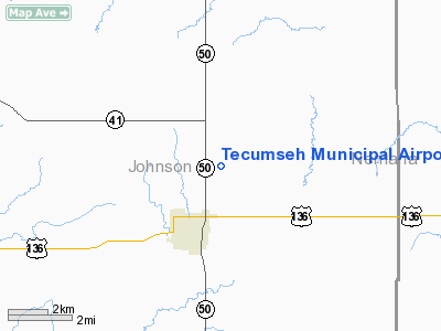
Location & QuickFacts
| FAA Information Effective: | 2008-09-25 |
| Airport Identifier: | 0G3 |
| Airport Status: | Operational |
| Longitude/Latitude: | 096-10-13.5889W/40-24-03.4060N
-96.170441/40.400946 (Estimated) |
| Elevation: | 1306 ft / 398.07 m (Surveyed) |
| Land: | 183 acres |
| From nearest city: | 2 nautical miles NE of Tecumseh, NE |
| Location: | Johnson County, NE |
| Magnetic Variation: | 06E (1985) |
Owner & Manager
| Ownership: | Publicly owned |
| Owner: | Tecumseh Airport Authority
PAUL BUSS- CHAIRMAN. |
| Address: | P.o. Box 837
Tecumseh, NE 68450-0837 |
| Phone number: | 402-274-2600 |
| Manager: | Mike Wendt |
| Address: | Po Box 537
Tecumseh, NE 68450-0537 |
| Phone number: | 402-335-3303 |
Airport Operations and Facilities
| Airport Use: | Open to public |
| Wind indicator: | Yes |
| Segmented Circle: | Yes |
| Control Tower: | No |
| Lighting Schedule: | DUSK-DAWN
ACTVT MIRL RY 15/33 - CTAF. |
| Beacon Color: | Clear-Green (lighted land airport) |
| Landing fee charge: | No |
| Sectional chart: | Omaha |
| Region: | ACE - Central |
| Traffic Pattern Alt: | 800 ft |
| Boundary ARTCC: | ZMP - Minneapolis |
| Tie-in FSS: | OLU - Columbus |
| FSS on Airport: | No |
| FSS Toll Free: | 1-800-WX-BRIEF |
| NOTAMs Facility: | OLU (NOTAM-d service avaliable) |
| Federal Agreements: | NGY |
Airport Communications
Airport Services
| Fuel available: | 100LL
FOR FUEL CALL (402) 335-3303. |
| Airframe Repair: | NONE |
| Power Plant Repair: | NONE |
| Bottled Oxygen: | NONE |
| Bulk Oxygen: | NONE |
Runway Information
Runway 15/33
| Dimension: | 3502 x 75 ft / 1067.4 x 22.9 m |
| Surface: | CONC, |
| Weight Limit: | Single wheel: 6000 lbs. |
| Edge Lights: | Medium |
| |
Runway 15 |
Runway 33 |
| Longitude: | 096-10-21.7433W | 096-10-05.4344W |
| Latitude: | 40-24-19.5483N | 40-23-47.2637N |
| Elevation: | 1305.00 ft | 1301.00 ft |
| Traffic Pattern: | Left | Left |
| Markings: | Non-precision instrument, Good Condition | Non-precision instrument, Good Condition |
| Obstruction: | 14 ft trees, 600.0 ft from runway, 75 ft left of centerline, 28:1 slope to clear | , 50:1 slope to clear |
|
Radio Navigation Aids
| ID |
Type |
Name |
Ch |
Freq |
Var |
Dist |
| AYB | NDB | Auburn | | 430.00 | 05E | 16.9 nm |
| AFK | NDB | Nebraska City | | 347.00 | 05E | 18.7 nm |
| HWB | NDB | Shaw | | 263.00 | 06E | 28.1 nm |
| BJU | NDB | Big Blue | | 248.00 | 06E | 29.5 nm |
| FNB | NDB | Brenner | | 404.00 | 05E | 33.1 nm |
| LN | NDB | Potts | | 385.00 | 06E | 34.1 nm |
| PMV | NDB | Plattsmouth | | 329.00 | 06E | 34.7 nm |
| MYZ | NDB | Marysville | | 341.00 | 06E | 39.2 nm |
| SDA | NDB | Shenandoah | | 411.00 | 05E | 40.7 nm |
| FBY | NDB | Fairbury | | 293.00 | 06E | 47.6 nm |
| MLE | NDB | Millard | | 371.00 | 06E | 47.8 nm |
| OFF | TACAN | Offutt | 054X | | 05E | 44.8 nm |
| BIE | VOR | Beatrice | | 110.60 | 07E | 27.4 nm |
| RBA | VOR/DME | Robinson | 019X | 108.20 | 04E | 47.7 nm |
| PWE | VORTAC | Pawnee City | 071X | 112.40 | 05E | 12.2 nm |
| LNK | VORTAC | Lincoln | 108X | 116.10 | 09E | 40.8 nm |
Images and information placed above are from
http://www.airport-data.com/airport/0G3/
We thank them for the data!
| General Info
|
| Country |
United States
|
| State |
NEBRASKA
|
| FAA ID |
0G3
|
| Latitude |
40-23-57.999N
|
| Longitude |
096-10-17.029W
|
| Elevation |
1305 feet
|
| Near City |
TECUMSEH
|
We don't guarantee the information is fresh and accurate. The data may
be wrong or outdated.
For more up-to-date information please refer to other sources.
|
|


