 |
|
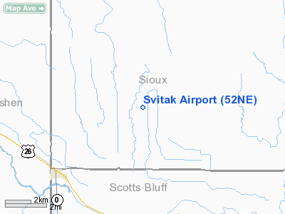
Location & QuickFacts
| FAA Information Effective: | 2008-09-25 |
| Airport Identifier: | 52NE |
| Airport Status: | Operational |
| Longitude/Latitude: | 103-57-56.8080W/42-02-41.8680N
-103.965780/42.044963 (Estimated) |
| Elevation: | 4183 ft / 1274.98 m (Estimated) |
| Land: | 2 acres |
| From nearest city: | 5 nautical miles NW of Morrill, NE |
| Location: | Sioux County, NE |
| Magnetic Variation: | 11E (1985) |
Owner & Manager
| Ownership: | Privately owned |
| Owner: | Randolph S Svitak |
| Address: | 650 S D Rd
Morrill, NE 69358-2212 |
| Phone number: | 308-247-2489 |
| Manager: | Randolph S Svitak |
| Address: | 650 S D Rd
Morrill, NE 69358-2212 |
| Phone number: | 308-247-2489 |
Airport Operations and Facilities
| Airport Use: | Private |
| Wind indicator: | Yes |
| Segmented Circle: | No |
| Control Tower: | No |
| Landing fee charge: | No |
| Sectional chart: | Cheyenne |
| Region: | ACE - Central |
| Boundary ARTCC: | ZDV - Denver |
| Tie-in FSS: | OLU - Columbus |
| FSS on Airport: | No |
| FSS Toll Free: | 1-800-WX-BRIEF |
Runway Information
Runway 09/27
| Dimension: | 1800 x 40 ft / 548.6 x 12.2 m |
| Surface: | TURF, |
| |
Runway 09 |
Runway 27 |
| Traffic Pattern: | Left | Left |
| Obstruction: | 40 ft pline, 560.0 ft from runway | 45 ft trees, 150.0 ft from runway |
|
Radio Navigation Aids
| ID |
Type |
Name |
Ch |
Freq |
Var |
Dist |
| TOR | NDB | Torrington | | 293.00 | 11E | 8.5 nm |
| GIG | NDB | Gering | | 341.00 | 11E | 14.0 nm |
| GYZ | NDB | Camp Guernsey | | 280.00 | 11E | 35.4 nm |
| CDR | VOR/DME | Chadron | 081X | 113.40 | 13E | 42.4 nm |
| BFF | VORTAC | Scottsbluff | 073X | 112.60 | 13E | 23.4 nm |
Images and information placed above are from
http://www.airport-data.com/airport/52NE/
We thank them for the data!
| General Info
|
| Country |
United States
|
| State |
NEBRASKA
|
| FAA ID |
52NE
|
| Latitude |
42-02-41.868N
|
| Longitude |
103-57-56.808W
|
| Elevation |
4183 feet
|
| Near City |
MORRILL
|
We don't guarantee the information is fresh and accurate. The data may
be wrong or outdated.
For more up-to-date information please refer to other sources.
|
|


