 |
|
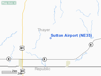
Location & QuickFacts
| FAA Information Effective: | 2008-09-25 |
| Airport Identifier: | NE35 |
| Airport Status: | Operational |
| Longitude/Latitude: | 097-32-28.1510W/40-03-30.0190N
-97.541153/40.058339 (Estimated) |
| Elevation: | 1583 ft / 482.50 m (Estimated) |
| Land: | 3 acres |
| From nearest city: | 6 nautical miles NE of Chester, NE |
| Location: | Thayer County, NE |
| Magnetic Variation: | 07E (1985) |
Owner & Manager
| Ownership: | Privately owned |
| Owner: | Chester Spray, Inc. |
| Address: |
Chester, NE 68327 |
| Phone number: | 402-324-5285 |
| Manager: | Stuart Sutton |
| Address: | Rr 1, Box 54
Chester, NE 68327 |
| Phone number: | 402-324-5285 |
Airport Operations and Facilities
| Airport Use: | Private |
| Wind indicator: | Yes |
| Segmented Circle: | No |
| Control Tower: | No |
| Landing fee charge: | No |
| Sectional chart: | Omaha |
| Region: | ACE - Central |
| Boundary ARTCC: | ZMP - Minneapolis |
| Tie-in FSS: | OLU - Columbus |
| FSS on Airport: | No |
| FSS Toll Free: | 1-800-WX-BRIEF |
Airport Communications
Airport Services
| Airframe Repair: | NONE |
| Power Plant Repair: | NONE |
Runway Information
Runway N/S
| Dimension: | 1400 x 100 ft / 426.7 x 30.5 m |
| Surface: | TURF, |
| Edge Lights: | Low
RWY LGTS SOUTH OF ROAD. |
| |
Runway N |
Runway S |
| Traffic Pattern: | Left | Left |
|
Radio Navigation Aids
| ID |
Type |
Name |
Ch |
Freq |
Var |
Dist |
| HJH | NDB | Hebron | | 323.00 | 06E | 5.9 nm |
| RPB | NDB | Republican | | 414.00 | 07E | 15.7 nm |
| FBY | NDB | Fairbury | | 293.00 | 06E | 18.7 nm |
| DBX | NDB | Morrison | | 212.00 | 06E | 29.1 nm |
| CNK | NDB | Concordia | | 335.00 | 06E | 30.8 nm |
| FMZ | NDB | Beklof | | 392.00 | 07E | 32.0 nm |
| HWB | NDB | Shaw | | 263.00 | 06E | 38.1 nm |
| BJU | NDB | Big Blue | | 248.00 | 06E | 38.1 nm |
| MYZ | NDB | Marysville | | 341.00 | 06E | 43.6 nm |
| CYW | NDB | Clay Center | | 362.00 | 07E | 44.4 nm |
| BIE | VOR | Beatrice | | 110.60 | 07E | 39.0 nm |
| TKO | VORTAC | Mankato | 035X | 109.80 | 10E | 36.4 nm |
Remarks
- PRVDD E-W CO RD CROSSING RWY N OF MIDWAY POINT BE CLSD FOR ALL VEHICULAR TFC OR REROUTED ARND RWY. PRVDD RWY APCHS ARE MAINTD FOR MIN 20:1 GLIDE SLOPE & TRSNL SLOPE OF 7:1.
Images and information placed above are from
http://www.airport-data.com/airport/NE35/
We thank them for the data!
| General Info
|
| Country |
United States
|
| State |
NEBRASKA
|
| FAA ID |
NE35
|
| Latitude |
40-03-30.019N
|
| Longitude |
097-32-28.151W
|
| Elevation |
1583 feet
|
| Near City |
CHESTER
|
We don't guarantee the information is fresh and accurate. The data may
be wrong or outdated.
For more up-to-date information please refer to other sources.
|
|


