 |
|
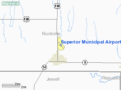
Location & QuickFacts
| FAA Information Effective: | 2008-09-25 |
| Airport Identifier: | 12K |
| Airport Status: | Operational |
| Longitude/Latitude: | 098-03-36.4000W/40-02-46.9000N
-98.060111/40.046361 (Estimated) |
| Elevation: | 1691 ft / 515.42 m (Surveyed) |
| Land: | 248 acres |
| From nearest city: | 2 nautical miles N of Superior, NE |
| Location: | Nuckolls County, NE |
| Magnetic Variation: | 07E (1985) |
Owner & Manager
| Ownership: | Publicly owned |
| Owner: | Superior Airport Authority
LANCE TEACHWORTH, CHAIRMAN. |
| Address: | 1109 Louden Street
Superior, NE 68978-2315 |
| Phone number: | 402-879-4583 |
| Manager: | Barry Blackstone |
| Address: | Rt 2 Box 16a
Superior, NE 68978-9503 |
| Phone number: | 402-879-3006 |
Airport Operations and Facilities
| Airport Use: | Open to public |
| Wind indicator: | Yes |
| Segmented Circle: | Yes |
| Control Tower: | No |
| Lighting Schedule: | DUSK-DAWN
ACTVT LIRL RY 14/32 - CTAF. |
| Beacon Color: | Clear-Green (lighted land airport) |
| Landing fee charge: | No |
| Sectional chart: | Omaha |
| Region: | ACE - Central |
| Traffic Pattern Alt: | 800 ft |
| Boundary ARTCC: | ZMP - Minneapolis |
| Tie-in FSS: | OLU - Columbus |
| FSS on Airport: | No |
| FSS Toll Free: | 1-800-WX-BRIEF |
| NOTAMs Facility: | OLU (NOTAM-d service avaliable) |
| Federal Agreements: | NGY |
Airport Communications
| CTAF: | 123.000 |
| Unicom: | 123.000 |
Airport Services
| Fuel available: | 100LL |
| Bottled Oxygen: | NONE |
| Bulk Oxygen: | NONE |
Runway Information
Runway 14/32
| Dimension: | 3702 x 60 ft / 1128.4 x 18.3 m |
| Surface: | ASPH-CONC, Good Condition |
| Edge Lights: | Low |
| |
Runway 14 |
Runway 32 |
| Longitude: | 098-03-50.0090W | 098-03-22.7000W |
| Latitude: | 40-03-01.8490N | 40-02-31.8940N |
| Elevation: | 1691.00 ft | 1650.00 ft |
| Alignment: | 127 | 127 |
| Traffic Pattern: | Left | Left |
|
Runway 18/36
| Dimension: | 3000 x 200 ft / 914.4 x 61.0 m |
| Surface: | TURF, Fair Condition |
| |
Runway 18 |
Runway 36 |
| Longitude: | 098-03-46.1570W | 098-03-53.1580W |
| Latitude: | 40-03-03.5470N | 40-02-34.4470N |
| Elevation: | 1682.00 ft | 1691.00 ft |
| Alignment: | 127 | 10 |
| Traffic Pattern: | Left | Left |
| Obstruction: | 28 ft tree, 1085.0 ft from runway, 38:1 slope to clear | 121 ft tank, 4350.0 ft from runway, 555 ft right of centerline, 35:1 slope to clear |
|
Radio Navigation Aids
| ID |
Type |
Name |
Ch |
Freq |
Var |
Dist |
| HJH | NDB | Hebron | | 323.00 | 06E | 22.6 nm |
| RPB | NDB | Republican | | 414.00 | 07E | 23.2 nm |
| CNK | NDB | Concordia | | 335.00 | 06E | 35.1 nm |
| FMZ | NDB | Beklof | | 392.00 | 07E | 39.7 nm |
| FBY | NDB | Fairbury | | 293.00 | 06E | 41.8 nm |
| PSS | NDB | Prosser | | 338.00 | 07E | 43.0 nm |
| DBX | NDB | Morrison | | 212.00 | 06E | 50.0 nm |
| HSI | VOR/DME | Hastings | 025X | 108.80 | 07E | 37.6 nm |
| TKO | VORTAC | Mankato | 035X | 109.80 | 10E | 17.1 nm |
Remarks
Images and information placed above are from
http://www.airport-data.com/airport/12K/
We thank them for the data!
| General Info
|
| Country |
United States
|
| State |
NEBRASKA
|
| FAA ID |
12K
|
| Latitude |
40-02-46.900N
|
| Longitude |
098-03-36.400W
|
| Elevation |
1691 feet
|
| Near City |
SUPERIOR
|
We don't guarantee the information is fresh and accurate. The data may
be wrong or outdated.
For more up-to-date information please refer to other sources.
|
|


