 |
|
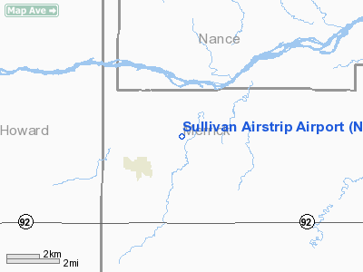
Sullivan Airstrip Airport |
Location & QuickFacts
| FAA Information Effective: | 2008-09-25 |
| Airport Identifier: | NE12 |
| Airport Status: | Operational |
| Longitude/Latitude: | 098-13-41.2260W/41-14-20.0470N
-98.228118/41.238902 (Estimated) |
| Elevation: | 1745 ft / 531.88 m (Estimated) |
| Land: | 0 acres |
| From nearest city: | 2 nautical miles NE of Palmer, NE |
| Location: | Merrick County, NE |
| Magnetic Variation: | 07E (1985) |
Owner & Manager
| Ownership: | Privately owned |
| Owner: | Robt W Sullivan |
| Address: | Rt 2 Box 164
Palmer, NE 68864 |
| Phone number: | 308-894-6654 |
| Manager: | Robt W Sullivan |
| Address: | Rt 2 Box 164
Palmer, NE 68864 |
| Phone number: | 308-894-6654 |
Airport Operations and Facilities
| Airport Use: | Private |
| Wind indicator: | Yes |
| Segmented Circle: | No |
| Control Tower: | No |
| Lighting Schedule: | PHONE REQ
FOR LIRL RY 17/35 CALL 308-894-6654. |
| Landing fee charge: | No |
| Sectional chart: | Omaha |
| Region: | ACE - Central |
| Boundary ARTCC: | ZMP - Minneapolis |
| Tie-in FSS: | OLU - Columbus |
| FSS on Airport: | No |
| FSS Toll Free: | 1-800-WX-BRIEF |
Airport Services
| Airframe Repair: | NONE |
| Power Plant Repair: | NONE |
Runway Information
Runway 17/35
| Dimension: | 2575 x 75 ft / 784.9 x 22.9 m |
| Surface: | TURF, |
| Edge Lights: | Low |
| |
Runway 17 |
Runway 35 |
| Traffic Pattern: | Left | Left |
|
Radio Navigation Aids
| ID |
Type |
Name |
Ch |
Freq |
Var |
Dist |
| BVN | NDB | Alaby | | 332.00 | 06E | 30.5 nm |
| JYR | NDB | York | | 257.00 | 06E | 34.5 nm |
| PSS | NDB | Prosser | | 338.00 | 07E | 35.1 nm |
| ODX | NDB | Ord | | 356.00 | 07E | 39.8 nm |
| PLT | NDB | Platte Center | | 407.00 | 08E | 41.2 nm |
| FMZ | NDB | Beklof | | 392.00 | 07E | 49.2 nm |
| EAR | VOR | Kearney | | 111.20 | 10E | 46.9 nm |
| HSI | VOR/DME | Hastings | 025X | 108.80 | 07E | 39.2 nm |
| OLU | VOR/DME | Columbus | 055X | 111.80 | 08E | 42.0 nm |
| OBH | VORTAC | Wolbach | 095X | 114.80 | 07E | 10.0 nm |
| GRI | VORTAC | Grand Island | 057X | 112.00 | 07E | 15.8 nm |
Remarks
- PRVDD APCH TO ARPT ARE MAINT FOR A MIN 20:1 GLIDE SLOPE & TRSNL SFC MAINT FOR A 7:1 SLOPE.
Images and information placed above are from
http://www.airport-data.com/airport/NE12/
We thank them for the data!
| General Info
|
| Country |
United States
|
| State |
NEBRASKA
|
| FAA ID |
NE12
|
| Latitude |
41-14-20.047N
|
| Longitude |
098-13-41.226W
|
| Elevation |
1745 feet
|
| Near City |
PALMER
|
We don't guarantee the information is fresh and accurate. The data may
be wrong or outdated.
For more up-to-date information please refer to other sources.
|
|


