 |
|
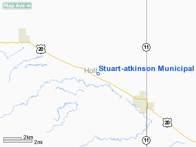
Stuart-atkinson Muni Airport |
Location & QuickFacts
| FAA Information Effective: | 2008-09-25 |
| Airport Identifier: | 8V2 |
| Airport Status: | Operational |
| Longitude/Latitude: | 099-02-16.3540W/42-33-45.0060N
-99.037876/42.562502 (Estimated) |
| Elevation: | 2130 ft / 649.22 m (Surveyed) |
| Land: | 241 acres |
| From nearest city: | 3 nautical miles NW of Atkinson, NE |
| Location: | Holt County, NE |
| Magnetic Variation: | 08E (1985) |
Owner & Manager
| Ownership: | Publicly owned |
| Owner: | Stuart Atkinson Airport Auth |
| Address: | Po Box 758
Atkinson, NE 68713-0758 |
| Phone number: | 402-925-2732 |
| Manager: | Gary Freidel |
| Address: | Po Box 654
Atkinson, NE 68713-0654 |
| Phone number: | 402-925-5527 |
Airport Operations and Facilities
| Airport Use: | Open to public |
| Wind indicator: | Yes |
| Segmented Circle: | No |
| Control Tower: | No |
| Lighting Schedule: | DUSK-DAWN |
| Beacon Color: | Clear-Green (lighted land airport) |
| Landing fee charge: | No |
| Sectional chart: | Omaha |
| Region: | ACE - Central |
| Boundary ARTCC: | ZMP - Minneapolis |
| Tie-in FSS: | OLU - Columbus |
| FSS on Airport: | No |
| FSS Toll Free: | 1-800-WX-BRIEF |
| NOTAMs Facility: | OLU (NOTAM-d service avaliable) |
| Federal Agreements: | N1 |
Airport Communications
Airport Services
| Fuel available: | 100LL
FOR FUEL CALL (402) 925-5527. |
| Bottled Oxygen: | NONE |
| Bulk Oxygen: | NONE |
Runway Information
Runway 05/23
| Dimension: | 3000 x 100 ft / 914.4 x 30.5 m
NARROWED TO 100', CENTERLINE STAYED THE SAME. |
| Surface: | TURF, Fair Condition |
| |
Runway 05 |
Runway 23 |
| Longitude: | 099-02-26.9200W | 099-01-52.3100W |
| Latitude: | 42-33-37.9000N | 42-33-52.8600N |
| Elevation: | 2122.00 ft | 2127.00 ft |
| Alignment: | 60 | 127 |
| Traffic Pattern: | Left | Left |
| Obstruction: | 21 ft rr, 450.0 ft from runway, 170 ft right of centerline, 21:1 slope to clear | 16 ft road, 320.0 ft from runway, 120 ft left of centerline, 20:1 slope to clear |
|
Runway 11/29
| Dimension: | 4040 x 50 ft / 1231.4 x 15.2 m
NARROWED TO 100', CENTERLINE STAYED THE SAME. |
| Surface: | ASPH, Good Condition |
| Weight Limit: | Single wheel: 4000 lbs. |
| Edge Lights: | Low |
| |
Runway 11 |
Runway 29 |
| Longitude: | 099-02-39.1700W | 099-01-51.8600W |
| Latitude: | 42-33-51.1800N | 42-33-31.2600N |
| Elevation: | 2128.00 ft | 2123.00 ft |
| Traffic Pattern: | Left | Left |
| Markings: | Basic, Good Condition | Basic, Good Condition |
| Displaced threshold: | 0.00 ft | 140.00 ft |
| Obstruction: | , 50:1 slope to clear | 15 ft road, 250.0 ft from runway, 130 ft right of centerline, 3:1 slope to clear
APCH SLOPE 26:1 TO DSPLCD THR.
+5 FT FENCE 130 FT FM RY END 130 FT R. |
|
Radio Navigation Aids
| ID |
Type |
Name |
Ch |
Freq |
Var |
Dist |
| RBE | NDB | Rock County | | 341.00 | 08E | 23.9 nm |
| AGZ | NDB | Wagner | | 392.00 | 08E | 44.5 nm |
| BUB | NDB | Burwell | | 377.00 | 07E | 47.6 nm |
| ANW | VOR/DME | Ainsworth | 074X | 112.70 | 09E | 42.1 nm |
| ONL | VORTAC | O'neill | 086X | 113.90 | 10E | 16.5 nm |
Remarks
- PROVIDED THAT THE APCH TO EACH RWY IS MAINTAINED FOR A MINIMUM 20:1 GLIDE SLOPE AND THE TRANSITIONAL SURFACE BE MAINTAINED FOR A 7:1 SLOPE.
Images and information placed above are from
http://www.airport-data.com/airport/8V2/
We thank them for the data!
| General Info
|
| Country |
United States
|
| State |
NEBRASKA
|
| FAA ID |
8V2
|
| Latitude |
42-33-45.006N
|
| Longitude |
099-02-16.354W
|
| Elevation |
2130 feet
|
| Near City |
ATKINSON
|
We don't guarantee the information is fresh and accurate. The data may
be wrong or outdated.
For more up-to-date information please refer to other sources.
|
|


