 |
|
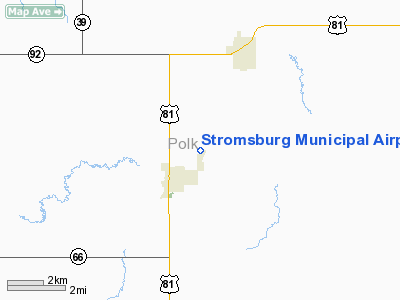
Location & QuickFacts
| FAA Information Effective: | 2008-09-25 |
| Airport Identifier: | 23NE |
| Airport Status: | Operational |
| Longitude/Latitude: | 097-34-39.1830W/41-07-45.0510N
-97.577551/41.129181 (Estimated) |
| Elevation: | 1675 ft / 510.54 m (Estimated) |
| Land: | 26 acres |
| From nearest city: | 1 nautical miles NE of Stromsburg, NE |
| Location: | Polk County, NE |
| Magnetic Variation: | 07E (1985) |
Owner & Manager
| Ownership: | Publicly owned |
| Owner: | Stromsburg Municipal Airport |
| Address: | P.o. Box 452
Stromsburg, NE 68666 |
| Phone number: | 402-764-5131 |
| Manager: | Morris Bowden |
| Address: | Box 452
Stromsburg, NE 68666 |
| Phone number: | 402-764-5131 |
Airport Operations and Facilities
| Airport Use: | Private |
| Wind indicator: | Yes |
| Segmented Circle: | No |
| Control Tower: | No |
| Lighting Schedule: | DUSK-DAWN |
| Landing fee charge: | No |
| Sectional chart: | Omaha |
| Region: | ACE - Central |
| Boundary ARTCC: | ZMP - Minneapolis |
| Tie-in FSS: | OLU - Columbus |
| FSS on Airport: | No |
| FSS Toll Free: | 1-800-WX-BRIEF |
| NOTAMs Facility: | OLU |
Airport Services
| Airframe Repair: | NONE |
| Power Plant Repair: | NONE |
| Bottled Oxygen: | NONE |
| Bulk Oxygen: | NONE |
Runway Information
Runway 02/20
| Dimension: | 2210 x 21 ft / 673.6 x 6.4 m |
| Surface: | ASPH, Fair Condition
PAVEMENT HAS MANY CRACKS. |
| Edge Lights: | Non-standard lighting system
NSTD LIRL 40 FT FROM PAVEMENT EDGE. |
| |
Runway 02 |
Runway 20 |
| Traffic Pattern: | Left | Left |
| Markings: | Nonstandard,
02/20 CNTRLN ONLY. | , |
| Obstruction: | 26 ft rr, 200.0 ft from runway, 100 ft right of centerline
02/20 RR TRACK RUNS PARALLEL 100' FROM RWY CNTRLN. | 22 ft rr, 200.0 ft from runway, 100 ft left of centerline |
|
Radio Navigation Aids
| ID |
Type |
Name |
Ch |
Freq |
Var |
Dist |
| JYR | NDB | York | | 257.00 | 06E | 14.0 nm |
| PLT | NDB | Platte Center | | 407.00 | 08E | 23.8 nm |
| SWT | NDB | Seward | | 269.00 | 06E | 26.6 nm |
| FMZ | NDB | Beklof | | 392.00 | 07E | 32.4 nm |
| BVN | NDB | Alaby | | 332.00 | 06E | 42.0 nm |
| LN | NDB | Potts | | 385.00 | 06E | 43.6 nm |
| AHQ | NDB | Wahoo | | 400.00 | 07E | 44.8 nm |
| OF | NDB | Carsy | | 510.00 | 08E | 45.8 nm |
| PSS | NDB | Prosser | | 338.00 | 07E | 48.8 nm |
| OLU | VOR/DME | Columbus | 055X | 111.80 | 08E | 22.1 nm |
| HSI | VOR/DME | Hastings | 025X | 108.80 | 07E | 49.9 nm |
| GRI | VORTAC | Grand Island | 057X | 112.00 | 07E | 34.5 nm |
| OBH | VORTAC | Wolbach | 095X | 114.80 | 07E | 38.1 nm |
| LNK | VORTAC | Lincoln | 108X | 116.10 | 09E | 39.8 nm |
Images and information placed above are from
http://www.airport-data.com/airport/23NE/
We thank them for the data!
|
|


