 |
|
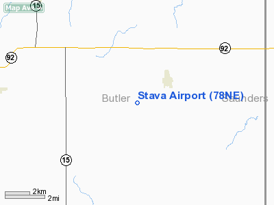
Location & QuickFacts
| FAA Information Effective: | 2008-09-25 |
| Airport Identifier: | 78NE |
| Airport Status: | Operational |
| Longitude/Latitude: | 097-01-53.1150W/41-09-58.0390N
-97.031421/41.166122 (Estimated) |
| Elevation: | 1655 ft / 504.44 m (Estimated) |
| Land: | 0 acres |
| From nearest city: | 2 nautical miles SW of Brainard, NE |
| Location: | Butler County, NE |
| Magnetic Variation: | 07E (1985) |
Owner & Manager
| Ownership: | Privately owned |
| Owner: | Robert D Stava |
| Address: |
Brainard, NE 68626 |
| Phone number: | 402-545-2941 |
| Address: |
|
Airport Operations and Facilities
| Airport Use: | Private |
| Segmented Circle: | No |
| Control Tower: | No |
| Sectional chart: | Omaha |
| Region: | ACE - Central |
| Boundary ARTCC: | ZMP - Minneapolis |
| Tie-in FSS: | OLU - Columbus |
| FSS Toll Free: | 1-800-WX-BRIEF |
Runway Information
Runway 17/35
| Dimension: | 2600 x 60 ft / 792.5 x 18.3 m |
| Surface: | TURF, |
| |
Runway 17 |
Runway 35 |
| Traffic Pattern: | Left | Left |
|
Radio Navigation Aids
| ID |
Type |
Name |
Ch |
Freq |
Var |
Dist |
| SWT | NDB | Seward | | 269.00 | 06E | 18.7 nm |
| AHQ | NDB | Wahoo | | 400.00 | 07E | 20.1 nm |
| PLT | NDB | Platte Center | | 407.00 | 08E | 25.4 nm |
| LN | NDB | Potts | | 385.00 | 06E | 28.0 nm |
| FET | NDB | Fremont | | 311.00 | 06E | 28.8 nm |
| JYR | NDB | York | | 257.00 | 06E | 31.1 nm |
| MLE | NDB | Millard | | 371.00 | 06E | 41.5 nm |
| FMZ | NDB | Beklof | | 392.00 | 07E | 42.4 nm |
| OF | NDB | Carsy | | 510.00 | 08E | 47.8 nm |
| BJU | NDB | Big Blue | | 248.00 | 06E | 49.3 nm |
| OLU | VOR/DME | Columbus | 055X | 111.80 | 08E | 22.1 nm |
| SCB | VOR/DME | Scribner | 47X | 111.00 | 06E | 32.0 nm |
| LNK | VORTAC | Lincoln | 108X | 116.10 | 09E | 19.6 nm |
Remarks
- PRVDD APCH SFCS ARE MAINTAINED FOR 20:1 GS & TRANSITIONAL SFCS FOR A 7:1 SLOPE.
Images and information placed above are from
http://www.airport-data.com/airport/78NE/
We thank them for the data!
| General Info
|
| Country |
United States
|
| State |
NEBRASKA
|
| FAA ID |
78NE
|
| Latitude |
41-09-58.039N
|
| Longitude |
097-01-53.115W
|
| Elevation |
1655 feet
|
| Near City |
BRAINARD
|
We don't guarantee the information is fresh and accurate. The data may
be wrong or outdated.
For more up-to-date information please refer to other sources.
|
|


