 |
|
Location & QuickFacts
| FAA Information Effective: | 2008-09-25 |
| Airport Identifier: | NE15 |
| Airport Status: | Operational |
| Longitude/Latitude: | 096-22-58.0000W/41-03-00.0000N
-96.382778/41.050000 (Estimated) |
| Elevation: | 1080 ft / 329.18 m (Estimated) |
| Land: | 0 acres |
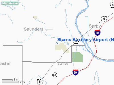
| From nearest city: | 1 nautical miles NW of Ashland, NE |
| Location: | Saunders County, NE |
| Magnetic Variation: | 05E (1995) |
Owner & Manager
| Ownership: | Privately owned |
| Owner: | John F Starns |
| Address: | Po Box 37 Rr2
Ashland, NE 68003 |
| Phone number: | 402-944-7329 |
| Manager: | John F Starns |
| Address: | Po Box 37 Rr2
Ashland, NE 68003 |
| Phone number: | 402-944-7329 |
Airport Operations and Facilities
| Airport Use: | Private |
| Wind indicator: | Yes |
| Segmented Circle: | No |
| Control Tower: | No |
| Landing fee charge: | No |
| Sectional chart: | Omaha |
| Region: | ACE - Central |
| Boundary ARTCC: | ZMP - Minneapolis |
| Tie-in FSS: | OLU - Columbus |
| FSS on Airport: | No |
| FSS Toll Free: | 1-800-WX-BRIEF |
Runway Information
Runway 06/24
| Dimension: | 1800 x 40 ft / 548.6 x 12.2 m |
| Surface: | TURF, |
| |
Runway 06 |
Runway 24 |
| Traffic Pattern: | Left | Left |
| Obstruction: | 25 ft trees, 500.0 ft from runway | 45 ft pline, 750.0 ft from runway |
|
Radio Navigation Aids
| ID |
Type |
Name |
Ch |
Freq |
Var |
Dist |
| MLE | NDB | Millard | | 371.00 | 06E | 15.0 nm |
| AHQ | NDB | Wahoo | | 400.00 | 07E | 15.0 nm |
| PMV | NDB | Plattsmouth | | 329.00 | 06E | 22.3 nm |
| FET | NDB | Fremont | | 311.00 | 06E | 24.8 nm |
| LN | NDB | Potts | | 385.00 | 06E | 25.1 nm |
| OM | NDB | Gerfi | | 320.00 | 05E | 27.1 nm |
| SWT | NDB | Seward | | 269.00 | 06E | 35.0 nm |
| AFK | NDB | Nebraska City | | 347.00 | 05E | 35.7 nm |
| AYB | NDB | Auburn | | 430.00 | 05E | 45.3 nm |
| BJU | NDB | Big Blue | | 248.00 | 06E | 45.7 nm |
| SDA | NDB | Shenandoah | | 411.00 | 05E | 47.8 nm |
| OFF | TACAN | Offutt | 054X | | 05E | 22.2 nm |
| TQE | VOR | Tekamah | | 108.40 | 07E | 43.6 nm |
| BIE | VOR | Beatrice | | 110.60 | 07E | 48.1 nm |
| SCB | VOR/DME | Scribner | 47X | 111.00 | 06E | 35.2 nm |
| OLU | VOR/DME | Columbus | 055X | 111.80 | 08E | 49.5 nm |
| LNK | VORTAC | Lincoln | 108X | 116.10 | 09E | 18.0 nm |
| OVR | VORTAC | Omaha | 110X | 116.30 | 08E | 30.1 nm |
| OMA | VOT | Omaha | | 109.00 | | 26.9 nm |
Remarks
- OWNER DESIRES ARPT NOT BE CHARTED.
- PRVDD MAINTAIN A CLEAR 20:1 APCH AND 7:1 TRANSITIONAL SURFACE; ALL TFC PATTERNS MUST NOT INTERFERE WITH STARN BROTHERS ARPT TO THE NW.
Images and information placed above are from
http://www.airport-data.com/airport/NE15/
We thank them for the data!
| General Info
|
| Country |
United States
|
| State |
NEBRASKA
|
| FAA ID |
NE15
|
| Latitude |
41-03-00.000N
|
| Longitude |
096-22-58.000W
|
| Elevation |
1080 feet
|
| Near City |
ASHLAND
|
We don't guarantee the information is fresh and accurate. The data may
be wrong or outdated.
For more up-to-date information please refer to other sources.
|
|


