 |
|
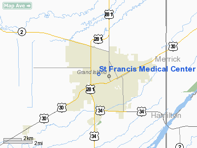
St Francis Medical Center Heliport |
Location & QuickFacts
| FAA Information Effective: | 2008-09-25 |
| Airport Identifier: | NE76 |
| Airport Status: | Operational |
| Longitude/Latitude: | 098-22-21.2280W/40-55-30.0440N
-98.372563/40.925012 (Estimated) |
| Elevation: | 2106 ft / 641.91 m (Estimated) |
| Land: | 0 acres |
| From nearest city: | 0 nautical miles N of Grand Island, NE |
| Location: | Hall County, NE |
| Magnetic Variation: | 07E (1990) |
Owner & Manager
| Ownership: | Privately owned |
| Owner: | Saint Francis Med Center |
| Address: | 2620 W Faidley Ave Box 9804
Grand Island, NE 68802 |
| Phone number: | 308-384-4600 |
| Manager: | Dave Kozak |
| Address: | 2620 W Faidley Ave Box 9804
Grand Island, NE 68802 |
| Phone number: | 308-384-4600 |
Airport Operations and Facilities
| Airport Use: | Private
MEDICAL USE. |
| Wind indicator: | Yes |
| Segmented Circle: | No |
| Control Tower: | No |
| Sectional chart: | Omaha |
| Region: | ACE - Central |
| Boundary ARTCC: | ZMP - Minneapolis |
| Tie-in FSS: | OLU - Columbus |
| FSS on Airport: | No |
| FSS Toll Free: | 1-800-WX-BRIEF |
Runway Information
Helipad H1
| Dimension: | 45 x 45 ft / 13.7 x 13.7 m |
| Surface: | CONC, |
| |
Runway H1 |
Runway |
| Latitude: | 40-55-33.0000N | |
| Traffic Pattern: | Left | Left |
|
Radio Navigation Aids
| ID |
Type |
Name |
Ch |
Freq |
Var |
Dist |
| PSS | NDB | Prosser | | 338.00 | 07E | 15.1 nm |
| JYR | NDB | York | | 257.00 | 06E | 34.4 nm |
| FMZ | NDB | Beklof | | 392.00 | 07E | 41.8 nm |
| ODX | NDB | Ord | | 356.00 | 07E | 49.4 nm |
| EAR | VOR | Kearney | | 111.20 | 10E | 31.2 nm |
| HSI | VOR/DME | Hastings | 025X | 108.80 | 07E | 19.4 nm |
| GRI | VORTAC | Grand Island | 057X | 112.00 | 07E | 4.4 nm |
| OBH | VORTAC | Wolbach | 095X | 114.80 | 07E | 27.1 nm |
Remarks
- PROVIDED APCHS ARE MAINTAINED FOR 8:1 SLOPES; TRANSITIONAL SURFACES FOR 2:1 SLOPE.
Images and information placed above are from
http://www.airport-data.com/airport/NE76/
We thank them for the data!
| General Info
|
| Country |
United States
|
| State |
NEBRASKA
|
| FAA ID |
NE76
|
| Latitude |
40-55-30.044N
|
| Longitude |
098-22-21.228W
|
| Elevation |
1851 feet
|
| Near City |
GRAND ISLAND
|
We don't guarantee the information is fresh and accurate. The data may
be wrong or outdated.
For more up-to-date information please refer to other sources.
|
|


