 |
|
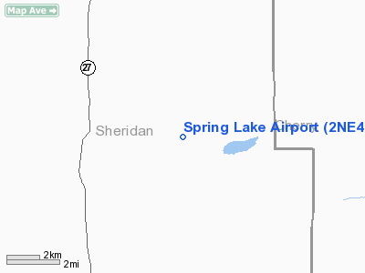
Location & QuickFacts
| FAA Information Effective: | 2008-09-25 |
| Airport Identifier: | 2NE4 |
| Airport Status: | Operational |
| Longitude/Latitude: | 102-08-01.6620W/42-26-59.9650N
-102.133795/42.449990 (Estimated) |
| Elevation: | 3815 ft / 1162.81 m (Estimated) |
| Land: | 0 acres |
| From nearest city: | 23 nautical miles SE of Gordon, NE |
| Location: | Sheridan County, NE |
| Magnetic Variation: | 10E (1985) |
Owner & Manager
| Ownership: | Privately owned |
| Owner: | Patrick D Vinton |
| Address: |
Gordon, NE 69343 |
| Phone number: | 308-282-0835 |
| Manager: | Patrick D Vinton |
| Address: |
Gordon, NE 69343 |
| Phone number: | 308-282-0835 |
Airport Operations and Facilities
| Airport Use: | Private |
| Wind indicator: | Yes |
| Segmented Circle: | No |
| Control Tower: | No |
| Landing fee charge: | No |
| Sectional chart: | Cheyenne |
| Region: | ACE - Central |
| Boundary ARTCC: | ZDV - Denver |
| Tie-in FSS: | OLU - Columbus |
| FSS on Airport: | No |
| FSS Toll Free: | 1-800-WX-BRIEF |
Airport Services
| Fuel available: | MOGAS |
| Airframe Repair: | NONE |
| Power Plant Repair: | NONE |
Runway Information
Runway E/W
| Dimension: | 2000 x 60 ft / 609.6 x 18.3 m |
| Surface: | TURF, |
| |
Runway E |
Runway W |
| Traffic Pattern: | Left | Left |
|
Runway N/S
| Dimension: | 1300 x 60 ft / 396.2 x 18.3 m |
| Surface: | TURF, |
| |
Runway N |
Runway S |
| Traffic Pattern: | Left | Left |
|
Runway NE/SW
| Dimension: | 1800 x 60 ft / 548.6 x 18.3 m |
| Surface: | TURF, |
| |
Runway NE |
Runway SW |
| Traffic Pattern: | Left | Left |
|
Radio Navigation Aids
| ID |
Type |
Name |
Ch |
Freq |
Var |
Dist |
| GRN | NDB | Gordon | | 414.00 | 09E | 21.2 nm |
| ALU | NDB | Alliance | | 380.00 | 11E | 38.4 nm |
| HIN | NDB | Whitney | | 275.00 | 11E | 48.2 nm |
| AIA | VOR/DME | Alliance | 055X | 111.80 | 11E | 38.1 nm |
Remarks
Images and information placed above are from
http://www.airport-data.com/airport/2NE4/
We thank them for the data!
| General Info
|
| Country |
United States
|
| State |
NEBRASKA
|
| FAA ID |
2NE4
|
| Latitude |
42-26-59.965N
|
| Longitude |
102-08-01.662W
|
| Elevation |
3815 feet
|
| Near City |
GORDON
|
We don't guarantee the information is fresh and accurate. The data may
be wrong or outdated.
For more up-to-date information please refer to other sources.
|
|


