 |
|
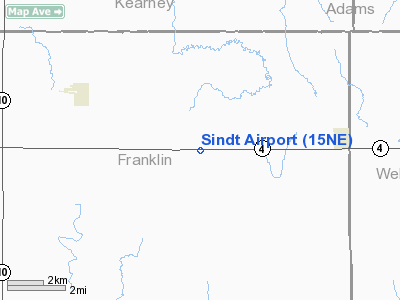
Location & QuickFacts
| FAA Information Effective: | 2008-09-25 |
| Airport Identifier: | 15NE |
| Airport Status: | Operational |
| Longitude/Latitude: | 098-49-24.2730W/40-17-28.0500N
-98.823409/40.291125 (Estimated) |
| Elevation: | 1990 ft / 606.55 m (Estimated) |
| Land: | 6 acres |
| From nearest city: | 4 nautical miles SE of Upland, NE |
| Location: | Franklin County, NE |
| Magnetic Variation: | 08E (1985) |
Owner & Manager
| Ownership: | Privately owned |
| Owner: | Harold I. Sindt Jr. |
| Address: | 1977 Highway 4
Upland, NE 68981 |
| Phone number: | 402-756-8252 |
| Manager: | Harold Sindt Jr. |
| Address: | Rr 1 Box 44
Upland, NE 68981 |
| Phone number: | 402-756-8252 |
Airport Operations and Facilities
| Airport Use: | Private |
| Wind indicator: | Yes |
| Segmented Circle: | No |
| Control Tower: | No |
| Sectional chart: | Omaha |
| Region: | ACE - Central |
| Boundary ARTCC: | ZMP - Minneapolis |
| Tie-in FSS: | OLU - Columbus |
| FSS on Airport: | No |
| FSS Toll Free: | 1-800-WX-BRIEF |
Runway Information
Runway 03/21
| Dimension: | 2900 x 60 ft / 883.9 x 18.3 m |
| Surface: | TURF, |
| |
Runway 03 |
Runway 21 |
| Traffic Pattern: | Left | Left |
|
Radio Navigation Aids
| ID |
Type |
Name |
Ch |
Freq |
Var |
Dist |
| HDE | NDB | Holdrege | | 396.00 | 07E | 25.5 nm |
| PSS | NDB | Prosser | | 338.00 | 07E | 28.5 nm |
| PHG | NDB | Phillipsburg | | 368.00 | 08E | 41.2 nm |
| EAR | VOR | Kearney | | 111.20 | 10E | 27.4 nm |
| HSI | VOR/DME | Hastings | 025X | 108.80 | 07E | 26.1 nm |
| TKO | VORTAC | Mankato | 035X | 109.80 | 10E | 39.0 nm |
| GRI | VORTAC | Grand Island | 057X | 112.00 | 07E | 47.7 nm |
Remarks
- PRVDD THE APCH TO EACH RY IS MAINTAINED FOR A MINIMUM 20:1 GLILDE SLOPE, THE ARPT TRANSITIONAL SFC BE MAINTAINED FOR A 7:1 SLOPE.
Images and information placed above are from
http://www.airport-data.com/airport/15NE/
We thank them for the data!
| General Info
|
| Country |
United States
|
| State |
NEBRASKA
|
| FAA ID |
15NE
|
| Latitude |
40-17-28.050N
|
| Longitude |
098-49-24.273W
|
| Elevation |
1990 feet
|
| Near City |
UPLAND
|
We don't guarantee the information is fresh and accurate. The data may
be wrong or outdated.
For more up-to-date information please refer to other sources.
|
|


