 |
|
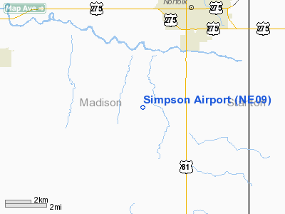
Location & QuickFacts
| FAA Information Effective: | 2008-09-25 |
| Airport Identifier: | NE09 |
| Airport Status: | Operational |
| Longitude/Latitude: | 097-28-02.1860W/41-57-48.0180N
-97.467274/41.963338 (Estimated) |
| Elevation: | 1650 ft / 502.92 m (Estimated) |
| Land: | 0 acres |
| From nearest city: | 4 nautical miles S of Norfolk, NE |
| Location: | Madison County, NE |
| Magnetic Variation: | 07E (1985) |
Owner & Manager
| Ownership: | Privately owned |
| Owner: | John H Simpson |
| Address: | Box 263
Norfolk, NE 68701 |
| Phone number: | 402-371-9307 |
| Manager: | Aero Service Inc. |
| Address: | Box 263
Norfolk, NE 68701 |
| Phone number: | 402-371-9307 |
Airport Operations and Facilities
| Airport Use: | Private |
| Wind indicator: | Yes |
| Segmented Circle: | No |
| Control Tower: | No |
| Landing fee charge: | No |
| Sectional chart: | Omaha |
| Region: | ACE - Central |
| Boundary ARTCC: | ZMP - Minneapolis |
| Tie-in FSS: | OLU - Columbus |
| FSS on Airport: | No |
| FSS Toll Free: | 1-800-WX-BRIEF |
Airport Services
| Airframe Repair: | NONE |
| Power Plant Repair: | NONE |
Runway Information
Runway N/S
| Dimension: | 2500 x 100 ft / 762.0 x 30.5 m |
| Surface: | TURF, |
| |
Runway N |
Runway S |
| Traffic Pattern: | Left | Left |
| Obstruction: | 25 ft trees pline | |
|
Radio Navigation Aids
| ID |
Type |
Name |
Ch |
Freq |
Var |
Dist |
| OF | NDB | Carsy | | 510.00 | 08E | 4.6 nm |
| LCG | NDB | Wayne | | 389.00 | 06E | 27.3 nm |
| PLT | NDB | Platte Center | | 407.00 | 08E | 28.3 nm |
| BVN | NDB | Alaby | | 332.00 | 06E | 29.7 nm |
| OFK | VOR/DME | Norfolk | 033X | 109.60 | 08E | 2.1 nm |
| OLU | VOR/DME | Columbus | 055X | 111.80 | 08E | 31.4 nm |
| SCB | VOR/DME | Scribner | 47X | 111.00 | 06E | 43.3 nm |
Remarks
- LIVESTOCK MAY BE ON RWY.
- NO SNOW REMOVAL
Images and information placed above are from
http://www.airport-data.com/airport/NE09/
We thank them for the data!
| General Info
|
| Country |
United States
|
| State |
NEBRASKA
|
| FAA ID |
NE09
|
| Latitude |
41-57-48.018N
|
| Longitude |
097-28-02.186W
|
| Elevation |
1650 feet
|
| Near City |
NORFOLK
|
We don't guarantee the information is fresh and accurate. The data may
be wrong or outdated.
For more up-to-date information please refer to other sources.
|
|


