 |
|
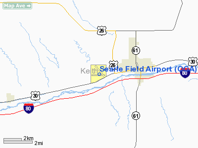
Location & QuickFacts
| FAA Information Effective: | 2008-09-25 |
| Airport Identifier: | OGA |
| Airport Status: | Operational |
| Longitude/Latitude: | 101-46-10.9000W/41-07-10.1000N
-101.769694/41.119472 (Estimated) |
| Elevation: | 3279 ft / 999.44 m (Surveyed) |
| Land: | 281 acres |
| From nearest city: | 2 nautical miles W of Ogallala, NE |
| Location: | Keith County, NE |
| Magnetic Variation: | 11E (1980) |
Owner & Manager
| Ownership: | Publicly owned |
| Owner: | City Of Ogallala |
| Address: | 411 E 2nd St., 509 Lakehurst Drive
Ogallala, NE 69153 |
| Phone number: | 308-284-6001 |
| Manager: | Mike Candy |
| Address: |
Ogallala, NE 69153 |
| Phone number: | 308-284-3848 |
Airport Operations and Facilities
| Airport Use: | Open to public |
| Wind indicator: | Yes |
| Segmented Circle: | Yes |
| Control Tower: | No |
| Lighting Schedule: | DUSK-DAWN
ACTVT MIRL RYS 13/31 & 08/26 & PAPI RYS 08, 26 & 31 & VASI RY 13 - CTAF. |
| Beacon Color: | Clear-Green (lighted land airport) |
| Landing fee charge: | No |
| Sectional chart: | Cheyenne |
| Region: | ACE - Central |
| Boundary ARTCC: | ZDV - Denver |
| Tie-in FSS: | OLU - Columbus |
| FSS on Airport: | No |
| FSS Toll Free: | 1-800-WX-BRIEF |
| NOTAMs Facility: | OGA (NOTAM-d service avaliable) |
| Federal Agreements: | NGY |
Airport Communications
| CTAF: | 122.800 |
| Unicom: | 122.800 |
Airport Services
| Fuel available: | 100LLA+ |
| Airframe Repair: | MAJOR |
| Power Plant Repair: | MAJOR |
| Bottled Oxygen: | NONE |
| Bulk Oxygen: | NONE |
Runway Information
Runway 08/26
| Dimension: | 5100 x 75 ft / 1554.5 x 22.9 m |
| Surface: | CONC, Good Condition |
| Weight Limit: | Single wheel: 12500 lbs.
Dual wheel: 12500 lbs. |
| Edge Lights: | Medium |
| |
Runway 08 |
Runway 26 |
| Longitude: | 101-46-52.1186W | 101-45-45.4702W |
| Latitude: | 41-07-04.0702N | 41-07-04.1359N |
| Elevation: | 3260.00 ft | 3245.00 ft |
| Alignment: | 90 | 127 |
| Traffic Pattern: | Left | Left |
| Markings: | Non-precision instrument, Good Condition | Non-precision instrument, Good Condition |
| Crossing Height: | 42.00 ft | 49.00 ft |
| VASI: | 2-light PAPI on left side | 2-light PAPI on left side |
| Visual Glide Angle: | 3.00° | 3.00° |
|
Runway 13/31
| Dimension: | 3698 x 60 ft / 1127.2 x 18.3 m |
| Surface: | CONC, |
| Weight Limit: | Single wheel: 12500 lbs.
Dual wheel: 12500 lbs. |
| Edge Lights: | Medium |
| |
Runway 13 |
Runway 31 |
| Longitude: | 101-46-14.1410W | 101-45-45.8760W |
| Latitude: | 41-07-33.1960N | 41-07-03.5700N |
| Elevation: | 3278.00 ft | 3244.00 ft |
| Alignment: | 127 | 127 |
| Traffic Pattern: | Left | Left |
| Markings: | Non-precision instrument, Good Condition | Non-precision instrument, Good Condition |
| Crossing Height: | 41.00 ft | 40.00 ft |
| VASI: | 4-box on left side | 2-light PAPI on left side |
| Visual Glide Angle: | 3.50° | 3.00° |
| Obstruction: | 82 ft pole, 2100.0 ft from runway, 23:1 slope to clear | 24 ft pole, 680.0 ft from runway, 155 ft left of centerline, 20:1 slope to clear |
|
Radio Navigation Aids
| ID |
Type |
Name |
Ch |
Freq |
Var |
Dist |
| GGF | NDB | Grant | | 359.00 | 09E | 15.0 nm |
| OKS | NDB | Oshkosh | | 233.00 | 09E | 31.2 nm |
| CNP | NDB | Chappell | | 383.00 | 10E | 31.3 nm |
| IML | NDB | Imperial | | 283.00 | 09E | 37.1 nm |
| HEQ | NDB | Heginbotham | | 404.00 | 11E | 39.8 nm |
| SAE | VOR/DME | Searle | 39X | 110.20 | 11E | 0.3 nm |
| LBF | VORTAC | North Platte | 121X | 117.40 | 11E | 46.5 nm |
Remarks
- RY 08 DESIGNATED AS CALM WIND RY.
Images and information placed above are from
http://www.airport-data.com/airport/OGA/
We thank them for the data!
| General Info
|
| Country |
United States
|
| State |
NEBRASKA
|
| FAA ID |
OGA
|
| Latitude |
41-07-10.099N
|
| Longitude |
101-46-10.898W
|
| Elevation |
3278 feet
|
| Near City |
OGALLALA
|
We don't guarantee the information is fresh and accurate. The data may
be wrong or outdated.
For more up-to-date information please refer to other sources.
|
|


